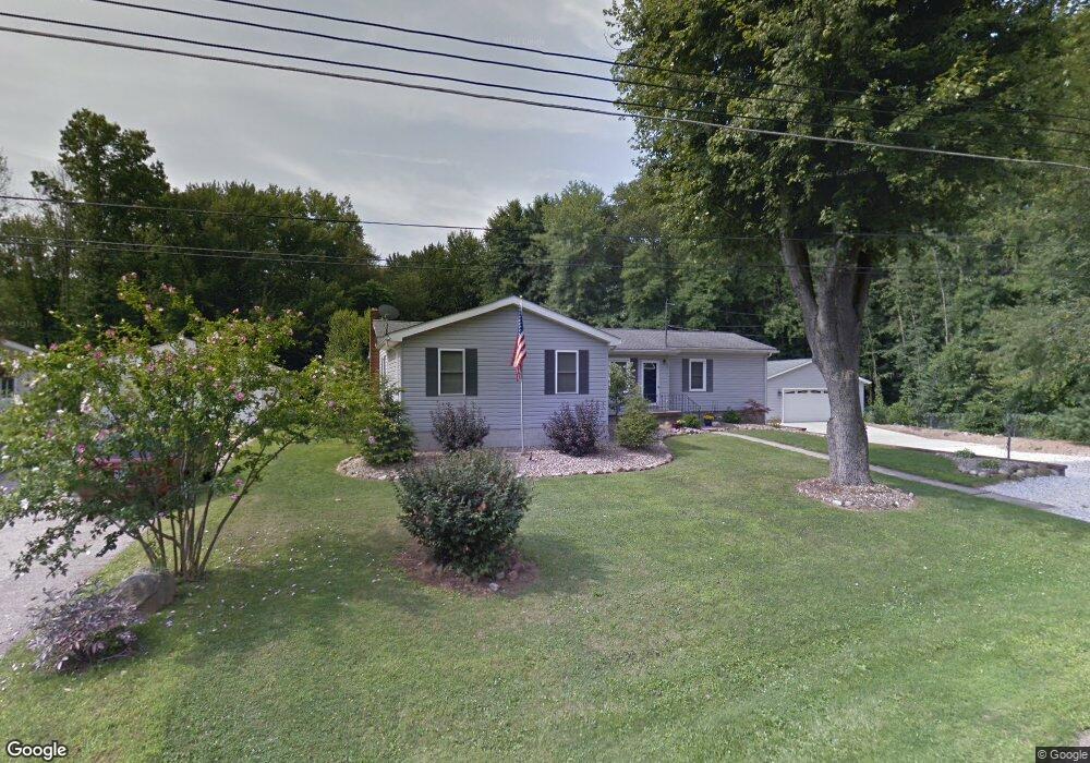
886 Woodsfield Dr Akron, OH 44319
East Barberton NeighborhoodEstimated Value: $194,000 - $268,000
3
Beds
1
Bath
1,752
Sq Ft
$127/Sq Ft
Est. Value
About This Home
This home is located at 886 Woodsfield Dr, Akron, OH 44319 and is currently estimated at $222,138, approximately $126 per square foot. 886 Woodsfield Dr is a home located in Summit County with nearby schools including Coventry Middle School, Coventry High School, and St. Francis de Sales School.
Ownership History
Date
Name
Owned For
Owner Type
Purchase Details
Closed on
Oct 8, 2015
Sold by
Mills Frederick R and Mills Barbara J
Bought by
Mills Barbara J and Mills Revocable Trust
Current Estimated Value
Purchase Details
Closed on
Aug 16, 2012
Sold by
Naragon Jeffrey B
Bought by
Mills Frederick R and Mills Barbara J
Purchase Details
Closed on
Mar 10, 2009
Sold by
Mills Barbara J and Mills Frederick R
Bought by
Mills Frederick R and Mills Barbara J
Home Financials for this Owner
Home Financials are based on the most recent Mortgage that was taken out on this home.
Original Mortgage
$74,000
Interest Rate
5.09%
Mortgage Type
New Conventional
Create a Home Valuation Report for This Property
The Home Valuation Report is an in-depth analysis detailing your home's value as well as a comparison with similar homes in the area
Home Values in the Area
Average Home Value in this Area
Purchase History
| Date | Buyer | Sale Price | Title Company |
|---|---|---|---|
| Mills Barbara J | -- | C & J Title Box | |
| Mills Frederick R | $325 | None Available | |
| Mills Frederick R | -- | Attorney |
Source: Public Records
Mortgage History
| Date | Status | Borrower | Loan Amount |
|---|---|---|---|
| Previous Owner | Mills Frederick R | $74,000 |
Source: Public Records
Tax History Compared to Growth
Tax History
| Year | Tax Paid | Tax Assessment Tax Assessment Total Assessment is a certain percentage of the fair market value that is determined by local assessors to be the total taxable value of land and additions on the property. | Land | Improvement |
|---|---|---|---|---|
| 2025 | $3,978 | $68,947 | $12,138 | $56,809 |
| 2024 | $3,978 | $68,947 | $12,138 | $56,809 |
| 2023 | $3,978 | $68,947 | $12,138 | $56,809 |
| 2022 | $3,441 | $49,238 | $8,428 | $40,810 |
| 2021 | $3,239 | $49,238 | $8,428 | $40,810 |
| 2020 | $3,144 | $49,240 | $8,430 | $40,810 |
| 2019 | $2,997 | $42,790 | $6,100 | $36,690 |
| 2018 | $2,968 | $42,790 | $6,100 | $36,690 |
| 2017 | $3,007 | $42,790 | $6,100 | $36,690 |
| 2016 | $3,000 | $42,790 | $6,100 | $36,690 |
| 2015 | $3,007 | $42,790 | $6,100 | $36,690 |
| 2014 | $2,924 | $42,790 | $6,100 | $36,690 |
| 2013 | $2,923 | $43,360 | $6,100 | $37,260 |
Source: Public Records
Map
Nearby Homes
- 2984 Manchester Rd
- 0 Joyce Ave NW Unit 35 5043152
- 0 Joyce Ave NW Unit 34 5043158
- 32 Joyce Ave
- 860 Sutherland Ave
- 894 Sutherland Ave
- 2784 Conway St
- 2832 Wingate Ave
- 2953 Clearfield Ave
- 2912 Clearfield Ave
- 1129 Winston St
- 1092 Sutherland Ave
- 2660 Conrad Ave
- 2679 Edwin Ave
- V/L 1.16 Acres E Tuscarawas Extension
- 2513 Christensen Ave
- 2462 Edwin Ave
- 584 Apple Dr
- 1174 Kohler Ave
- 2668 30th St SW
- 878 Woodsfield Dr
- 870 Woodsfield Dr
- 885 Woodsfield Dr
- 877 Woodsfield Dr
- 867 Woodsfield Dr
- 894 Woodsfield Dr
- 855 Woodsfield Dr
- 3006 Littledale Rd
- 2998 Littledale Rd
- 3014 Littledale Rd
- 47871 County 64 Rd
- 2983 Littledale Rd
- 3020 Littledale Rd
- 2991 Littledale Rd
- 843 Woodsfield Dr
- 3030 Littledale Rd
- 834 Woodsfield Dr
- 3009 Littledale Rd
- 835 Woodsfield Dr
- 847 Garson Dr