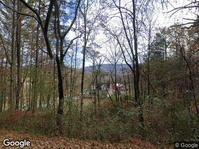
888 Highpoint Dr Dunlap, TN 37327
Dunlap NeighborhoodEstimated Value: $187,911 - $282,000
--
Bed
2
Baths
1,368
Sq Ft
$163/Sq Ft
Est. Value
About This Home
This home is located at 888 Highpoint Dr, Dunlap, TN 37327 and is currently estimated at $222,478, approximately $162 per square foot. 888 Highpoint Dr is a home located in Sequatchie County with nearby schools including Griffith Elementary School, Sequatchie County Middle School, and Sequatchie County High School.
Ownership History
Date
Name
Owned For
Owner Type
Purchase Details
Closed on
Jan 9, 2004
Sold by
Bank Of New York Tru
Bought by
Stock Donald E and Stock Kimberly A
Current Estimated Value
Home Financials for this Owner
Home Financials are based on the most recent Mortgage that was taken out on this home.
Original Mortgage
$75,900
Interest Rate
5.85%
Purchase Details
Closed on
Feb 21, 2003
Bought by
Bank Of New York Meks 7105 Corporate Dr
Purchase Details
Closed on
Nov 15, 1995
Bought by
Harvey Tommy L and Wife Patricia A
Create a Home Valuation Report for This Property
The Home Valuation Report is an in-depth analysis detailing your home's value as well as a comparison with similar homes in the area
Home Values in the Area
Average Home Value in this Area
Purchase History
| Date | Buyer | Sale Price | Title Company |
|---|---|---|---|
| Stock Donald E | $79,900 | -- | |
| Bank Of New York Meks 7105 Corporate Dr | $136,000 | -- | |
| Harvey Tommy L | $2,000 | -- |
Source: Public Records
Mortgage History
| Date | Status | Borrower | Loan Amount |
|---|---|---|---|
| Open | Stock Donald E | $57,000 | |
| Closed | Donald Stock | $31,900 | |
| Closed | Harvey Tommy L | $75,900 |
Source: Public Records
Tax History Compared to Growth
Tax History
| Year | Tax Paid | Tax Assessment Tax Assessment Total Assessment is a certain percentage of the fair market value that is determined by local assessors to be the total taxable value of land and additions on the property. | Land | Improvement |
|---|---|---|---|---|
| 2024 | $1,032 | $42,750 | $3,175 | $39,575 |
| 2023 | $1,032 | $42,750 | $3,175 | $39,575 |
| 2022 | $875 | $26,350 | $2,425 | $23,925 |
| 2021 | $862 | $26,350 | $2,425 | $23,925 |
| 2020 | $862 | $26,350 | $2,425 | $23,925 |
| 2019 | $862 | $26,350 | $2,425 | $23,925 |
| 2018 | $852 | $26,350 | $2,425 | $23,925 |
| 2017 | $842 | $26,350 | $2,425 | $23,925 |
| 2016 | $939 | $28,175 | $2,925 | $25,250 |
| 2015 | $938 | $28,175 | $2,925 | $25,250 |
| 2014 | $938 | $28,175 | $2,925 | $25,250 |
Source: Public Records
Map
Nearby Homes
- 888 Highpoint Dr
- 888 Highpoint Dr
- 804 Highpoint Dr
- 814 Highpoint Dr
- 204 Bernie Dr
- 136 Highpoint Dr
- 530 Hill Dr
- 0 Hill Dr
- 0 Hill Dr Unit 1370705
- 0 Hill Dr Unit 1370706
- 0 Hill Dr Unit RTC2728746
- 0 Hill Dr Unit RTC2714852
- 0 Hill Dr Unit RTC2714855
- 0 Hill Dr Unit 1194064
- 0 Hill Dr Unit 1194060
- 0 Hill Dr Unit 1194056
- 0 Hill Dr Unit 1231784
- 0 Hill Dr Unit 1250414
- 0 Hill Dr Unit RTC2498724
- 0 Hill Dr Unit RTC2498725
