T
Seller's Agent in 2025
Tarsha Vachon
Century 21 NE Group
(603) 332-9500
1 in this area
2 Total Sales
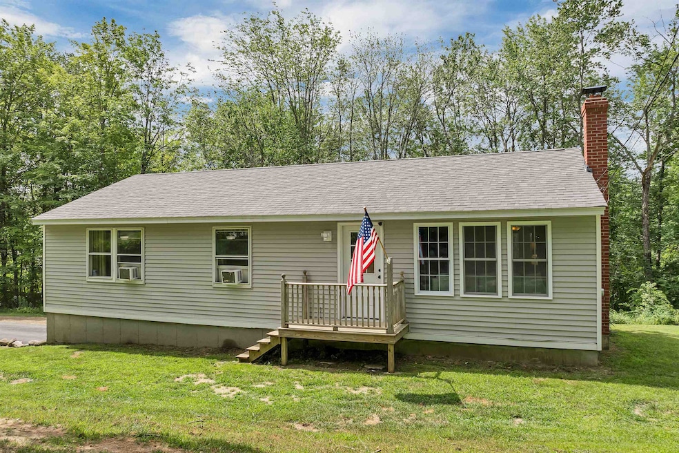
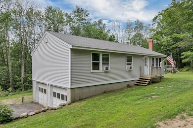
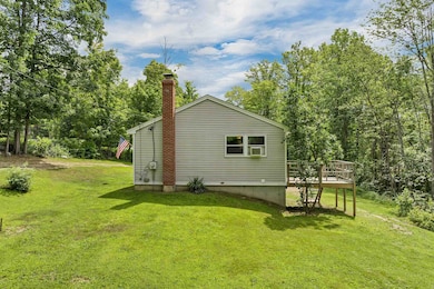
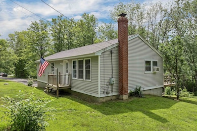
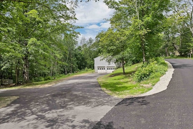
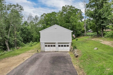
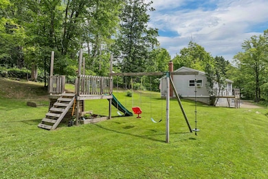
Step into this inviting 3-bedroom, 2-bath home offering 1,104 sq ft of comfortable living space on a generous lot. The spacious backyard is perfect for outdoor entertaining or unwinding in the fresh air. Inside, the kitchen includes beautiful Hickory faced wood cabinets and a handy breakfast bar that opens to the living area—great for casual meals or gathering with friends and family. A paved driveway provides easy parking, and the property is ideally located close to outdoor recreation. A perfect mix of comfort and outdoor charm—ready to make your own!
**OPEN HOUSE FOR 7/14/25 HAS BEEN CANCELLED**
Last Agent to Sell the Property
Century 21 NE Group License #081856 Listed on: 07/10/2025

| Date | Type | Sale Price | Title Company |
|---|---|---|---|
| Warranty Deed | $415,000 | -- | |
| Warranty Deed | $415,000 | -- | |
| Quit Claim Deed | -- | None Available | |
| Quit Claim Deed | -- | None Available | |
| Warranty Deed | $105,300 | -- | |
| Warranty Deed | $105,300 | -- |
| Date | Status | Loan Amount | Loan Type |
|---|---|---|---|
| Open | $407,483 | FHA | |
| Closed | $407,483 | FHA | |
| Previous Owner | $44,800 | Unknown | |
| Previous Owner | $53,806 | Unknown | |
| Closed | $0 | No Value Available |
| Date | Event | Price | List to Sale | Price per Sq Ft |
|---|---|---|---|---|
| 08/08/2025 08/08/25 | Sold | $415,000 | +3.8% | $376 / Sq Ft |
| 07/10/2025 07/10/25 | For Sale | $399,999 | -- | $362 / Sq Ft |
| Year | Tax Paid | Tax Assessment Tax Assessment Total Assessment is a certain percentage of the fair market value that is determined by local assessors to be the total taxable value of land and additions on the property. | Land | Improvement |
|---|---|---|---|---|
| 2024 | $4,270 | $216,100 | $65,600 | $150,500 |
| 2023 | $4,028 | $216,100 | $65,600 | $150,500 |
| 2022 | $3,702 | $216,100 | $65,600 | $150,500 |
| 2021 | $3,989 | $216,100 | $65,600 | $150,500 |
| 2020 | $3,965 | $154,600 | $56,100 | $98,500 |
| 2019 | $3,628 | $154,600 | $56,100 | $98,500 |
| 2018 | $3,651 | $154,500 | $56,100 | $98,400 |
| 2016 | $3,283 | $154,500 | $56,100 | $98,400 |
| 2015 | $3,108 | $142,500 | $68,600 | $73,900 |
| 2014 | $3,300 | $142,500 | $68,600 | $73,900 |
| 2013 | $3,214 | $141,700 | $68,600 | $73,100 |
| 2012 | $3,171 | $141,700 | $68,600 | $73,100 |
T
Seller's Agent in 2025
Tarsha Vachon
Century 21 NE Group
(603) 332-9500
1 in this area
2 Total Sales
S
Seller Co-Listing Agent in 2025
Sarah Garland
Century 21 NE Group
(603) 312-3031
1 in this area
25 Total Sales
Buyer's Agent in 2025
Patrick Desmond
Pine River Realty LLC
(603) 815-2248
1 in this area
75 Total Sales
Source: PrimeMLS
MLS Number: 5050892
APN: STRF-000020-000038-000001
Disclaimer: Certain information contained herein is derived from information provided by parties other than Homes.com. All information provided is deemed reliable, but is not guaranteed to be accurate and should be independently verified.
![]() Copyright 2025 PrimeMLS, Inc. All rights reserved. This information is deemed reliable, but not guaranteed. The data relating to real estate displayed on this display comes in part from the IDX Program of PrimeMLS. The information being provided is for consumers’ personal, non-commercial use and may not be used for any purpose other than to identify prospective properties consumers may be interested in purchasing.
Copyright 2025 PrimeMLS, Inc. All rights reserved. This information is deemed reliable, but not guaranteed. The data relating to real estate displayed on this display comes in part from the IDX Program of PrimeMLS. The information being provided is for consumers’ personal, non-commercial use and may not be used for any purpose other than to identify prospective properties consumers may be interested in purchasing.