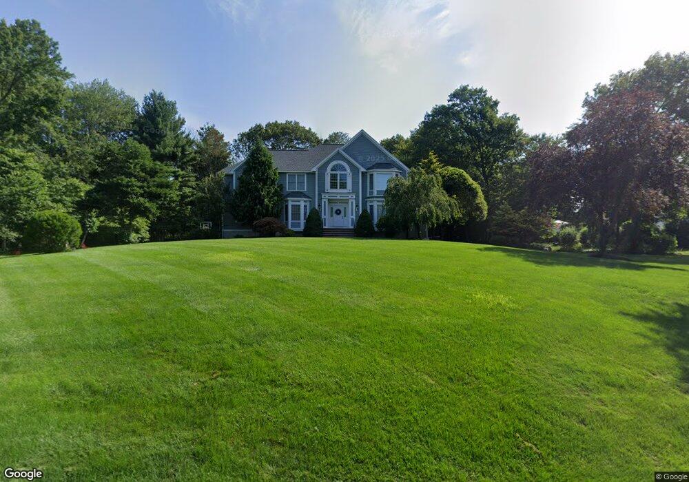
89 Osgood St Andover, MA 01810
Haggetts NeighborhoodEstimated Value: $1,476,239 - $1,616,000
4
Beds
3
Baths
4,140
Sq Ft
$372/Sq Ft
Est. Value
About This Home
This home is located at 89 Osgood St, Andover, MA 01810 and is currently estimated at $1,542,060, approximately $372 per square foot. 89 Osgood St is a home located in Essex County with nearby schools including Henry C. Sanborn Elementary School, Wood Hill Middle School, and Andover High School.
Ownership History
Date
Name
Owned For
Owner Type
Purchase Details
Closed on
Feb 22, 2002
Sold by
Omega Dev Llc
Bought by
Miller Bret G and Miller Beverly Jane
Current Estimated Value
Home Financials for this Owner
Home Financials are based on the most recent Mortgage that was taken out on this home.
Original Mortgage
$647,700
Interest Rate
7.08%
Mortgage Type
Purchase Money Mortgage
Purchase Details
Closed on
Apr 14, 2000
Sold by
Est Treanor Dorothy N and Dalton Susan T
Bought by
Omega Dev Llc
Home Financials for this Owner
Home Financials are based on the most recent Mortgage that was taken out on this home.
Original Mortgage
$412,900
Interest Rate
8.26%
Mortgage Type
Purchase Money Mortgage
Create a Home Valuation Report for This Property
The Home Valuation Report is an in-depth analysis detailing your home's value as well as a comparison with similar homes in the area
Home Values in the Area
Average Home Value in this Area
Purchase History
| Date | Buyer | Sale Price | Title Company |
|---|---|---|---|
| Miller Bret G | $809,658 | -- | |
| Omega Dev Llc | $215,000 | -- |
Source: Public Records
Mortgage History
| Date | Status | Borrower | Loan Amount |
|---|---|---|---|
| Open | Omega Dev Llc | $567,350 | |
| Closed | Omega Dev Llc | $50,000 | |
| Closed | Omega Dev Llc | $647,700 | |
| Previous Owner | Omega Dev Llc | $412,900 |
Source: Public Records
Tax History
| Year | Tax Paid | Tax Assessment Tax Assessment Total Assessment is a certain percentage of the fair market value that is determined by local assessors to be the total taxable value of land and additions on the property. | Land | Improvement |
|---|---|---|---|---|
| 2024 | $17,320 | $1,344,700 | $508,300 | $836,400 |
| 2023 | $16,594 | $1,214,800 | $457,800 | $757,000 |
| 2022 | $15,672 | $1,073,400 | $398,100 | $675,300 |
| 2021 | $15,045 | $984,000 | $362,000 | $622,000 |
| 2020 | $14,482 | $964,800 | $353,300 | $611,500 |
| 2019 | $14,424 | $944,600 | $342,800 | $601,800 |
| 2018 | $13,835 | $884,600 | $329,700 | $554,900 |
| 2017 | $13,301 | $876,200 | $323,200 | $553,000 |
| 2016 | $13,030 | $879,200 | $323,200 | $556,000 |
| 2015 | $12,522 | $836,500 | $310,600 | $525,900 |
Source: Public Records
Map
Nearby Homes
- 6 Hearthstone Place
- 58 Blanchard St
- 14 Geneva Rd
- 15 Geneva Rd
- 14 Jill's Way Unit 14
- 22 Haggetts Pond Rd
- 2 Garfield Ln W
- 11 Rennie Dr
- 20 Kensington Way Unit 20
- 72 Tewksbury St
- 18 Dale St Unit 9D
- 241 Lowell St Unit 3
- 6 Exeter Way
- 1 Delisio Dr
- 1 Lancaster Place
- 1283 Shawsheen St
- 910 Livingston St
- 50 Nolan Ct Unit 50
- 5 Hillcrest Rd
- 399 North St
- 85 Osgood St
- 86 Osgood St
- 94 Osgood St
- 1 Apple Blossom Rd
- 81 Osgood St
- 3 Apple Blossom Rd
- 98 Osgood St
- 5 Apple Blossom Rd
- 2 Apple Blossom Rd
- 79 Osgood St
- 102 Osgood St
- 7 Apple Blossom Rd
- 4 Apple Blossom Rd
- 6 Apple Blossom Rd
- 9 Apple Blossom Rd
- 71 Osgood St
- 72 Osgood St
- 106 Osgood St
- 11 Apple Blossom Rd
- 15 Apple Blossom Rd
Your Personal Tour Guide
Ask me questions while you tour the home.