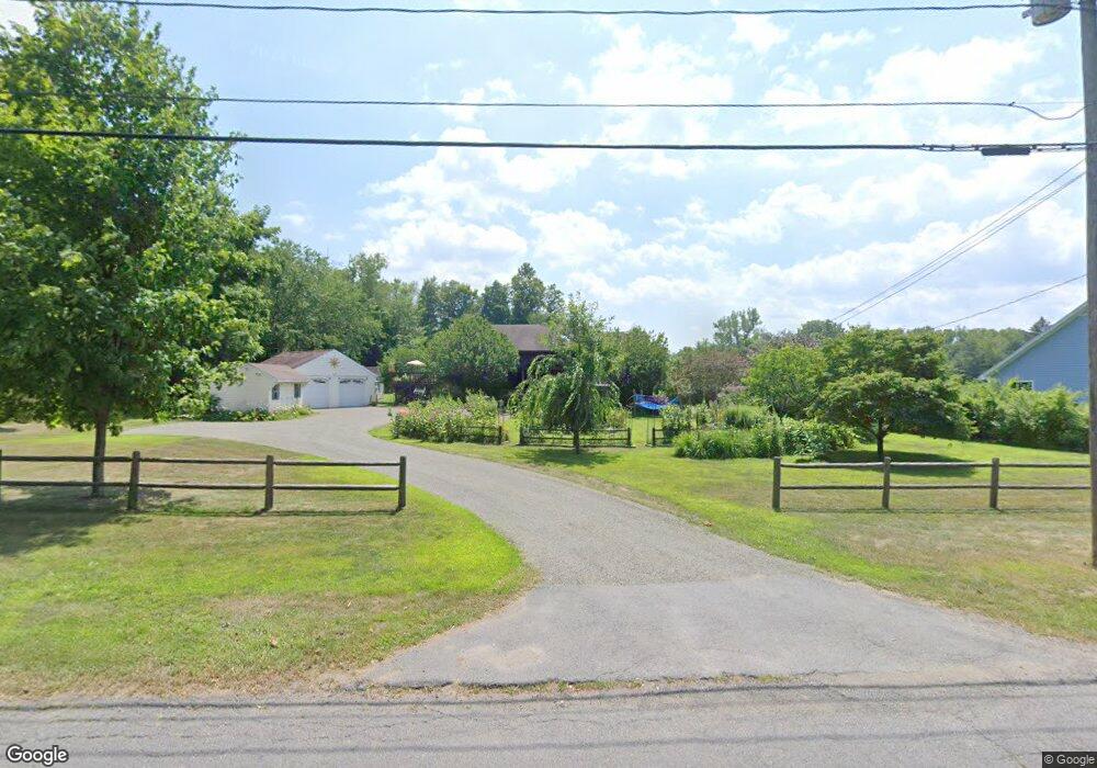
89 Pulpit Hill Rd Amherst, MA 01002
Estimated Value: $590,000 - $695,000
4
Beds
3
Baths
2,194
Sq Ft
$289/Sq Ft
Est. Value
About This Home
This home is located at 89 Pulpit Hill Rd, Amherst, MA 01002 and is currently estimated at $634,725, approximately $289 per square foot. 89 Pulpit Hill Rd is a home located in Hampshire County with nearby schools including Wildwood Elementary School, Amherst Regional Middle School, and Amherst Regional High School.
Ownership History
Date
Name
Owned For
Owner Type
Purchase Details
Closed on
Apr 9, 2025
Sold by
Levy Thomas C and Priest Haley J
Bought by
Thomas Charles Levy Ret and Levy
Current Estimated Value
Purchase Details
Closed on
Mar 3, 2025
Sold by
Levy Thomas C and Priest Haley A
Bought by
Thomas Charles Levy Ret and Levy
Purchase Details
Closed on
Jul 21, 1995
Sold by
Nowicki Joseph J and Nowicki Michael Jp
Bought by
Levy Thomas C and Priest Haleya J
Create a Home Valuation Report for This Property
The Home Valuation Report is an in-depth analysis detailing your home's value as well as a comparison with similar homes in the area
Home Values in the Area
Average Home Value in this Area
Purchase History
| Date | Buyer | Sale Price | Title Company |
|---|---|---|---|
| Thomas Charles Levy Ret | -- | None Available | |
| Thomas Charles Levy Ret | -- | None Available | |
| Thomas Charles Levy Ret | -- | None Available | |
| Thomas Charles Levy Ret | -- | None Available | |
| Levy Thomas C | $57,000 | -- | |
| Levy Thomas C | $57,000 | -- |
Source: Public Records
Mortgage History
| Date | Status | Borrower | Loan Amount |
|---|---|---|---|
| Previous Owner | Levy Thomas C | $116,000 | |
| Previous Owner | Levy Thomas C | $270,400 | |
| Previous Owner | Levy Thomas C | $25,000 | |
| Previous Owner | Levy Thomas C | $80,000 |
Source: Public Records
Tax History Compared to Growth
Tax History
| Year | Tax Paid | Tax Assessment Tax Assessment Total Assessment is a certain percentage of the fair market value that is determined by local assessors to be the total taxable value of land and additions on the property. | Land | Improvement |
|---|---|---|---|---|
| 2025 | $9,808 | $546,400 | $167,600 | $378,800 |
| 2024 | $9,577 | $517,400 | $158,600 | $358,800 |
| 2023 | $8,922 | $443,900 | $145,000 | $298,900 |
| 2022 | $8,461 | $397,800 | $131,400 | $266,400 |
| 2021 | $8,097 | $371,100 | $122,200 | $248,900 |
| 2020 | $7,912 | $371,100 | $122,200 | $248,900 |
| 2019 | $7,654 | $351,100 | $122,200 | $228,900 |
| 2018 | $7,422 | $351,100 | $122,200 | $228,900 |
| 2017 | $7,656 | $350,700 | $116,800 | $233,900 |
| 2016 | $7,442 | $350,700 | $116,800 | $233,900 |
| 2015 | $7,203 | $350,700 | $116,800 | $233,900 |
Source: Public Records
Map
Nearby Homes
- 0 Henry St
- Lot 3A-3 Leverett Rd
- 13 Harlow Dr
- 110 Grantwood Dr
- Lot A Kingman Rd
- 185 Cherry Ln
- 11 Sheerman Ln
- 39 Valley Ln
- 88 Farview Way
- 113 Juggler Meadow Rd
- 15 S Plain Rd
- 7 Roosevelt St
- Lot A January Hills Rd
- 73 Depot Rd
- 305 Strong St
- 27 January Hills Rd
- 10 Depot Rd
- 161 Chestnut St
- 0 Red Gate Ln Unit 73348273
- 65 N Prospect St
- 95 Pulpit Hill Rd
- 83 Pulpit Hill Rd
- 99 Pulpit Hill Rd
- 110 Pulpit Hill Rd
- 40 Ball Ln
- 120 Pulpit Hill Rd Unit 27
- 120 Pulpit Hill Rd Unit 14
- 120 Pulpit Hill Rd Unit 19
- 120 Pulpit Hill Rd Unit 2
- 120 Pulpit Hill Rd Unit 8
- 120 Pulpit Hill Rd Unit 9
- 120 Pulpit Hill Rd Unit 10
- 120 Pulpit Hill Rd Unit 16
- 120 Pulpit Hill Rd Unit 17
- 120 Pulpit Hill Rd Unit 18
- 120 Pulpit Hill Rd Unit 20
- 120 Pulpit Hill Rd Unit 21
- 120 Pulpit Hill Rd Unit 22
- 120 Pulpit Hill Rd Unit 23
- 120 Pulpit Hill Rd Unit 24