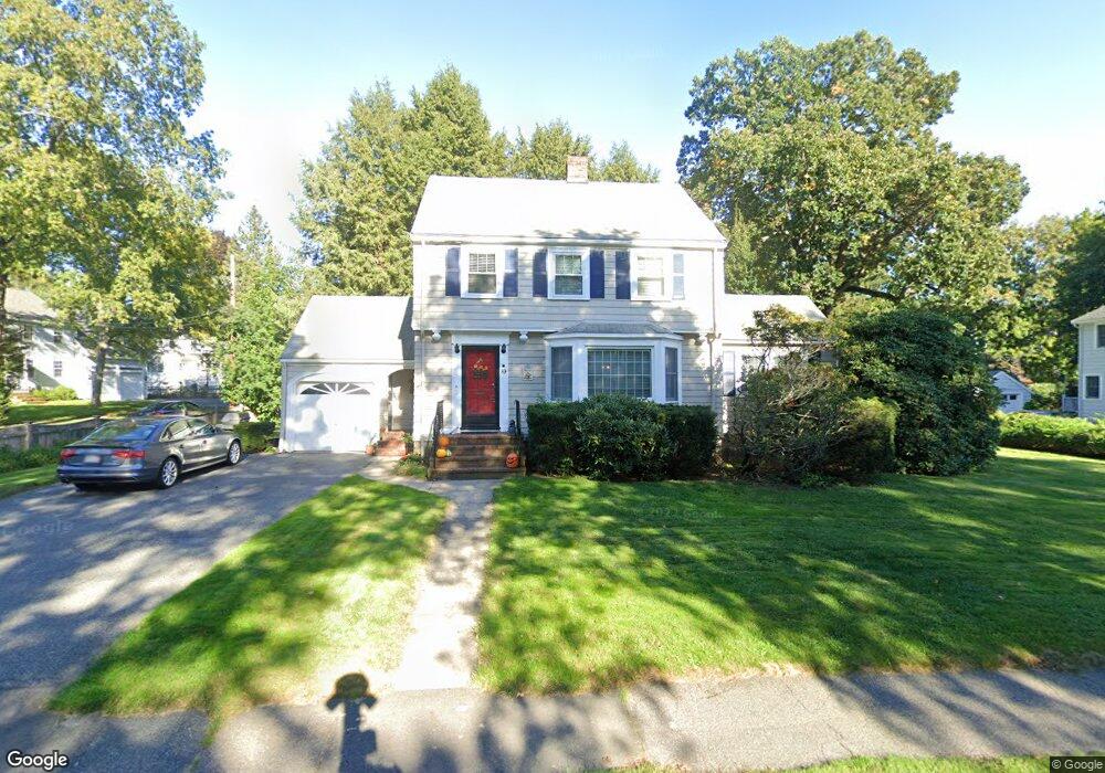
89 Washington Ave Needham, MA 02492
Estimated Value: $1,291,032 - $1,460,000
3
Beds
2
Baths
1,510
Sq Ft
$910/Sq Ft
Est. Value
About This Home
This home is located at 89 Washington Ave, Needham, MA 02492 and is currently estimated at $1,373,758, approximately $909 per square foot. 89 Washington Ave is a home located in Norfolk County with nearby schools including Mitchell Elementary School, High Rock Middle School, and Pollard Middle School.
Ownership History
Date
Name
Owned For
Owner Type
Purchase Details
Closed on
Jul 31, 2003
Sold by
Murphy John F and Murphy Anne M
Bought by
Theall Mark H and Theall Allison M
Current Estimated Value
Home Financials for this Owner
Home Financials are based on the most recent Mortgage that was taken out on this home.
Original Mortgage
$300,000
Interest Rate
5.28%
Mortgage Type
Purchase Money Mortgage
Purchase Details
Closed on
Jul 31, 1997
Sold by
Anthonakes John A and Anthonakes Helen
Bought by
Murphy John F and Murphy Anne M
Home Financials for this Owner
Home Financials are based on the most recent Mortgage that was taken out on this home.
Original Mortgage
$210,000
Interest Rate
7.55%
Mortgage Type
Purchase Money Mortgage
Create a Home Valuation Report for This Property
The Home Valuation Report is an in-depth analysis detailing your home's value as well as a comparison with similar homes in the area
Home Values in the Area
Average Home Value in this Area
Purchase History
| Date | Buyer | Sale Price | Title Company |
|---|---|---|---|
| Theall Mark H | $590,000 | -- | |
| Murphy John F | $328,500 | -- |
Source: Public Records
Mortgage History
| Date | Status | Borrower | Loan Amount |
|---|---|---|---|
| Open | Murphy John F | $365,000 | |
| Closed | Murphy John F | $350,000 | |
| Closed | Theall Mark H | $300,000 | |
| Previous Owner | Murphy John F | $213,000 | |
| Previous Owner | Murphy John F | $210,000 |
Source: Public Records
Tax History
| Year | Tax Paid | Tax Assessment Tax Assessment Total Assessment is a certain percentage of the fair market value that is determined by local assessors to be the total taxable value of land and additions on the property. | Land | Improvement |
|---|---|---|---|---|
| 2025 | $10,541 | $994,400 | $802,600 | $191,800 |
| 2024 | $10,558 | $843,300 | $590,700 | $252,600 |
| 2023 | $10,741 | $823,700 | $590,700 | $233,000 |
| 2022 | $9,979 | $746,400 | $522,900 | $223,500 |
| 2021 | $9,726 | $746,400 | $522,900 | $223,500 |
| 2020 | $9,195 | $736,200 | $522,900 | $213,300 |
| 2019 | $8,471 | $683,700 | $475,500 | $208,200 |
| 2018 | $8,122 | $683,700 | $475,500 | $208,200 |
| 2017 | $7,843 | $659,600 | $475,500 | $184,100 |
| 2016 | $7,612 | $659,600 | $475,500 | $184,100 |
| 2015 | $7,447 | $659,600 | $475,500 | $184,100 |
| 2014 | $6,680 | $573,900 | $396,500 | $177,400 |
Source: Public Records
Map
Nearby Homes
- 176 Highgate St
- 36 Otis St Unit 36
- 190 Brookline St
- 31 Birds Hill Ave
- 638 Webster St
- 638 Webster St Unit 638
- 68 Brookline St
- 126 Prince St
- 17 Lindbergh Ave
- 100 Bradford St
- 510 Webster St
- 19 Oakland Ave Unit 19
- 19 Highland Ct Unit 19
- 971 Webster St
- 233 Warren St
- 68 Pleasant St Unit 68
- 1011 Webster St
- 58 Morton St
- 24 Mellen St
- 60 Sutton Rd
- 79 Washington Ave
- 56 Nichols Rd
- 75 Washington Ave
- 99 Washington Ave
- 92 Washington Ave
- 80 Washington Ave
- 77 Hawthorn Ave
- 83 Hawthorn Ave
- 55 Nichols Rd
- 71 Washington Ave
- 100 Washington Ave
- 89 Hawthorn Ave
- 74 Washington Ave
- 67 Hawthorn Ave
- 67 Washington Ave
- 104 Washington Ave
- 70 Washington Ave
- 93 Hawthorn Ave
- 109 Washington Ave
- 44 Ellicott St
Your Personal Tour Guide
Ask me questions while you tour the home.