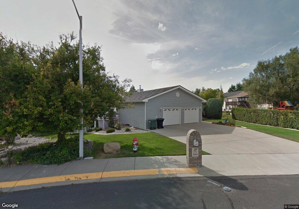
890 Silverdollar Cir Billings, MT 59105
Billings Heights NeighborhoodEstimated Value: $449,000 - $562,000
6
Beds
3
Baths
1,943
Sq Ft
$271/Sq Ft
Est. Value
About This Home
This home is located at 890 Silverdollar Cir, Billings, MT 59105 and is currently estimated at $526,215, approximately $270 per square foot. 890 Silverdollar Cir is a home located in Yellowstone County with nearby schools including Eagle Cliffs Elementary School, Castle Rock Junior High School, and Skyview High School.
Ownership History
Date
Name
Owned For
Owner Type
Purchase Details
Closed on
Sep 26, 2007
Sold by
Hanson Russell M and Hanson Vivian B
Bought by
Zabrocki Michael J and Zabrocki Vivian J
Current Estimated Value
Home Financials for this Owner
Home Financials are based on the most recent Mortgage that was taken out on this home.
Original Mortgage
$117,500
Interest Rate
6.46%
Mortgage Type
Purchase Money Mortgage
Create a Home Valuation Report for This Property
The Home Valuation Report is an in-depth analysis detailing your home's value as well as a comparison with similar homes in the area
Home Values in the Area
Average Home Value in this Area
Purchase History
| Date | Buyer | Sale Price | Title Company |
|---|---|---|---|
| Zabrocki Michael J | -- | None Available |
Source: Public Records
Mortgage History
| Date | Status | Borrower | Loan Amount |
|---|---|---|---|
| Closed | Zabrocki Michael J | $117,500 |
Source: Public Records
Tax History
| Year | Tax Paid | Tax Assessment Tax Assessment Total Assessment is a certain percentage of the fair market value that is determined by local assessors to be the total taxable value of land and additions on the property. | Land | Improvement |
|---|---|---|---|---|
| 2025 | $5,103 | $578,200 | $74,250 | $503,950 |
| 2024 | $5,103 | $506,300 | $66,110 | $440,190 |
| 2023 | $5,107 | $506,300 | $66,110 | $440,190 |
| 2022 | $4,380 | $377,900 | $0 | $0 |
| 2021 | $4,138 | $377,900 | $0 | $0 |
| 2020 | $4,111 | $359,000 | $0 | $0 |
| 2019 | $3,936 | $359,000 | $0 | $0 |
| 2018 | $3,880 | $347,300 | $0 | $0 |
| 2017 | $3,215 | $347,300 | $0 | $0 |
| 2016 | $3,710 | $345,800 | $0 | $0 |
| 2015 | $3,631 | $345,800 | $0 | $0 |
| 2014 | $3,212 | $161,014 | $0 | $0 |
Source: Public Records
Map
Nearby Homes
- 917 Senora Ave
- 1051 Strawberry Ave
- 1071 Strawberry Ave
- 1195 Patriot St
- 1168 Minuteman St
- 2011 Gleneagles Blvd
- 2059 Gleneagles Blvd
- 2027 Gleneagles Blvd
- 2019 Gleneagles Blvd
- 2067 Gleneagles Blvd
- 1010 Moon Valley Rd
- 1017 Toole Cir
- 651 Tumbleweed Dr
- 450 Freedom Ave
- 373 Stewart Ct S
- 1152 Toole Ct
- 540 Pinon Dr
- Lot D Alkali Creek Rd
- 600 Tumbleweed Dr
- Lot 35 Valley Heights Rd
- 890 Ginger Ave
- 872 Ginger Ave
- 872 Silverdollar Cir
- 900 Ginger Ave
- 854 Ginger Ave
- 931 Senora Ave
- 854 Silverdollar Cir
- 916 Ginger Ave
- 818 Silverdollar Cir
- 836 Ginger Ave
- 947 Senora Ave
- 930 Ginger Ave
- 873 Ginger Ave
- 865 Ginger Ave
- 901 Ginger Ave
- 818 Ginger Ave
- 855 Ginger Ave
- 928 Senora Ave
- 917 Ginger Ave
- 914 Senora Ave
Your Personal Tour Guide
Ask me questions while you tour the home.