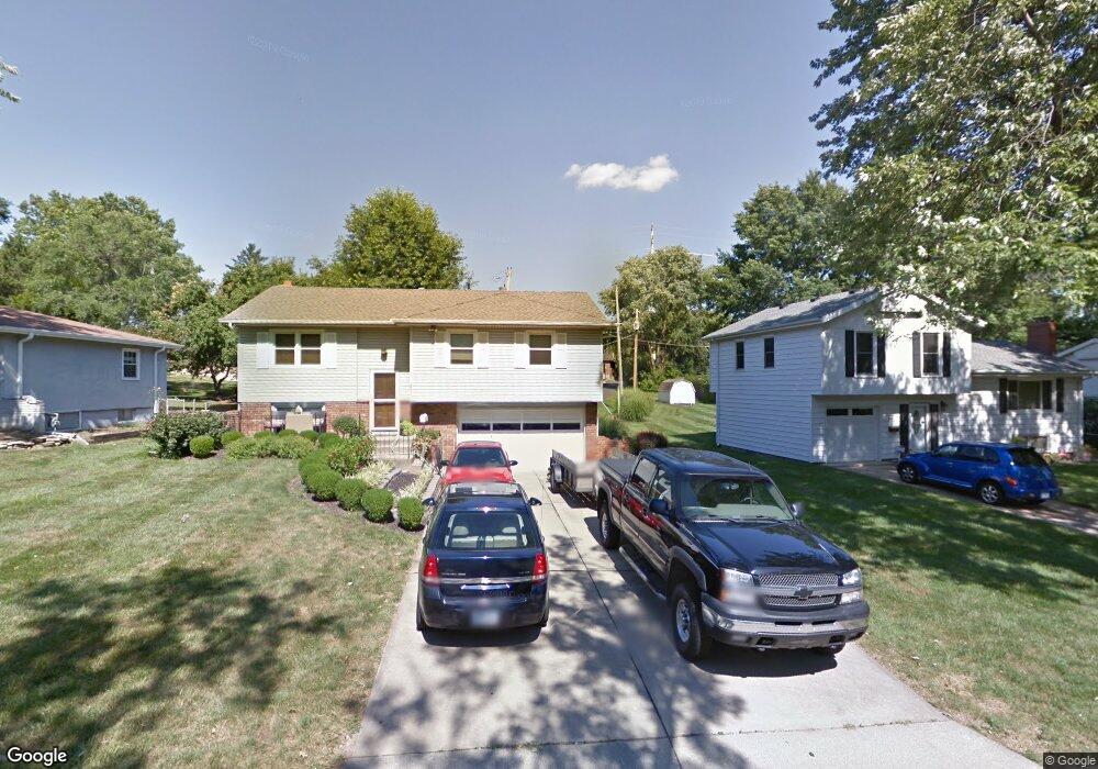
8915 Knox Ln Overland Park, KS 66212
Elmhurst NeighborhoodEstimated Value: $312,000 - $343,000
3
Beds
2
Baths
1,042
Sq Ft
$312/Sq Ft
Est. Value
About This Home
This home is located at 8915 Knox Ln, Overland Park, KS 66212 and is currently estimated at $325,140, approximately $312 per square foot. 8915 Knox Ln is a home located in Johnson County with nearby schools including Pawnee Elementary School, Westridge Middle School, and Shawnee Mission West High School.
Ownership History
Date
Name
Owned For
Owner Type
Purchase Details
Closed on
Sep 20, 2018
Sold by
Hudnall Megan
Bought by
Hudnall Kevin
Current Estimated Value
Purchase Details
Closed on
May 29, 2015
Sold by
Hudnall Judith J and Hudnall Stephen C
Bought by
Hudnall Kevin Chaeles and Hudnall Megan C
Home Financials for this Owner
Home Financials are based on the most recent Mortgage that was taken out on this home.
Original Mortgage
$95,000
Outstanding Balance
$73,396
Interest Rate
3.68%
Mortgage Type
New Conventional
Estimated Equity
$251,744
Create a Home Valuation Report for This Property
The Home Valuation Report is an in-depth analysis detailing your home's value as well as a comparison with similar homes in the area
Home Values in the Area
Average Home Value in this Area
Purchase History
| Date | Buyer | Sale Price | Title Company |
|---|---|---|---|
| Hudnall Kevin | -- | None Available | |
| Hudnall Kevin Chaeles | -- | All American Title Co |
Source: Public Records
Mortgage History
| Date | Status | Borrower | Loan Amount |
|---|---|---|---|
| Open | Hudnall Kevin Chaeles | $95,000 |
Source: Public Records
Tax History Compared to Growth
Tax History
| Year | Tax Paid | Tax Assessment Tax Assessment Total Assessment is a certain percentage of the fair market value that is determined by local assessors to be the total taxable value of land and additions on the property. | Land | Improvement |
|---|---|---|---|---|
| 2024 | $3,019 | $31,625 | $7,291 | $24,334 |
| 2023 | $2,893 | $29,705 | $7,291 | $22,414 |
| 2022 | $2,669 | $27,612 | $7,291 | $20,321 |
| 2021 | $2,669 | $24,334 | $6,077 | $18,257 |
| 2020 | $2,258 | $22,172 | $4,676 | $17,496 |
| 2019 | $2,095 | $20,597 | $3,778 | $16,819 |
| 2018 | $1,997 | $19,562 | $3,778 | $15,784 |
| 2017 | $1,770 | $17,078 | $3,778 | $13,300 |
| 2016 | $1,742 | $16,537 | $3,778 | $12,759 |
| 2015 | $1,637 | $15,882 | $3,778 | $12,104 |
| 2013 | -- | $15,663 | $3,778 | $11,885 |
Source: Public Records
Map
Nearby Homes
- 8931 Knox Ln
- 8947 Knox Ln
- 8926 Grant St
- 9310 W 90th St
- 9028 Grant St
- 9016 Wedd St
- 9121 Hayes Dr
- 9101 Wedd St
- 9135 Hayes Dr
- 8751 Wedd St
- 10106 W 91st St
- 9020 Grandview Dr
- 9210 Farley Ln
- 8805 Grandview St
- 10310 W 89th St
- 9303 Hayes Dr
- 9193 W 92nd Place
- 9146 W 92nd Place
- 10227 W 86th Terrace
- 8556 Wedd St
- 8909 Knox Ln
- 8923 Knox Ln
- 8901 Knox Ln
- 9700 W 89th Terrace
- 8908 Knox Ln
- 8939 Knox Ln
- 9708 W 89th Terrace
- 8900 Knox Ln
- 9716 W 89th Terrace
- 9709 W 89th Terrace
- 9709 W 89th St
- 9717 W 89th Terrace
- 8938 Knox Ln
- 8928 Carter Cir
- 0 Knox Ln
- 9724 W 89th Terrace
- 9751 W 89th St
- 9725 W 89th Terrace
- 9732 W 89th Terrace