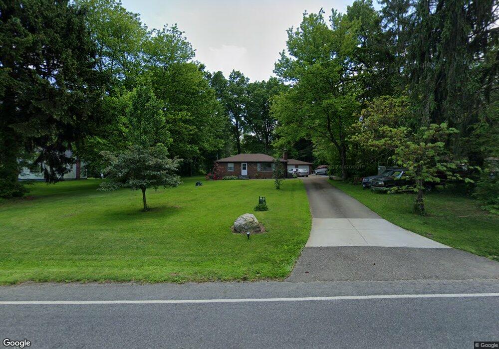
892 Renninger Rd New Franklin, OH 44319
Estimated Value: $123,000 - $179,000
2
Beds
1
Bath
864
Sq Ft
$187/Sq Ft
Est. Value
About This Home
This home is located at 892 Renninger Rd, New Franklin, OH 44319 and is currently estimated at $161,533, approximately $186 per square foot. 892 Renninger Rd is a home located in Summit County with nearby schools including Nolley Elementary School, Manchester Middle School, and Manchester High School.
Ownership History
Date
Name
Owned For
Owner Type
Purchase Details
Closed on
Aug 7, 2015
Sold by
Brown Annetta and Brown John
Bought by
Forte Michael
Current Estimated Value
Home Financials for this Owner
Home Financials are based on the most recent Mortgage that was taken out on this home.
Original Mortgage
$92,770
Interest Rate
3.75%
Mortgage Type
FHA
Purchase Details
Closed on
Jan 4, 2005
Sold by
Fort Wallace W
Bought by
Fort Wallace W and The Wallace W Fort Trust
Create a Home Valuation Report for This Property
The Home Valuation Report is an in-depth analysis detailing your home's value as well as a comparison with similar homes in the area
Home Values in the Area
Average Home Value in this Area
Purchase History
| Date | Buyer | Sale Price | Title Company |
|---|---|---|---|
| Forte Michael | $94,500 | First Security Title Corp | |
| Fort Wallace W | -- | -- |
Source: Public Records
Mortgage History
| Date | Status | Borrower | Loan Amount |
|---|---|---|---|
| Previous Owner | Forte Michael | $92,770 |
Source: Public Records
Tax History Compared to Growth
Tax History
| Year | Tax Paid | Tax Assessment Tax Assessment Total Assessment is a certain percentage of the fair market value that is determined by local assessors to be the total taxable value of land and additions on the property. | Land | Improvement |
|---|---|---|---|---|
| 2025 | $2,618 | $52,395 | $15,477 | $36,918 |
| 2024 | $2,618 | $52,395 | $15,477 | $36,918 |
| 2023 | $2,618 | $52,395 | $15,477 | $36,918 |
| 2022 | $2,535 | $39,512 | $11,550 | $27,962 |
| 2021 | $2,544 | $39,512 | $11,550 | $27,962 |
| 2020 | $2,500 | $39,510 | $11,550 | $27,960 |
| 2019 | $2,447 | $34,640 | $13,650 | $20,990 |
| 2018 | $2,112 | $34,640 | $13,650 | $20,990 |
| 2017 | $1,520 | $34,640 | $13,650 | $20,990 |
| 2016 | $2,081 | $31,300 | $13,650 | $17,650 |
| 2015 | $1,520 | $31,300 | $13,650 | $17,650 |
| 2014 | $1,509 | $31,300 | $13,650 | $17,650 |
| 2013 | $1,502 | $31,300 | $13,650 | $17,650 |
Source: Public Records
Map
Nearby Homes
- 4973 Patricia Dr
- 1365 Vanderhoof Rd
- 715 Highland Park Dr
- 4944 Coleman Dr
- 4869 Coleman Dr
- 5776 Harter Home Dr
- 5737 Towerview Dr
- S/L 14,15 Shakes Hotel Dr
- 1343 Vermillion Dr
- 4751 Bickford Ave
- lot 8 Whyem Dr
- 1062 Stump Rd
- 877 W Nimisila Rd
- 410 Silk Ct
- 7 Shrakes Hotel Dr
- 5 Shrakes Hotel Dr
- 6 Shrakes Hotel Dr
- 4 Shrakes Hotel Dr
- 3 Shrakes Hotel Dr
- 5898 Keller Rd
- 904 Renninger Rd
- 880 Renninger Rd
- 916 Renninger Rd
- 868 Renninger Rd
- 897 Renninger Rd
- 875 Renninger Rd
- 887 Renninger Rd
- 907 Renninger Rd
- 865 Renninger Rd
- 928 Renninger Rd
- 856 Renninger Rd
- 917 Renninger Rd
- 857 Renninger Rd
- 927 Renninger Rd
- 852 Zeletta Dr
- 846 Zeletta Dr
- 858 Zeletta Dr
- 847 Renninger Rd
- 864 Zeletta Dr
- 937 Renninger Rd