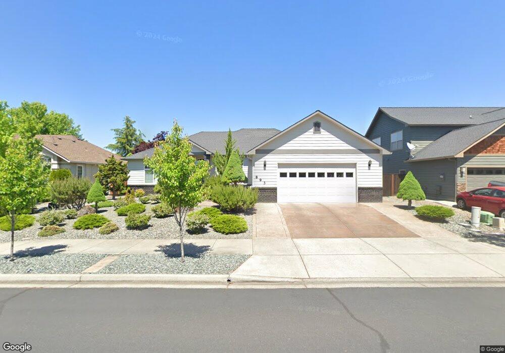
893 St Andrews Way Eagle Point, OR 97524
Estimated Value: $527,059 - $608,000
3
Beds
2
Baths
2,094
Sq Ft
$267/Sq Ft
Est. Value
About This Home
This home is located at 893 St Andrews Way, Eagle Point, OR 97524 and is currently estimated at $559,515, approximately $267 per square foot. 893 St Andrews Way is a home located in Jackson County with nearby schools including Eagle Point Middle School, White Mountain Middle School, and Eagle Point High School.
Ownership History
Date
Name
Owned For
Owner Type
Purchase Details
Closed on
Feb 26, 2003
Sold by
Eagle Ridge Building & Design Inc
Bought by
Shaddox M Dale and Shaddox Karen F
Current Estimated Value
Home Financials for this Owner
Home Financials are based on the most recent Mortgage that was taken out on this home.
Original Mortgage
$215,900
Outstanding Balance
$89,832
Interest Rate
5.93%
Estimated Equity
$469,683
Create a Home Valuation Report for This Property
The Home Valuation Report is an in-depth analysis detailing your home's value as well as a comparison with similar homes in the area
Home Values in the Area
Average Home Value in this Area
Purchase History
| Date | Buyer | Sale Price | Title Company |
|---|---|---|---|
| Shaddox M Dale | $269,900 | Lawyers Title Insurance Corp |
Source: Public Records
Mortgage History
| Date | Status | Borrower | Loan Amount |
|---|---|---|---|
| Open | Shaddox M Dale | $215,900 |
Source: Public Records
Tax History
| Year | Tax Paid | Tax Assessment Tax Assessment Total Assessment is a certain percentage of the fair market value that is determined by local assessors to be the total taxable value of land and additions on the property. | Land | Improvement |
|---|---|---|---|---|
| 2026 | $5,031 | $358,630 | $128,000 | $230,630 |
| 2025 | $4,912 | $359,000 | $72,970 | $286,030 |
| 2024 | $4,912 | $348,550 | $70,840 | $277,710 |
| 2023 | $4,746 | $338,400 | $68,780 | $269,620 |
| 2022 | $4,616 | $338,400 | $68,780 | $269,620 |
| 2021 | $4,480 | $328,550 | $66,780 | $261,770 |
| 2020 | $4,759 | $318,990 | $64,830 | $254,160 |
| 2019 | $4,686 | $300,680 | $61,110 | $239,570 |
| 2018 | $4,597 | $291,930 | $59,330 | $232,600 |
| 2017 | $4,484 | $291,930 | $59,330 | $232,600 |
| 2016 | $4,397 | $275,180 | $55,920 | $219,260 |
| 2015 | $4,253 | $275,180 | $55,920 | $219,260 |
| 2014 | $4,131 | $259,390 | $52,700 | $206,690 |
Source: Public Records
Map
Nearby Homes
- 964 Pumpkin Ridge
- 995 Pumpkin Ridge
- 936 Arrowhead Trail
- 888 Arrowhead Trail
- 131 Spanish Bay Ct
- 997 Arrowhead Trail
- 1043 Arrowhead Trail
- 374 Leandra Ln
- 74 Eagle View Dr
- 1140 Pumpkin Ridge Unit 336
- 1146 Pumpkin Unit 335
- 421 Stevens Rd Unit 20
- 421 Stevens Rd Unit 14
- 421 Stevens Rd Unit 52
- 384 Robert Trent Jones Blvd
- 1135 Pumpkin Ridge Unit 319
- 1141 Pumpkin Ridge Unit 320
- 235 Prairie Landing Dr
- 1164 Pumpkin Unit 332
- 1147 Pumpkin Unit 321
- 887 St Andrews Way
- 899 St Andrews Way
- 980 Fairview Ct
- 881 St Andrews Way
- 890 St Andrews Way
- 0 Saint Andrews Way Unit 100230472
- 0 Saint Andrews Way Unit 136 100235240
- 0 Saint Andrews Way Unit 134
- 896 St Andrews Way
- 9 Aspen Ct
- 13 Aspen Ct
- 974 Fairview Ct
- 884 St Andrews Way
- 902 St Andrews Way
- 875 St Andrews Way
- 911 St Andrews Way
- 878 St Andrews Way
- 908 St Andrews Way
- 971 Fairview Ct
- 150 Bellerive Dr
Your Personal Tour Guide
Ask me questions while you tour the home.