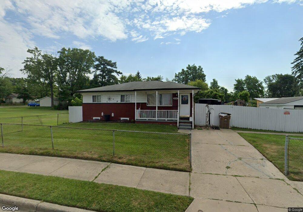
896 Stirling St Pontiac, MI 48340
Estimated Value: $91,000 - $136,271
3
Beds
1
Bath
955
Sq Ft
$124/Sq Ft
Est. Value
About This Home
This home is located at 896 Stirling St, Pontiac, MI 48340 and is currently estimated at $118,818, approximately $124 per square foot. 896 Stirling St is a home located in Oakland County with nearby schools including Rogers Elementary, Pontiac Middle School, and Pontiac High School.
Ownership History
Date
Name
Owned For
Owner Type
Purchase Details
Closed on
May 11, 2021
Sold by
Altenberger Bruce Allen and Attenberger James A
Bought by
Polo Heidi
Current Estimated Value
Purchase Details
Closed on
Oct 1, 2015
Sold by
Attenberger Bruce Allen and Attenberger Joanne
Bought by
Bale Chrisy
Purchase Details
Closed on
Jun 22, 2000
Sold by
Attenberger James A
Bought by
Attenberger James A and Attenberger Bruce Allen
Create a Home Valuation Report for This Property
The Home Valuation Report is an in-depth analysis detailing your home's value as well as a comparison with similar homes in the area
Home Values in the Area
Average Home Value in this Area
Purchase History
| Date | Buyer | Sale Price | Title Company |
|---|---|---|---|
| Polo Heidi | $65,000 | Ata National Title Group Llc | |
| Bale Chrisy | -- | Attorney | |
| Attenberger James A | -- | None Available | |
| Attenberger James A | -- | None Available |
Source: Public Records
Tax History Compared to Growth
Tax History
| Year | Tax Paid | Tax Assessment Tax Assessment Total Assessment is a certain percentage of the fair market value that is determined by local assessors to be the total taxable value of land and additions on the property. | Land | Improvement |
|---|---|---|---|---|
| 2024 | $1,497 | $47,620 | $0 | $0 |
| 2023 | $1,427 | $42,850 | $0 | $0 |
| 2022 | $1,449 | $36,970 | $0 | $0 |
| 2021 | $790 | $32,390 | $0 | $0 |
| 2020 | $1,050 | $29,330 | $0 | $0 |
| 2019 | $1,106 | $24,800 | $0 | $0 |
| 2018 | $1,065 | $22,500 | $0 | $0 |
| 2017 | $1,022 | $21,260 | $0 | $0 |
| 2016 | $1,046 | $17,810 | $0 | $0 |
| 2015 | -- | $16,140 | $0 | $0 |
| 2014 | -- | $15,630 | $0 | $0 |
| 2011 | -- | $28,370 | $0 | $0 |
Source: Public Records
Map
Nearby Homes
- 821 Robinwood St
- 785 Kenilworth Ave
- 790 Parkwood Ave
- 802 Cameron Ave
- 790 Cameron Ave
- 973 Kettering Ave
- 770 Cameron Ave
- 715 Kenilworth Ave
- 808 Kettering Ave
- 663 Lenox Ave
- 731 1st Ave
- 667 Raskob St
- 675 E Beverly Ave
- 630 E Madison Ave
- 644 Brady Ln
- 627 Wesbrook St
- 620 Wesbrook St
- 778 4th Ave
- 614 E Tennyson Ave
- 457 Cameron Ave
- 886 Stirling St
- 882 Stirling St
- 893 Melrose St
- 903 Melrose St
- 887 Melrose St
- 895 Stirling St
- 883 Melrose St
- 891 Stirling St
- 885 S Stirling
- 901 Stirling St
- 876 Stirling St
- 885 Stirling St
- 915 Melrose St
- 881 Stirling St
- 872 Stirling St
- 1232 N Perry St
- 873 Melrose St
- 875 Stirling St
- 890 Robinwood St
- 871 Stirling St