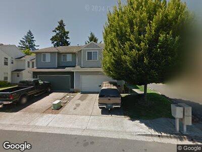
897 N 21st Ave Cornelius, OR 97113
Estimated Value: $429,000 - $521,000
3
Beds
3
Baths
1,874
Sq Ft
$249/Sq Ft
Est. Value
About This Home
This home is located at 897 N 21st Ave, Cornelius, OR 97113 and is currently estimated at $467,461, approximately $249 per square foot. 897 N 21st Ave is a home located in Washington County with nearby schools including Free Orchards Elementary School, Evergreen Jr High School, and Glencoe High School.
Ownership History
Date
Name
Owned For
Owner Type
Purchase Details
Closed on
Apr 6, 2007
Sold by
Vazquez Ignacio Garcia
Bought by
Creel James H and Creel Sandra L
Current Estimated Value
Home Financials for this Owner
Home Financials are based on the most recent Mortgage that was taken out on this home.
Original Mortgage
$184,000
Interest Rate
6.75%
Mortgage Type
Unknown
Purchase Details
Closed on
Dec 29, 2003
Sold by
Morey Robert S and Clark Morey Timi
Bought by
Vazquez Ignacio Garcia
Home Financials for this Owner
Home Financials are based on the most recent Mortgage that was taken out on this home.
Original Mortgage
$127,200
Interest Rate
7.99%
Mortgage Type
Unknown
Create a Home Valuation Report for This Property
The Home Valuation Report is an in-depth analysis detailing your home's value as well as a comparison with similar homes in the area
Home Values in the Area
Average Home Value in this Area
Purchase History
| Date | Buyer | Sale Price | Title Company |
|---|---|---|---|
| Creel James H | $230,000 | First American | |
| Vazquez Ignacio Garcia | $159,000 | Fidelity Natl Title Co Of Or |
Source: Public Records
Mortgage History
| Date | Status | Borrower | Loan Amount |
|---|---|---|---|
| Open | Creel James H | $146,309 | |
| Closed | Creel James H | $184,000 | |
| Closed | Creel James H | $34,500 | |
| Previous Owner | Vazquez Ignacio Garcia | $127,200 | |
| Closed | Vazquez Ignacio Garcia | $31,800 |
Source: Public Records
Tax History Compared to Growth
Tax History
| Year | Tax Paid | Tax Assessment Tax Assessment Total Assessment is a certain percentage of the fair market value that is determined by local assessors to be the total taxable value of land and additions on the property. | Land | Improvement |
|---|---|---|---|---|
| 2025 | $3,856 | $235,080 | -- | -- |
| 2024 | $3,530 | $228,240 | -- | -- |
| 2023 | $3,530 | $221,600 | $0 | $0 |
| 2022 | $3,435 | $221,600 | $0 | $0 |
| 2021 | $3,368 | $208,890 | $0 | $0 |
| 2020 | $3,297 | $202,810 | $0 | $0 |
| 2019 | $3,202 | $196,910 | $0 | $0 |
| 2018 | $3,063 | $191,180 | $0 | $0 |
| 2017 | $2,951 | $185,620 | $0 | $0 |
| 2016 | $2,870 | $180,220 | $0 | $0 |
| 2015 | $2,753 | $174,980 | $0 | $0 |
| 2014 | $2,658 | $169,890 | $0 | $0 |
Source: Public Records
Map
Nearby Homes
- 507 N 19th Ave Unit 2
- 507 N 19th Ave
- 507 N 19th Ave Unit 1
- 507 N 19th Ave Unit 37
- 507 N 19th Ave Unit 15
- 2597 N Lambert St
- 2651 N Fremont St
- 1044 N 26th Terrace
- 440 N 14th Ave
- 1427 N Davis St
- 2751 N Irvine Ct
- 802 N 28th Ave
- 570 N 10th St Unit 29
- 2799 N Fremont St
- 0 NW Spiesschaert Rd
- 570 N 10th Ave Unit 21
- 570 N 10th Ave Unit 75
- 570 N 10th Ave Unit 6
- 570 N 10th Ave Unit 110
- 570 N 10th Ave Unit 10
- 897 N 21st Ave
- 885 N 21st Ave
- 909 N 21st Ave
- 873 N 21st Ave
- 925 N 21st Ave
- 859 N 21st Ave
- 2118 N Kamiakan Dr
- 901 N 21st Ave
- 937 N 21st Ave
- 2016 N Holladay St
- 838 N 20th Way
- 845 N 21st Ave
- 840 N 20th Way
- 2124 N Kamiakan Dr
- 953 N 21st Ave
- 844 N 20th Way
- 2115 N Kamiakan Dr
- 831 N 21st Ave
- 856 N 20th Way
- 836 N 20th Way