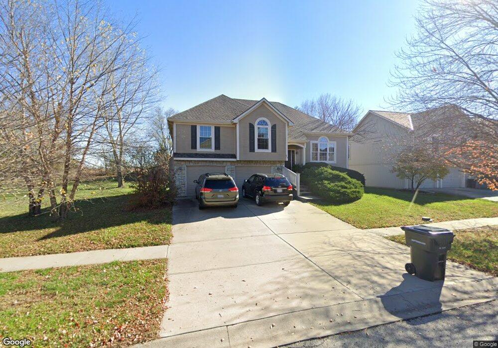
897 Wyndham Dr Lansing, KS 66043
Estimated Value: $366,000 - $385,000
4
Beds
3
Baths
1,718
Sq Ft
$218/Sq Ft
Est. Value
About This Home
This home is located at 897 Wyndham Dr, Lansing, KS 66043 and is currently estimated at $373,732, approximately $217 per square foot. 897 Wyndham Dr is a home located in Leavenworth County with nearby schools including Lansing Elementary School, Lansing Middle 6-8, and Lansing High 9-12.
Ownership History
Date
Name
Owned For
Owner Type
Purchase Details
Closed on
May 1, 2003
Bought by
Lauber Mark H and Lauber Sherry L
Current Estimated Value
Home Financials for this Owner
Home Financials are based on the most recent Mortgage that was taken out on this home.
Original Mortgage
$106,200
Interest Rate
5.79%
Mortgage Type
New Conventional
Create a Home Valuation Report for This Property
The Home Valuation Report is an in-depth analysis detailing your home's value as well as a comparison with similar homes in the area
Home Values in the Area
Average Home Value in this Area
Purchase History
| Date | Buyer | Sale Price | Title Company |
|---|---|---|---|
| Lauber Mark H | $184,500 | -- |
Source: Public Records
Mortgage History
| Date | Status | Borrower | Loan Amount |
|---|---|---|---|
| Closed | Lauber Mark H | $106,200 | |
| Closed | Lauber Mark H | $159,400 |
Source: Public Records
Tax History Compared to Growth
Tax History
| Year | Tax Paid | Tax Assessment Tax Assessment Total Assessment is a certain percentage of the fair market value that is determined by local assessors to be the total taxable value of land and additions on the property. | Land | Improvement |
|---|---|---|---|---|
| 2025 | $5,135 | $39,665 | $5,331 | $34,334 |
| 2024 | $4,764 | $38,139 | $5,331 | $32,808 |
| 2023 | $4,764 | $36,672 | $5,331 | $31,341 |
| 2022 | $4,581 | $33,338 | $3,328 | $30,010 |
| 2021 | $4,466 | $31,004 | $3,328 | $27,676 |
| 2020 | $4,163 | $28,462 | $3,328 | $25,134 |
| 2019 | $4,043 | $27,611 | $3,328 | $24,283 |
| 2018 | $3,705 | $25,340 | $3,328 | $22,012 |
| 2017 | $3,463 | $23,649 | $3,328 | $20,321 |
| 2016 | $3,430 | $23,414 | $3,328 | $20,086 |
| 2015 | $3,521 | $24,104 | $3,328 | $20,776 |
| 2014 | $3,356 | $23,460 | $3,328 | $20,132 |
Source: Public Records
Map
Nearby Homes
- 722 Bittersweet Rd
- 922 Southfork St
- 901 S Main St
- 624 S Bittersweet Ln
- 115 W Gilman Rd
- 527 S Valley Dr
- 104 Olive St
- 811 4-H Rd
- 506 1st Terrace
- 131 Rock Creek Loop
- 000 4-H Rd
- 202 S Main St
- 875 Clearview Dr
- 124 S Main St
- 102 S 3rd Ct
- 705 Rock Creek Dr
- 1221 S Desoto Rd
- 833 Rock Creek Dr
- 218 E Kay St
- 209 E Kay St