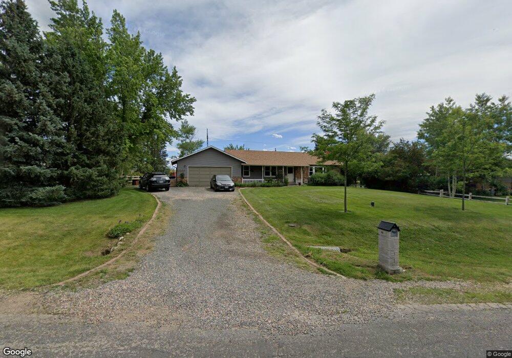
8978 Tahoe Ln Boulder, CO 80301
Estimated Value: $806,513 - $1,380,000
4
Beds
2
Baths
2,504
Sq Ft
$428/Sq Ft
Est. Value
About This Home
This home is located at 8978 Tahoe Ln, Boulder, CO 80301 and is currently estimated at $1,070,628, approximately $427 per square foot. 8978 Tahoe Ln is a home located in Boulder County with nearby schools including Douglass Elementary School, Nevin Platt Middle School, and Centaurus High School.
Ownership History
Date
Name
Owned For
Owner Type
Purchase Details
Closed on
Apr 2, 2004
Sold by
Dunaway David Ray and Dunaway Linda Lee
Bought by
Puscher Donald M and Sampsel Laurie
Current Estimated Value
Home Financials for this Owner
Home Financials are based on the most recent Mortgage that was taken out on this home.
Original Mortgage
$414,400
Outstanding Balance
$172,236
Interest Rate
4%
Mortgage Type
Purchase Money Mortgage
Estimated Equity
$898,392
Purchase Details
Closed on
Jul 5, 1996
Sold by
Steineck Raymond R
Bought by
Dunaway David Ray
Home Financials for this Owner
Home Financials are based on the most recent Mortgage that was taken out on this home.
Original Mortgage
$197,760
Interest Rate
8.05%
Mortgage Type
VA
Purchase Details
Closed on
Aug 18, 1971
Bought by
Puscher Donald M and Sampsel Laurie
Create a Home Valuation Report for This Property
The Home Valuation Report is an in-depth analysis detailing your home's value as well as a comparison with similar homes in the area
Home Values in the Area
Average Home Value in this Area
Purchase History
| Date | Buyer | Sale Price | Title Company |
|---|---|---|---|
| Puscher Donald M | $518,000 | -- | |
| Dunaway David Ray | $192,000 | Land Title | |
| Puscher Donald M | $4,000 | -- |
Source: Public Records
Mortgage History
| Date | Status | Borrower | Loan Amount |
|---|---|---|---|
| Open | Puscher Donald M | $414,400 | |
| Previous Owner | Dunaway David Ray | $197,760 | |
| Closed | Puscher Donald M | $51,800 |
Source: Public Records
Tax History
| Year | Tax Paid | Tax Assessment Tax Assessment Total Assessment is a certain percentage of the fair market value that is determined by local assessors to be the total taxable value of land and additions on the property. | Land | Improvement |
|---|---|---|---|---|
| 2025 | $5,401 | $61,112 | $32,669 | $28,443 |
| 2024 | $5,401 | $61,112 | $32,669 | $28,443 |
| 2023 | $5,319 | $57,419 | $21,554 | $39,550 |
| 2022 | $5,073 | $51,080 | $18,668 | $32,412 |
| 2021 | $4,844 | $52,549 | $19,205 | $33,344 |
| 2020 | $4,696 | $48,756 | $22,666 | $26,090 |
| 2019 | $4,622 | $48,756 | $22,666 | $26,090 |
| 2018 | $3,925 | $40,932 | $19,368 | $21,564 |
| 2017 | $3,814 | $45,252 | $21,412 | $23,840 |
| 2016 | $4,305 | $44,512 | $25,392 | $19,120 |
| 2015 | $4,056 | $38,741 | $17,910 | $20,831 |
| 2014 | $4,047 | $38,741 | $17,910 | $20,831 |
Source: Public Records
Map
Nearby Homes
- 1484 Wicklow St
- 1470 White Hawk Ranch Dr
- 1592 Kilkenny St
- 8778 Arapahoe Rd
- 1482 High Plains Ct
- 9022 Jason Ct
- 2554 Dutch Ct
- 1338 Tipperary St
- 2590 Blue Heron Cir W
- 2527 Columbine Cir
- 2548 Ginny Way
- 2551 Ginny Way
- 3044 Red Deer Trail
- 3031 Thunder Lake Cir
- 2428 Concord Cir
- 9776 Arapahoe Rd
- 2547 Concord Cir
- 805 Beauprez Ave
- 9850 Arapahoe Rd
- 595 Beauprez Ave
- 8996 Tahoe Ln
- 8958 Tahoe Ln
- 9014 Tahoe Ln
- 8940 Tahoe Ln
- 8985 Tahoe Ln
- 2070 Champlain Dr
- 8922 Tahoe Ln
- 9007 Tahoe Ln
- 9032 Tahoe Ln
- 8929 Tahoe Ln
- 9037 Tahoe Ln
- 9050 Tahoe Ln
- 1988 Park Lake Dr
- 2162 Placid Dr
- 2087 Mead Dr
- 2124 Champlain Dr
- 2178 Placid Dr
- 2050 Park Lake Dr
- 1866 Park Lake Dr
- 9070 Tahoe Ln
Your Personal Tour Guide
Ask me questions while you tour the home.