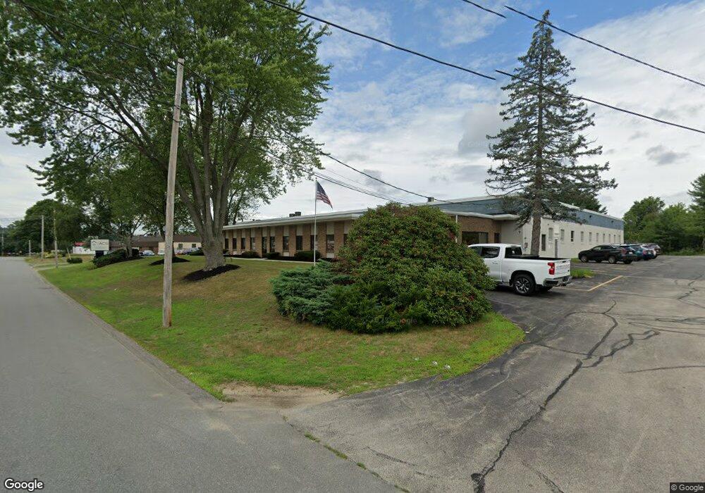
9-11 Flagstone Dr Hudson, NH 03051
Estimated Value: $5,854,660
--
Bed
--
Bath
31,552
Sq Ft
$186/Sq Ft
Est. Value
About This Home
This home is located at 9-11 Flagstone Dr, Hudson, NH 03051 and is currently estimated at $5,854,660, approximately $185 per square foot. 9-11 Flagstone Dr is a home located in Hillsborough County with nearby schools including Presentation of Mary Academy and World Academy.
Ownership History
Date
Name
Owned For
Owner Type
Purchase Details
Closed on
Sep 30, 2014
Sold by
Belair Rt
Bought by
9-11 Flagstone Drive L
Current Estimated Value
Purchase Details
Closed on
Sep 26, 2007
Sold by
Brassard Leon P and Brassard Jeannette A
Bought by
Belair Rt
Create a Home Valuation Report for This Property
The Home Valuation Report is an in-depth analysis detailing your home's value as well as a comparison with similar homes in the area
Home Values in the Area
Average Home Value in this Area
Purchase History
| Date | Buyer | Sale Price | Title Company |
|---|---|---|---|
| 9-11 Flagstone Drive L | $2,400,000 | -- | |
| 9-11 Flagstone Drive L | $2,400,000 | -- | |
| Belair Rt | $2,300,000 | -- | |
| Belair Rt | $2,300,000 | -- |
Source: Public Records
Mortgage History
| Date | Status | Borrower | Loan Amount |
|---|---|---|---|
| Previous Owner | Belair Rt | $1,687,500 | |
| Previous Owner | Belair Rt | $1,687,500 | |
| Previous Owner | Belair Rt | $260,000 |
Source: Public Records
Tax History Compared to Growth
Tax History
| Year | Tax Paid | Tax Assessment Tax Assessment Total Assessment is a certain percentage of the fair market value that is determined by local assessors to be the total taxable value of land and additions on the property. | Land | Improvement |
|---|---|---|---|---|
| 2024 | $43,861 | $2,666,300 | $942,500 | $1,723,800 |
| 2023 | $41,808 | $2,666,300 | $942,500 | $1,723,800 |
| 2022 | $39,168 | $2,666,300 | $942,500 | $1,723,800 |
| 2021 | $50,134 | $2,313,500 | $696,000 | $1,617,500 |
| 2020 | $47,161 | $2,206,900 | $696,000 | $1,510,900 |
| 2019 | $44,821 | $2,210,100 | $696,000 | $1,514,100 |
| 2018 | $44,423 | $2,210,100 | $696,000 | $1,514,100 |
| 2017 | $43,583 | $2,210,100 | $696,000 | $1,514,100 |
| 2016 | $34,568 | $1,573,400 | $501,100 | $1,072,300 |
| 2015 | $33,409 | $1,572,200 | $501,100 | $1,071,100 |
| 2014 | $32,749 | $1,572,200 | $501,100 | $1,071,100 |
| 2013 | -- | $1,572,200 | $501,100 | $1,071,100 |
Source: Public Records
Map
Nearby Homes
- 130 E Hobart St Unit 85
- 7 Fairhaven Rd
- 160 Daniel Webster Hwy Unit 328
- 7 Hickory St
- 2 Copper Hill Rd
- 59 Pike St
- 73 Bluestone Dr
- 85 Bluestone Dr
- 5 Louisburg Square Unit 11
- 92 Bluestone Dr
- 55 Glen Dr
- 22 Old Coach Rd
- 2 Waverly St
- 10 Cedar St
- 61 Spindlewick Dr
- 14 Tessier St
- 36 Eastman St Unit 26
- 27 Fifield St Unit 13
- 15 Roosevelt Ave
- 54 Dracut Rd
- 13 Flagstone Dr
- 3 Sagamore Park Rd
- 225 G E Lowell Rd
- 225 (G) Lowell Rd
- 225 (B) Lowell Rd
- 225 (D) Lowell Rd
- 225F Lowell Rd
- 225 Lowell Rd Unit B
- 11 Dakota Dr
- 225(F) Lowell Rd
- 7 Inspiration Park
- 205 Lowell Rd
- 9 Wason Rd
- 4 Hardy Rd
- 29 Flagstone Dr
- 20 Executive Dr
- 12 Holly Ln
- 4 Holly Ln
- 6 Holly Ln
- 8 Holly Ln