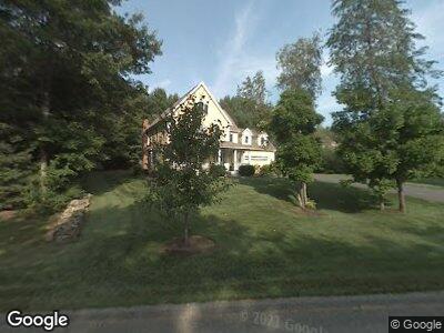
9 Adam Taylor Rd Sterling, MA 01564
Outlying Sterling NeighborhoodEstimated Value: $789,131 - $989,000
4
Beds
3
Baths
3,122
Sq Ft
$287/Sq Ft
Est. Value
About This Home
This home is located at 9 Adam Taylor Rd, Sterling, MA 01564 and is currently estimated at $896,377, approximately $287 per square foot. 9 Adam Taylor Rd is a home located in Worcester County with nearby schools including Wachusett Regional High School and South Lancaster Academy.
Ownership History
Date
Name
Owned For
Owner Type
Purchase Details
Closed on
Jul 7, 1999
Sold by
Sterling Countryside
Bought by
Lane Roy E and Lane Laurie A
Current Estimated Value
Create a Home Valuation Report for This Property
The Home Valuation Report is an in-depth analysis detailing your home's value as well as a comparison with similar homes in the area
Home Values in the Area
Average Home Value in this Area
Purchase History
| Date | Buyer | Sale Price | Title Company |
|---|---|---|---|
| Lane Roy E | $394,160 | -- |
Source: Public Records
Mortgage History
| Date | Status | Borrower | Loan Amount |
|---|---|---|---|
| Open | Lane Roy E | $193,000 | |
| Closed | Lane Roy E | $195,000 | |
| Closed | Lane Roy E | $196,000 | |
| Closed | Lane Roy E | $198,000 | |
| Closed | Lane Laurie A | $223,000 | |
| Closed | Lane Roy E | $223,700 |
Source: Public Records
Tax History Compared to Growth
Tax History
| Year | Tax Paid | Tax Assessment Tax Assessment Total Assessment is a certain percentage of the fair market value that is determined by local assessors to be the total taxable value of land and additions on the property. | Land | Improvement |
|---|---|---|---|---|
| 2025 | $10,040 | $779,500 | $166,300 | $613,200 |
| 2024 | $9,925 | $745,700 | $160,800 | $584,900 |
| 2023 | $9,202 | $643,500 | $152,400 | $491,100 |
| 2022 | $8,636 | $566,300 | $139,700 | $426,600 |
| 2021 | $3,175 | $577,700 | $174,600 | $403,100 |
| 2020 | $9,704 | $577,300 | $187,100 | $390,200 |
| 2019 | $9,379 | $543,100 | $193,300 | $349,800 |
| 2018 | $2,631 | $531,000 | $185,300 | $345,700 |
| 2017 | $8,553 | $474,400 | $188,200 | $286,200 |
| 2016 | $8,566 | $467,300 | $188,200 | $279,100 |
| 2015 | $7,806 | $451,500 | $179,100 | $272,400 |
| 2014 | $7,515 | $443,900 | $179,100 | $264,800 |
Source: Public Records
Map
Nearby Homes
- 3 Charles Patten Dr
- 30 Princeton Rd
- 158 Kendall Hill Rd
- 73 Worcester Rd Unit A
- 12 Gates Terrace
- 4 Gates Terrace
- 5 Millies Way Unit 5
- 2 Lakeview Ave
- 3 Chestnut Ave
- 21 Myrtle Ave
- 14 Myrtle Ave
- 0 Boutelle Rd
- 96 Clinton Rd
- 26 Tuttle Rd
- 110 Leominster Rd
- 27 Runaway Brook Rd
- 134 Leominster Rd
- 44 Beach Point Rd
- 318 Sterling St Unit E5
- 959 Sterling Rd
- 9 Adam Taylor Rd
- 12 Malvern Hill Rd
- 17 Adam Taylor Rd
- 17 Adam Taylor Rd
- 17 Adam Taylor Rd
- 10 Adam Taylor Rd
- 15 Malvern Hill Rd
- 10 Malvern Hill Rd
- 7 Adam Taylor Rd
- 13 Malvern Hill Rd
- 8 Adam Taylor Rd
- 12 Adam Taylor Rd
- 9 Malvern Hill Rd
- 9 Malvern Hill Rd
- 8 Malvern Hill Rd
- 13 Adam Taylor Rd
- 5 Stephanie Anne Ln
- 14 Adam Taylor Rd
- 5 Adam Taylor Rd
- 7 Malvern Hill Rd