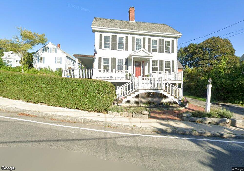
9 Andrews St Gloucester, MA 01930
Estimated Value: $695,000 - $1,244,000
5
Beds
2
Baths
1,991
Sq Ft
$450/Sq Ft
Est. Value
About This Home
This home is located at 9 Andrews St, Gloucester, MA 01930 and is currently estimated at $896,608, approximately $450 per square foot. 9 Andrews St is a home located in Essex County with nearby schools including Plum Cove School, Ralph B O'maley Middle School, and Gloucester High School.
Ownership History
Date
Name
Owned For
Owner Type
Purchase Details
Closed on
Jan 31, 2002
Sold by
Cain Thomas J and Cain Beverly A
Bought by
Hafey James and Moses Heidi
Current Estimated Value
Home Financials for this Owner
Home Financials are based on the most recent Mortgage that was taken out on this home.
Original Mortgage
$202,400
Interest Rate
7.15%
Mortgage Type
Purchase Money Mortgage
Purchase Details
Closed on
Jan 13, 1989
Sold by
Barusso Edna M
Bought by
Cain Thomas
Create a Home Valuation Report for This Property
The Home Valuation Report is an in-depth analysis detailing your home's value as well as a comparison with similar homes in the area
Purchase History
| Date | Buyer | Sale Price | Title Company |
|---|---|---|---|
| Hafey James | $253,000 | -- | |
| Cain Thomas | $190,000 | -- |
Source: Public Records
Mortgage History
| Date | Status | Borrower | Loan Amount |
|---|---|---|---|
| Open | Cain Thomas | $238,400 | |
| Closed | Cain Thomas | $202,400 | |
| Previous Owner | Cain Thomas | $170,000 | |
| Previous Owner | Cain Thomas | $145,000 |
Source: Public Records
Tax History
| Year | Tax Paid | Tax Assessment Tax Assessment Total Assessment is a certain percentage of the fair market value that is determined by local assessors to be the total taxable value of land and additions on the property. | Land | Improvement |
|---|---|---|---|---|
| 2025 | $6,206 | $638,500 | $212,900 | $425,600 |
| 2024 | $6,113 | $628,300 | $202,700 | $425,600 |
| 2023 | $5,859 | $553,300 | $181,000 | $372,300 |
| 2022 | $5,636 | $480,500 | $153,900 | $326,600 |
| 2021 | $5,443 | $437,500 | $139,900 | $297,600 |
| 2020 | $5,391 | $437,200 | $139,900 | $297,300 |
| 2019 | $5,180 | $408,200 | $139,900 | $268,300 |
| 2018 | $5,010 | $387,500 | $139,900 | $247,600 |
| 2017 | $4,858 | $368,300 | $133,300 | $235,000 |
| 2016 | $4,701 | $345,400 | $133,700 | $211,700 |
| 2015 | $4,498 | $329,500 | $133,700 | $195,800 |
Source: Public Records
Map
Nearby Homes
- 43 High St Unit B
- 10 Emerald St
- 1030 Washington St
- 9 Hickory St
- 4 Ciaramitaro Ct
- 136 Leonard St
- 94 Phillips Ave
- 13 Phillips Ave
- 32 Haven Ave
- 5 Boulder Top
- 33 Quarry Ridge Ln Unit 33
- 13 Rowe Point
- 5 Smith St Unit R
- 672 Washington St
- 1 Charte Ct
- 1 Main St Unit R
- 1 Main St Unit C
- 1 Jewett St Unit 2
- 177 Main St
- 1 High St
- 5 Langsford St
- 1 Andrews St
- 1092 Washington St
- 7 Langsford St
- 12 Andrews St
- 4 Langsford St
- 10 Andrews St
- 6 Andrews St
- 8 Langsford St
- 1094 Washington St
- 2 Andrews St
- 2 Langsford St
- 1096 Washington St
- 9 Langsford St
- 6 Langsford St
- 6 Langsford St Unit 1
- 6 Langsford St Unit 2
- 6R Langsford St
- 7 Lanes Cove Rd
- 1088 Washington St
Your Personal Tour Guide
Ask me questions while you tour the home.