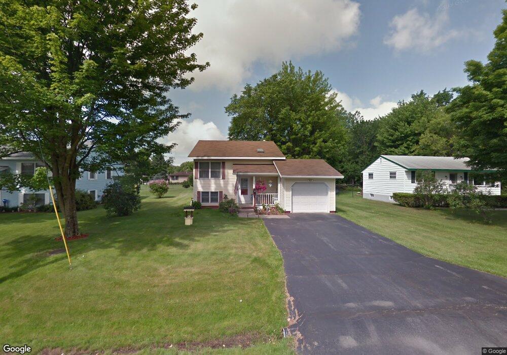
9 Brown Ave Swanton, VT 05488
Estimated Value: $300,000 - $311,354
2
Beds
1
Bath
1,080
Sq Ft
$285/Sq Ft
Est. Value
About This Home
This home is located at 9 Brown Ave, Swanton, VT 05488 and is currently estimated at $307,339, approximately $284 per square foot. 9 Brown Ave is a home located in Franklin County with nearby schools including Swanton Schools, Missisquoi Valley Union Middle/High School, and Munchkinland Montessori.
Ownership History
Date
Name
Owned For
Owner Type
Purchase Details
Closed on
Jan 31, 2025
Sold by
Thompson Jr. William
Bought by
Thompson Michelle
Current Estimated Value
Purchase Details
Closed on
Mar 30, 2022
Sold by
The William L Thompson Sr And Lorrain
Bought by
Thompson William L and Varney Michelle M
Purchase Details
Closed on
Jul 21, 2011
Sold by
Not Provided
Bought by
William L Thompson + Lorraine Thompson R
Create a Home Valuation Report for This Property
The Home Valuation Report is an in-depth analysis detailing your home's value as well as a comparison with similar homes in the area
Home Values in the Area
Average Home Value in this Area
Purchase History
| Date | Buyer | Sale Price | Title Company |
|---|---|---|---|
| Thompson Michelle | -- | -- | |
| Thompson William L | $224,000 | -- | |
| William L Thompson + Lorraine Thompson R | -- | -- |
Source: Public Records
Tax History Compared to Growth
Tax History
| Year | Tax Paid | Tax Assessment Tax Assessment Total Assessment is a certain percentage of the fair market value that is determined by local assessors to be the total taxable value of land and additions on the property. | Land | Improvement |
|---|---|---|---|---|
| 2024 | $4,438 | $189,900 | $35,800 | $154,100 |
| 2023 | $3,749 | $189,900 | $35,800 | $154,100 |
| 2022 | $2,667 | $186,600 | $35,800 | $150,800 |
| 2021 | $2,759 | $186,600 | $35,800 | $150,800 |
| 2020 | $2,932 | $186,600 | $35,800 | $150,800 |
| 2019 | $2,736 | $186,600 | $35,800 | $150,800 |
| 2018 | $2,665 | $186,600 | $35,800 | $150,800 |
| 2017 | $2,738 | $186,600 | $35,800 | $150,800 |
| 2016 | $2,627 | $186,600 | $35,800 | $150,800 |
Source: Public Records
Map
Nearby Homes