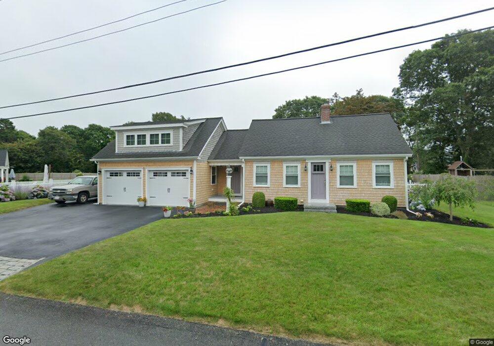
9 Cedar Point Dr Pocasset, MA 02559
Pocasset NeighborhoodEstimated Value: $1,032,000 - $1,262,000
3
Beds
2
Baths
1,176
Sq Ft
$934/Sq Ft
Est. Value
About This Home
This home is located at 9 Cedar Point Dr, Pocasset, MA 02559 and is currently estimated at $1,098,356, approximately $933 per square foot. 9 Cedar Point Dr is a home located in Barnstable County with nearby schools including Bourne High School, Cadence Academy Preschool - Bourne, and Heritage Christian Academy.
Ownership History
Date
Name
Owned For
Owner Type
Purchase Details
Closed on
Nov 29, 2024
Sold by
Devlin Frank R and Devlin Lori A
Bought by
Devlin Ft and Devlin
Current Estimated Value
Purchase Details
Closed on
Nov 20, 2006
Sold by
Quimby Benjamin
Bought by
Devlin Frank R and Devlin Lori A
Home Financials for this Owner
Home Financials are based on the most recent Mortgage that was taken out on this home.
Original Mortgage
$194,000
Interest Rate
6.33%
Mortgage Type
Purchase Money Mortgage
Create a Home Valuation Report for This Property
The Home Valuation Report is an in-depth analysis detailing your home's value as well as a comparison with similar homes in the area
Home Values in the Area
Average Home Value in this Area
Purchase History
| Date | Buyer | Sale Price | Title Company |
|---|---|---|---|
| Devlin Ft | -- | None Available | |
| Devlin Ft | -- | None Available | |
| Devlin Ft | -- | None Available | |
| Devlin Frank R | $420,000 | -- | |
| Devlin Frank R | $420,000 | -- |
Source: Public Records
Mortgage History
| Date | Status | Borrower | Loan Amount |
|---|---|---|---|
| Previous Owner | Devlin Frank R | $190,200 | |
| Previous Owner | Devlin Frank R | $194,000 | |
| Previous Owner | Devlin Frank R | $90,000 | |
| Previous Owner | Devlin Frank R | $30,000 |
Source: Public Records
Tax History Compared to Growth
Tax History
| Year | Tax Paid | Tax Assessment Tax Assessment Total Assessment is a certain percentage of the fair market value that is determined by local assessors to be the total taxable value of land and additions on the property. | Land | Improvement |
|---|---|---|---|---|
| 2025 | $7,361 | $942,500 | $387,200 | $555,300 |
| 2024 | $7,197 | $897,400 | $368,700 | $528,700 |
| 2023 | $6,742 | $765,300 | $326,300 | $439,000 |
| 2022 | $6,098 | $604,400 | $256,000 | $348,400 |
| 2021 | $5,926 | $550,200 | $233,000 | $317,200 |
| 2020 | $5,371 | $500,100 | $230,700 | $269,400 |
| 2019 | $5,096 | $484,900 | $230,700 | $254,200 |
| 2018 | $4,927 | $467,500 | $225,400 | $242,100 |
| 2017 | $4,662 | $452,600 | $223,300 | $229,300 |
| 2016 | $3,166 | $311,600 | $212,100 | $99,500 |
| 2015 | $2,970 | $294,900 | $195,400 | $99,500 |
Source: Public Records
Map
Nearby Homes
- 22 Nairn Rd
- 48 Red Brook Harbor Rd
- 3 Red Brook Pond Dr
- 1094 County Rd
- 171 Bellavista Dr
- 940 County Rd
- 254 Barlows Landing Rd
- 34 Kenwood Rd
- 45 Kenwood Rd
- 940 County Rd
- 709 County Rd
- 70 Wings Neck Rd
- 7 4th Ave
- 1234 Route 28a
- 174 Barlows Landing Rd
- 1234 Route 28a
- 15 1st St
- 24 Richmond Rd
- 10 Squeteague Harbor Rd
- 75 Winsor Rd
- 15 Cedar Point Dr
- 10 Cedar Point Dr
- 5 Cedar Point Dr
- 6 Cedar Point Dr
- 14 Cedar Point Dr
- 19 Cedar Point Dr
- 1 Elgin Rd
- 15 Spruce Dr
- 15 Spruce Dr
- 20 Cedar Point Dr
- 21 Spruce Dr
- 32 Elgin Rd
- 25 Spruce Dr
- 1018 Shore Rd
- 22 Cedar Point Dr
- 1025 Shore Rd
- 1027 Shore Rd
- 1035 Shore Rd
- 25 Cedar Point Dr
- 29 Spruce Dr