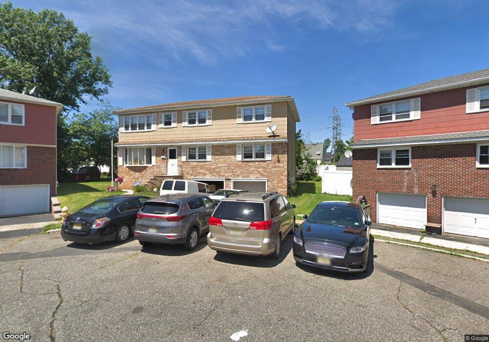
9 Jamie Ct Unit 2 Bloomfield, NJ 07003
Estimated Value: $653,057 - $816,000
3
Beds
1
Bath
2,208
Sq Ft
$337/Sq Ft
Est. Value
About This Home
This home is located at 9 Jamie Ct Unit 2, Bloomfield, NJ 07003 and is currently estimated at $744,764, approximately $337 per square foot. 9 Jamie Ct Unit 2 is a home located in Essex County with nearby schools including Franklin School, Bloomfield Middle School, and Bloomfield High School.
Ownership History
Date
Name
Owned For
Owner Type
Purchase Details
Closed on
Apr 25, 2021
Sold by
Stockert Michael D and Stockert Patricia J
Bought by
Sokoli Rebecca and Stockert Family Irrevocable Tr
Current Estimated Value
Purchase Details
Closed on
Oct 3, 2016
Sold by
Cianci Theresa
Bought by
Stockert Michael D and Stockert Patricia J
Purchase Details
Closed on
Oct 14, 2010
Sold by
Pallitto Jo Ann
Bought by
Cianci Guiseppe and Cianci Theresa
Create a Home Valuation Report for This Property
The Home Valuation Report is an in-depth analysis detailing your home's value as well as a comparison with similar homes in the area
Home Values in the Area
Average Home Value in this Area
Purchase History
| Date | Buyer | Sale Price | Title Company |
|---|---|---|---|
| Sokoli Rebecca | -- | Professional Abstract | |
| Stockert Michael D | $300,000 | Group 21 Title Agency | |
| Cianci Guiseppe | $367,500 | Chicago Title Insurance Co |
Source: Public Records
Tax History Compared to Growth
Tax History
| Year | Tax Paid | Tax Assessment Tax Assessment Total Assessment is a certain percentage of the fair market value that is determined by local assessors to be the total taxable value of land and additions on the property. | Land | Improvement |
|---|---|---|---|---|
| 2025 | $14,379 | $440,000 | $167,700 | $272,300 |
| 2024 | $14,379 | $440,000 | $167,700 | $272,300 |
| 2022 | $14,089 | $440,000 | $167,700 | $272,300 |
| 2021 | $13,829 | $440,000 | $167,700 | $272,300 |
| 2020 | $13,618 | $440,000 | $167,700 | $272,300 |
| 2019 | $13,559 | $340,600 | $156,000 | $184,600 |
| 2018 | $13,501 | $340,600 | $156,000 | $184,600 |
| 2017 | $13,297 | $340,600 | $156,000 | $184,600 |
| 2016 | $13,147 | $340,600 | $156,000 | $184,600 |
| 2015 | $13,028 | $340,600 | $156,000 | $184,600 |
| 2014 | $12,790 | $340,600 | $156,000 | $184,600 |
Source: Public Records
Map
Nearby Homes