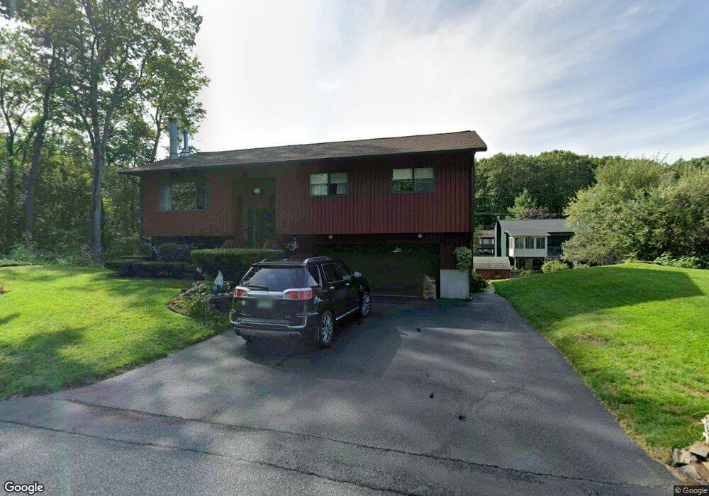
9 Laredo Cir Nashua, NH 03062
West Hollis NeighborhoodEstimated Value: $512,132 - $538,000
3
Beds
3
Baths
1,132
Sq Ft
$463/Sq Ft
Est. Value
About This Home
This home is located at 9 Laredo Cir, Nashua, NH 03062 and is currently estimated at $524,033, approximately $462 per square foot. 9 Laredo Cir is a home located in Hillsborough County with nearby schools including Ledge Street Elementary School, Elm Street Middle School, and Nashua High School South.
Ownership History
Date
Name
Owned For
Owner Type
Purchase Details
Closed on
Jul 23, 2020
Sold by
Omeara Robert E and Omeara Nancy J
Bought by
Omeara Ft and Omeara
Current Estimated Value
Purchase Details
Closed on
Jan 31, 1997
Sold by
Brown Robert O and Brown Marci
Bought by
Arce Luis F and Arce Beverly G
Home Financials for this Owner
Home Financials are based on the most recent Mortgage that was taken out on this home.
Original Mortgage
$92,000
Interest Rate
7.65%
Mortgage Type
Purchase Money Mortgage
Create a Home Valuation Report for This Property
The Home Valuation Report is an in-depth analysis detailing your home's value as well as a comparison with similar homes in the area
Home Values in the Area
Average Home Value in this Area
Purchase History
| Date | Buyer | Sale Price | Title Company |
|---|---|---|---|
| Omeara Ft | -- | None Available | |
| Arce Luis F | $112,500 | -- |
Source: Public Records
Mortgage History
| Date | Status | Borrower | Loan Amount |
|---|---|---|---|
| Previous Owner | Arce Luis F | $167,600 | |
| Previous Owner | Arce Luis F | $92,000 |
Source: Public Records
Tax History Compared to Growth
Tax History
| Year | Tax Paid | Tax Assessment Tax Assessment Total Assessment is a certain percentage of the fair market value that is determined by local assessors to be the total taxable value of land and additions on the property. | Land | Improvement |
|---|---|---|---|---|
| 2024 | $7,942 | $499,500 | $158,500 | $341,000 |
| 2023 | $7,593 | $416,500 | $126,800 | $289,700 |
| 2022 | $7,526 | $416,500 | $126,800 | $289,700 |
| 2021 | $6,618 | $285,000 | $88,800 | $196,200 |
| 2020 | $6,444 | $285,000 | $88,800 | $196,200 |
| 2019 | $6,202 | $285,000 | $88,800 | $196,200 |
| 2018 | $6,045 | $285,000 | $88,800 | $196,200 |
| 2017 | $6,089 | $236,100 | $69,000 | $167,100 |
| 2016 | $5,919 | $236,100 | $69,000 | $167,100 |
| 2015 | $5,792 | $236,100 | $69,000 | $167,100 |
| 2014 | $5,678 | $236,100 | $69,000 | $167,100 |
Source: Public Records
Map
Nearby Homes
- 25 Cortez Dr Unit U57
- 5 Iris Ct Unit U147
- 12 Spring Cove Rd Unit U103
- 47 Dogwood Dr Unit U202
- 40 Spring Cove Rd Unit U117
- 31 Spring Cove Rd Unit U148
- 500 Candlewood Park Unit 21
- 599 W Hollis St
- 4 Chesapeake Rd
- 8 Althea Ln Unit U26
- 24 Yarmouth Dr
- 46 Scenic Dr
- 20 Martha St
- 37 White Plains Dr
- 2 Rene Dr
- 5 Mark St
- 247 Main Dunstable Rd
- 424 Main Dunstable Rd
- 4 Henry David Dr Unit 203
- 5 Cheryl St
- 7 Laredo Cir
- 40 Westgate Crossing
- 11 Laredo Cir
- 38 Westgate Crossing
- 42 Westgate Crossing
- 36 Westgate Crossing
- 5 Laredo Cir
- 15 Laredo Cir
- 44 Westgate Crossing
- 18 Laredo Cir
- 12 Laredo Cir
- 34 Westgate Crossing
- 41 Westgate Crossing
- 39 Westgate Crossing
- 14 Laredo Cir
- 16 Laredo Cir
- 3 Laredo Cir
- 37 Westgate Crossing
- 10 Laredo Cir
- 46 Westgate Crossing