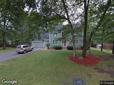
9 Meredith Dr Nashua, NH 03063
Northwest Nashua NeighborhoodEstimated Value: $643,013 - $683,000
3
Beds
3
Baths
2,056
Sq Ft
$323/Sq Ft
Est. Value
About This Home
This home is located at 9 Meredith Dr, Nashua, NH 03063 and is currently estimated at $663,503, approximately $322 per square foot. 9 Meredith Dr is a home located in Hillsborough County with nearby schools including Birch Hill Elementary School, Elm Street Middle School, and Nashua High School North.
Ownership History
Date
Name
Owned For
Owner Type
Purchase Details
Closed on
Jul 18, 2003
Sold by
Boyer Dennis A and Boyer Cherene F
Bought by
Kouchalakos William and Kouchalakos Ellen
Current Estimated Value
Home Financials for this Owner
Home Financials are based on the most recent Mortgage that was taken out on this home.
Original Mortgage
$257,600
Interest Rate
5.34%
Create a Home Valuation Report for This Property
The Home Valuation Report is an in-depth analysis detailing your home's value as well as a comparison with similar homes in the area
Home Values in the Area
Average Home Value in this Area
Purchase History
| Date | Buyer | Sale Price | Title Company |
|---|---|---|---|
| Kouchalakos William | $322,000 | -- |
Source: Public Records
Mortgage History
| Date | Status | Borrower | Loan Amount |
|---|---|---|---|
| Open | Kouchalakos William | $192,000 | |
| Closed | Kouchalakos William | $226,000 | |
| Closed | Kouchalakos William | $257,600 |
Source: Public Records
Tax History Compared to Growth
Tax History
| Year | Tax Paid | Tax Assessment Tax Assessment Total Assessment is a certain percentage of the fair market value that is determined by local assessors to be the total taxable value of land and additions on the property. | Land | Improvement |
|---|---|---|---|---|
| 2023 | $8,955 | $491,200 | $141,200 | $350,000 |
| 2022 | $8,876 | $491,200 | $141,200 | $350,000 |
| 2021 | $8,213 | $353,700 | $103,500 | $250,200 |
| 2020 | $7,954 | $351,800 | $103,500 | $248,300 |
| 2019 | $7,655 | $351,800 | $103,500 | $248,300 |
| 2018 | $7,462 | $351,800 | $103,500 | $248,300 |
| 2017 | $7,482 | $290,100 | $85,000 | $205,100 |
| 2016 | $7,273 | $290,100 | $85,000 | $205,100 |
| 2015 | $7,116 | $290,100 | $85,000 | $205,100 |
| 2014 | $6,962 | $289,500 | $85,000 | $204,500 |
Source: Public Records
Map
Nearby Homes
- 2 Sherwood Dr
- 12 Franconia Dr
- 64 Coburn Woods
- 98 Dublin Ave
- 6 Columbine Dr
- 12 Columbine Dr
- 10 Hunters Ln
- 5 Holden Rd Unit U90
- 1 Knowlton Rd
- 3 Knowlton Rd
- 3 Harvest Ln Unit U24
- 2 Thresher Rd Unit U128
- 7 Stinson Dr
- 32 Seminole Dr
- 8 Hopi Dr
- 101 Cannongate III Unit 3
- 44 Broad St
- 84 Cannongate III
- 11 Gloucester Ln Unit U33
- 70 Cannongate III
- 9 Meredith Dr
- 11 Meredith Dr
- 7 Meredith Dr
- 65 Dunbarton Dr
- 12 Meredith Dr
- 61 Dunbarton Dr
- 67 Dunbarton Dr
- 10 Meredith Dr
- 13 Meredith Dr
- 53 Dunbarton Dr
- 14 Meredith Dr
- 51 Dunbarton Dr
- 8 Meredith Dr
- 73 Dunbarton Dr
- 5 Meredith Dr
- 64 Dunbarton Dr
- 68 Dunbarton Dr
- 47 Dunbarton Dr
- 60 Dunbarton Dr
- 72 Dunbarton Dr