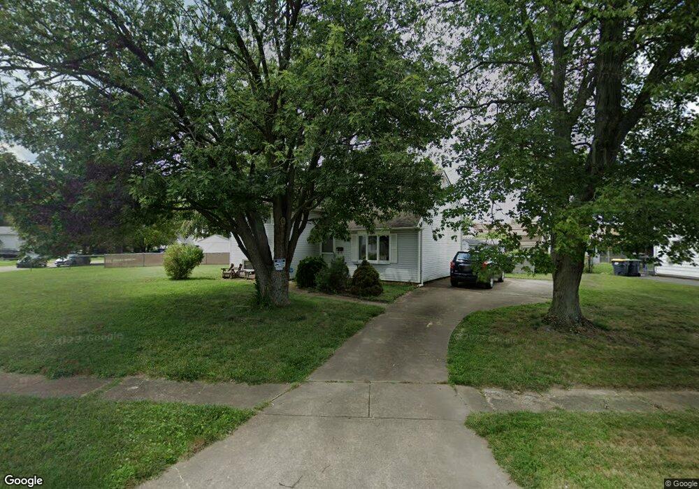
9 Merry Rd Newark, DE 19713
Estimated Value: $286,000 - $341,000
3
Beds
2
Baths
1,500
Sq Ft
$208/Sq Ft
Est. Value
About This Home
This home is located at 9 Merry Rd, Newark, DE 19713 and is currently estimated at $312,365, approximately $208 per square foot. 9 Merry Rd is a home located in New Castle County with nearby schools including Brookside Elementary School, Kirk (George V.) Middle School, and Newark High School.
Ownership History
Date
Name
Owned For
Owner Type
Purchase Details
Closed on
May 26, 2005
Sold by
Degroat Robert S and Degroat Darlene
Bought by
White Scott A
Current Estimated Value
Home Financials for this Owner
Home Financials are based on the most recent Mortgage that was taken out on this home.
Original Mortgage
$148,800
Outstanding Balance
$78,581
Interest Rate
5.94%
Mortgage Type
Fannie Mae Freddie Mac
Estimated Equity
$233,784
Purchase Details
Closed on
Jul 1, 2002
Sold by
Degroat Robert S
Bought by
Degroat Robert S and Degroat Darlene
Home Financials for this Owner
Home Financials are based on the most recent Mortgage that was taken out on this home.
Original Mortgage
$108,000
Interest Rate
8.99%
Create a Home Valuation Report for This Property
The Home Valuation Report is an in-depth analysis detailing your home's value as well as a comparison with similar homes in the area
Home Values in the Area
Average Home Value in this Area
Purchase History
| Date | Buyer | Sale Price | Title Company |
|---|---|---|---|
| White Scott A | $186,000 | -- | |
| Degroat Robert S | -- | -- |
Source: Public Records
Mortgage History
| Date | Status | Borrower | Loan Amount |
|---|---|---|---|
| Open | White Scott A | $148,800 | |
| Previous Owner | Degroat Robert S | $108,000 |
Source: Public Records
Tax History Compared to Growth
Tax History
| Year | Tax Paid | Tax Assessment Tax Assessment Total Assessment is a certain percentage of the fair market value that is determined by local assessors to be the total taxable value of land and additions on the property. | Land | Improvement |
|---|---|---|---|---|
| 2024 | $1,888 | $44,200 | $9,100 | $35,100 |
| 2023 | $1,835 | $44,200 | $9,100 | $35,100 |
| 2022 | $1,831 | $44,200 | $9,100 | $35,100 |
| 2021 | $1,792 | $44,200 | $9,100 | $35,100 |
| 2020 | $1,746 | $44,200 | $9,100 | $35,100 |
| 2019 | $1,711 | $44,200 | $9,100 | $35,100 |
| 2018 | $1,504 | $44,200 | $9,100 | $35,100 |
| 2017 | $1,451 | $44,200 | $9,100 | $35,100 |
| 2016 | $1,446 | $44,200 | $9,100 | $35,100 |
| 2015 | $1,319 | $44,200 | $9,100 | $35,100 |
| 2014 | $1,317 | $44,200 | $9,100 | $35,100 |
Source: Public Records
Map
Nearby Homes
- 3 Matthews Rd
- 11 Mitchell Cir
- 4 Martell Rd
- 183 Brookside Blvd
- 727 Rosemary Way
- 3 Durham Ct
- Schubert Plan at Chestnut Hill Preserve - Townhomes
- 13 Erskine Ct
- 48 Chippendale Cir
- 42 Lynch Farm Dr
- 11 Palmer Place
- 9 E Village Rd Unit 9
- 23 E Village Rd
- 620 Ilse Dr
- 886 Broadfield Dr
- 107 Anderson Rd
- 5 Fountainview Dr Unit 23
- 17 Kensington Ln
- 11 Kensington Ln
- 3000 Fountainview Cir Unit 3411