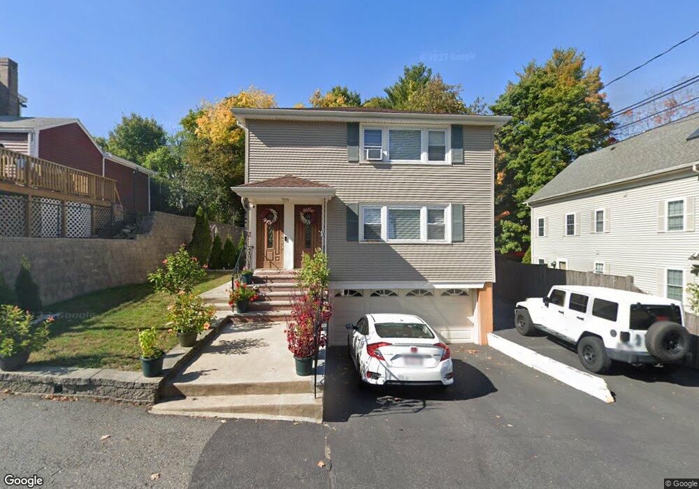
9 Moore St Unit 11 Waltham, MA 02453
South Side NeighborhoodEstimated Value: $856,000 - $1,018,000
6
Beds
3
Baths
2,288
Sq Ft
$416/Sq Ft
Est. Value
About This Home
This home is located at 9 Moore St Unit 11, Waltham, MA 02453 and is currently estimated at $952,549, approximately $416 per square foot. 9 Moore St Unit 11 is a home located in Middlesex County with nearby schools including Henry Whittemore Elementary School, John W. Mcdevitt Middle School, and Waltham Sr High School.
Ownership History
Date
Name
Owned For
Owner Type
Purchase Details
Closed on
Nov 9, 2016
Sold by
Pinto Cesar A
Bought by
Pinto Cesar A
Current Estimated Value
Purchase Details
Closed on
Oct 27, 1993
Sold by
Dime Sb Ny
Bought by
Pinto Cedar A
Purchase Details
Closed on
Jun 22, 1993
Sold by
Kelleher James M
Bought by
Dime Sb Of Ny
Purchase Details
Closed on
Aug 4, 1987
Sold by
Quaranto John J
Bought by
Kelleher James M
Create a Home Valuation Report for This Property
The Home Valuation Report is an in-depth analysis detailing your home's value as well as a comparison with similar homes in the area
Home Values in the Area
Average Home Value in this Area
Purchase History
| Date | Buyer | Sale Price | Title Company |
|---|---|---|---|
| Pinto Cesar A | -- | -- | |
| Pinto Cedar A | $140,000 | -- | |
| Dime Sb Of Ny | $108,022 | -- | |
| Kelleher James M | $228,000 | -- |
Source: Public Records
Mortgage History
| Date | Status | Borrower | Loan Amount |
|---|---|---|---|
| Previous Owner | Kelleher James M | $150,000 | |
| Previous Owner | Kelleher James M | $225,000 | |
| Previous Owner | Kelleher James M | $25,000 |
Source: Public Records
Tax History Compared to Growth
Tax History
| Year | Tax Paid | Tax Assessment Tax Assessment Total Assessment is a certain percentage of the fair market value that is determined by local assessors to be the total taxable value of land and additions on the property. | Land | Improvement |
|---|---|---|---|---|
| 2025 | $8,029 | $817,600 | $355,500 | $462,100 |
| 2024 | $7,424 | $770,100 | $355,500 | $414,600 |
| 2023 | $7,436 | $720,500 | $323,800 | $396,700 |
| 2022 | $7,527 | $675,700 | $295,700 | $380,000 |
| 2021 | $7,065 | $624,100 | $267,500 | $356,600 |
| 2020 | $7,003 | $586,000 | $253,400 | $332,600 |
| 2019 | $6,606 | $521,800 | $250,900 | $270,900 |
| 2018 | $5,967 | $473,200 | $232,300 | $240,900 |
| 2017 | $5,678 | $452,100 | $211,200 | $240,900 |
| 2016 | $5,233 | $427,500 | $186,600 | $240,900 |
| 2015 | $5,091 | $387,700 | $183,000 | $204,700 |
Source: Public Records
Map
Nearby Homes
- 9 John St
- 39 Clinton St Unit 2
- 39 Clinton St Unit 1
- 180 River St Unit 9
- 28-32 Calvary St
- 176 River St
- 308 Newton St Unit 1
- 162 Myrtle St Unit 1
- 240 River St
- 312 Newton St Unit 1A
- 266-274 River St
- 138 Myrtle St Unit 2
- 76 Taft Ave Unit 1
- 76 Taft Ave
- 76 Taft Ave Unit 2
- 301 River St
- 76 Harding St
- 81 Alder St
- 10 Naviens Ln Unit 2
- 75 Cherry St
- 7 Moore St Unit 7
- 7 Moore St Unit 2
- 7 Moore St Unit 1
- 7 Moore St Unit U:2
- 92 Oak St
- 103 Calvary St
- 86 Oak St
- 86 Oak St Unit B
- 86 Oak St Unit A
- 99 Calvary St
- 12 Moore St
- 18 Moore St Unit 20
- 18 Moore St Unit 2
- 113 Calvary St Unit 115
- 80 Oak St
- 93-95 Calvary St
- 93 Calvary St Unit 95
- 93 Calvary St
- 93 Calvary St Unit 2
- 93 Calvary St Unit 1