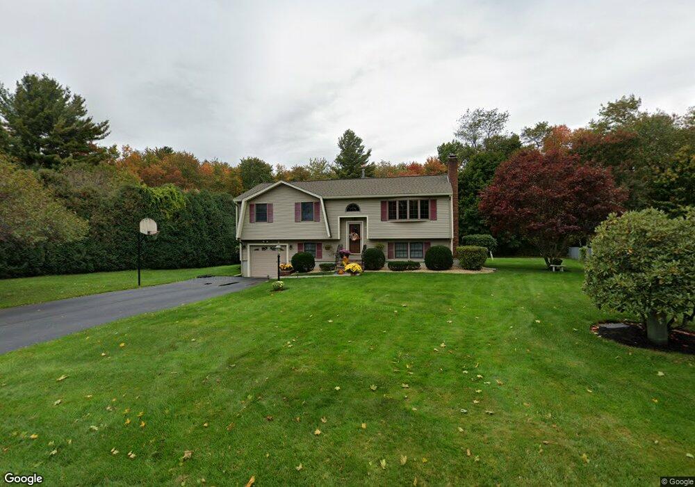
9 Rolling Ridge Ln Methuen, MA 01844
The North End NeighborhoodEstimated Value: $653,610 - $731,000
3
Beds
2
Baths
1,996
Sq Ft
$342/Sq Ft
Est. Value
About This Home
This home is located at 9 Rolling Ridge Ln, Methuen, MA 01844 and is currently estimated at $682,153, approximately $341 per square foot. 9 Rolling Ridge Ln is a home located in Essex County with nearby schools including Methuen High School and The Birches Academy of Academics and Art.
Ownership History
Date
Name
Owned For
Owner Type
Purchase Details
Closed on
Nov 10, 2017
Sold by
Sergi Shirley A and Sergi Salvatore P
Bought by
Salvatore & S Sergi Ft and Sergi
Current Estimated Value
Purchase Details
Closed on
Apr 1, 1984
Bought by
Sergi Salvatore
Create a Home Valuation Report for This Property
The Home Valuation Report is an in-depth analysis detailing your home's value as well as a comparison with similar homes in the area
Home Values in the Area
Average Home Value in this Area
Purchase History
| Date | Buyer | Sale Price | Title Company |
|---|---|---|---|
| Salvatore & S Sergi Ft | -- | -- | |
| Salvatore & S Sergi Ft | -- | -- | |
| Salvatore & S Sergi Ft | -- | -- | |
| Sergi Salvatore | -- | -- |
Source: Public Records
Mortgage History
| Date | Status | Borrower | Loan Amount |
|---|---|---|---|
| Previous Owner | Sergi Salvatore | $55,000 | |
| Previous Owner | Sergi Salvatore | $65,000 |
Source: Public Records
Tax History
| Year | Tax Paid | Tax Assessment Tax Assessment Total Assessment is a certain percentage of the fair market value that is determined by local assessors to be the total taxable value of land and additions on the property. | Land | Improvement |
|---|---|---|---|---|
| 2025 | $5,994 | $566,500 | $246,400 | $320,100 |
| 2024 | $6,024 | $554,700 | $224,000 | $330,700 |
| 2023 | $5,696 | $486,800 | $200,000 | $286,800 |
| 2022 | $5,381 | $412,300 | $160,000 | $252,300 |
| 2021 | $5,106 | $387,100 | $152,000 | $235,100 |
| 2020 | $5,064 | $376,800 | $152,000 | $224,800 |
| 2019 | $4,964 | $349,800 | $144,000 | $205,800 |
| 2018 | $4,789 | $335,600 | $144,000 | $191,600 |
| 2017 | $4,603 | $314,200 | $144,000 | $170,200 |
| 2016 | $4,548 | $307,100 | $144,000 | $163,100 |
| 2015 | $4,433 | $303,600 | $144,000 | $159,600 |
Source: Public Records
Map
Nearby Homes
- 18 Argilla Rd
- 34 Sable Run Ln
- 7 Tree Top Way
- 3 Adams Ave
- 40 Phoebe St Unit 101
- 127 Phoebe St Unit 127
- 125 Phoebe St Unit 125
- 11 Brookside Ct
- 28 Currier Ave
- 64-66 Howe St
- 21 Huntington Ave
- 64 Pine Tree Dr Unit 64
- Lot 108 Garden City Rd
- 37 Iris Ave
- 22 Tyler St
- 687 Jackson St
- 128 Pleasant Valley St
- 27 Cole St
- 47 Bailey Ct
- 20 Colonial Dr
- 13 Rolling Ridge Ln
- 4 Rolling Ridge Ln
- 6 Rolling Ridge Ln
- 2 Rolling Ridge Ln
- 10 Rolling Ridge Ln
- 291 Howe St
- 289 Howe St
- 14 Rolling Ridge Ln
- 21 Rolling Ridge Ln
- 287 Howe St
- 297 Howe St
- 114 Rolling Ridge Ln
- 299 Howe St
- 110 Rolling Ridge Ln
- 25 Rolling Ridge Ln
- 118 Rolling Ridge Ln
- 106 Rolling Ridge Ln
- 1 Stoney Brook Rd
- 102 Rolling Ridge Ln
- 265 Howe St
Your Personal Tour Guide
Ask me questions while you tour the home.