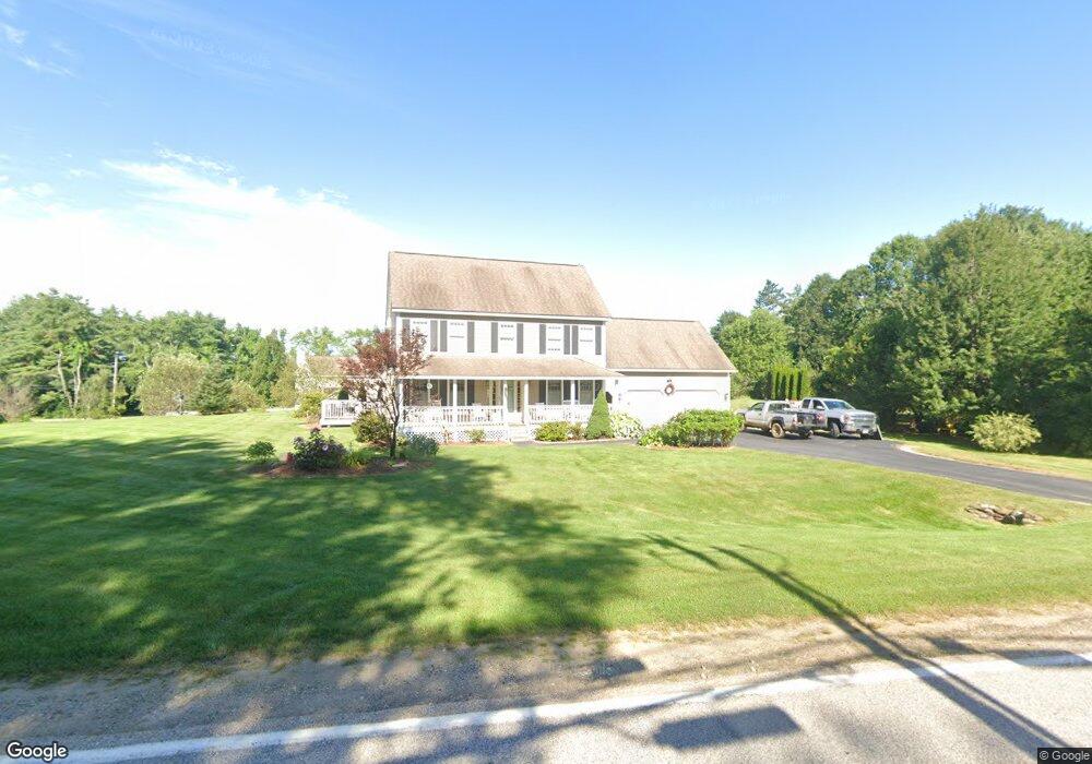
9 Sanborn Rd Concord, NH 03301
East Concord NeighborhoodEstimated Value: $594,000 - $603,000
4
Beds
3
Baths
1,878
Sq Ft
$318/Sq Ft
Est. Value
About This Home
This home is located at 9 Sanborn Rd, Concord, NH 03301 and is currently estimated at $597,118, approximately $317 per square foot. 9 Sanborn Rd is a home located in Merrimack County with nearby schools including Broken Ground School, Rundlett Middle School, and Concord High School.
Ownership History
Date
Name
Owned For
Owner Type
Purchase Details
Closed on
Oct 24, 2001
Sold by
Cherry Hill Homes Ubc
Bought by
Clark Douglas E and Clark Kathleen L
Current Estimated Value
Home Financials for this Owner
Home Financials are based on the most recent Mortgage that was taken out on this home.
Original Mortgage
$217,800
Interest Rate
6.86%
Mortgage Type
Purchase Money Mortgage
Create a Home Valuation Report for This Property
The Home Valuation Report is an in-depth analysis detailing your home's value as well as a comparison with similar homes in the area
Home Values in the Area
Average Home Value in this Area
Purchase History
| Date | Buyer | Sale Price | Title Company |
|---|---|---|---|
| Clark Douglas E | $45,000 | -- |
Source: Public Records
Mortgage History
| Date | Status | Borrower | Loan Amount |
|---|---|---|---|
| Open | Clark Douglas E | $243,950 | |
| Closed | Clark Douglas E | $246,325 | |
| Closed | Clark Douglas E | $240,925 | |
| Closed | Clark Douglas E | $217,800 |
Source: Public Records
Tax History
| Year | Tax Paid | Tax Assessment Tax Assessment Total Assessment is a certain percentage of the fair market value that is determined by local assessors to be the total taxable value of land and additions on the property. | Land | Improvement |
|---|---|---|---|---|
| 2025 | $11,391 | $391,300 | $138,200 | $253,100 |
| 2024 | $10,835 | $391,300 | $138,200 | $253,100 |
| 2023 | $10,516 | $391,500 | $138,200 | $253,300 |
| 2022 | $10,136 | $391,500 | $138,200 | $253,300 |
| 2021 | $9,834 | $391,500 | $138,200 | $253,300 |
| 2020 | $9,334 | $348,800 | $85,100 | $263,700 |
| 2019 | $9,226 | $332,100 | $81,600 | $250,500 |
| 2018 | $8,916 | $316,300 | $81,600 | $234,700 |
| 2017 | $8,576 | $303,700 | $78,600 | $225,100 |
| 2016 | $8,282 | $299,300 | $78,600 | $220,700 |
| 2015 | $7,887 | $287,600 | $77,700 | $209,900 |
| 2014 | $7,711 | $287,600 | $77,700 | $209,900 |
| 2013 | -- | $283,200 | $77,700 | $205,500 |
| 2012 | -- | $271,900 | $81,600 | $190,300 |
Source: Public Records
Map
Nearby Homes
- 432 Mountain Rd
- 563 Mountain Rd
- 540 Mountain Rd
- 12 Jonathan Dr
- 6 Crawford Rd
- 137 Snow Pond Rd
- 73 Snow St
- 8 Randlett St
- 12 Shelburne Ln
- 10 Shelburne Ln
- 59 Hobart St
- 60 Penacook St
- 91 Boyce Rd
- 6 Old Boyce Rd
- 24 Foxcross Cir
- 4 Otter Dr
- 21 Hobart St
- 120 Fisherville Rd Unit 176
- 120 Fisherville Rd Unit 115
- 120 Fisherville Rd Unit 13
- 406 Mountain Rd
- 410 Mountain Rd
- 4 Sanborn Rd
- 1 Sanborn Rd
- 405 Mountain Rd
- 15 Sanborn Rd
- 9 Misty Oak Dr
- 9 Misty Oak Dr Unit 1
- 18 Sanborn Rd
- 2 Sanborn Rd
- 413 Mountain Rd
- 414 Mountain Rd
- 397 Mountain Rd
- 21 Sanborn Rd
- 20 Sanborn Rd
- 418 Mountain Rd
- 388 Mountain Rd
- 395 Mountain Rd
- 419 Mountain Rd
- 4 Morrill Ln Unit 17
Your Personal Tour Guide
Ask me questions while you tour the home.