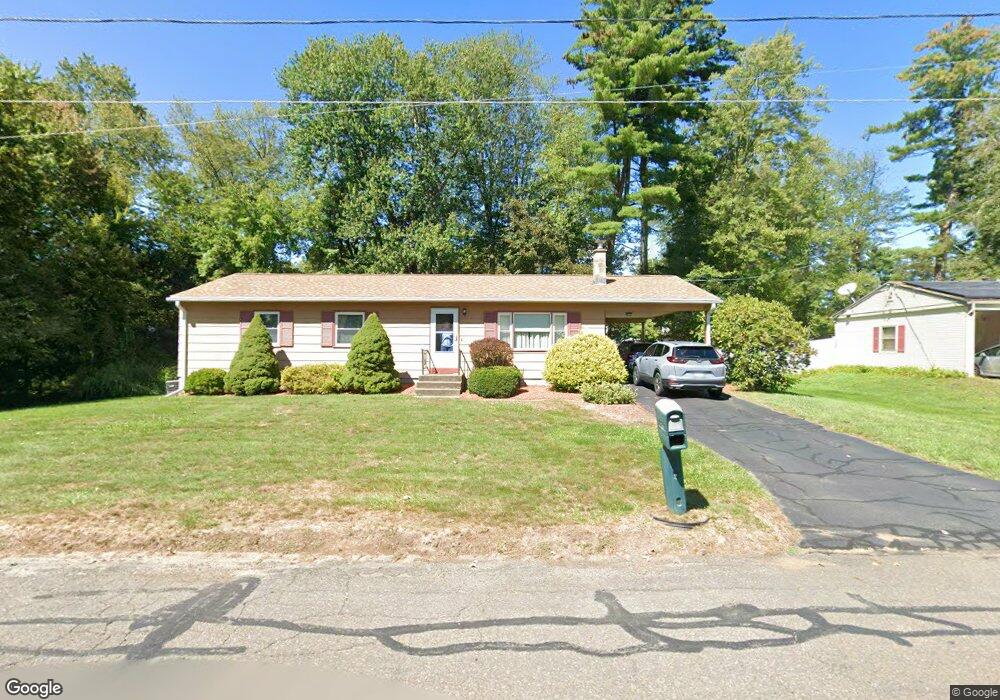
90 Deerfield Dr Florence, MA 01062
Florence NeighborhoodEstimated Value: $364,516 - $404,000
4
Beds
2
Baths
1,248
Sq Ft
$309/Sq Ft
Est. Value
About This Home
This home is located at 90 Deerfield Dr, Florence, MA 01062 and is currently estimated at $385,129, approximately $308 per square foot. 90 Deerfield Dr is a home located in Hampshire County with nearby schools including Northampton High School, Hilltown Cooperative Charter Public School, and The Montessori School of Northampton.
Ownership History
Date
Name
Owned For
Owner Type
Purchase Details
Closed on
Oct 29, 1975
Bought by
Emerson Edwin B and Emerson Jennette
Current Estimated Value
Create a Home Valuation Report for This Property
The Home Valuation Report is an in-depth analysis detailing your home's value as well as a comparison with similar homes in the area
Home Values in the Area
Average Home Value in this Area
Purchase History
| Date | Buyer | Sale Price | Title Company |
|---|---|---|---|
| Emerson Edwin B | $26,500 | -- |
Source: Public Records
Mortgage History
| Date | Status | Borrower | Loan Amount |
|---|---|---|---|
| Open | Emerson Edwin B | $50,000 | |
| Closed | Emerson Edwin B | $40,000 | |
| Closed | Emerson Edwin B | $40,000 |
Source: Public Records
Tax History
| Year | Tax Paid | Tax Assessment Tax Assessment Total Assessment is a certain percentage of the fair market value that is determined by local assessors to be the total taxable value of land and additions on the property. | Land | Improvement |
|---|---|---|---|---|
| 2025 | $4,368 | $313,600 | $133,100 | $180,500 |
| 2024 | $4,668 | $307,300 | $126,900 | $180,400 |
| 2023 | $4,263 | $269,100 | $115,200 | $153,900 |
| 2022 | $3,800 | $212,400 | $107,900 | $104,500 |
| 2021 | $3,790 | $218,200 | $102,900 | $115,300 |
| 2020 | $3,666 | $218,200 | $102,900 | $115,300 |
| 2019 | $3,387 | $195,000 | $87,900 | $107,100 |
| 2018 | $3,411 | $200,200 | $87,900 | $112,300 |
| 2017 | $3,341 | $200,200 | $87,900 | $112,300 |
| 2016 | $3,166 | $195,900 | $87,900 | $108,000 |
| 2015 | $3,042 | $192,500 | $87,900 | $104,600 |
| 2014 | $2,963 | $192,500 | $87,900 | $104,600 |
Source: Public Records
Map
Nearby Homes
- 723 Lot B Ryan Rd
- 815 Burts Pit Rd
- 296 Ryan Rd Unit A
- 296 Ryan Rd
- 296 Ryan Rd Unit B
- 42 Clark St
- 635 Florence Rd
- 697 Florence Rd
- 832 Westhampton Rd
- 0 W Farms Rd
- 404 Sylvester Rd
- 892 Westhampton Rd
- 20-11 Sylvester Rd
- 967 Florence Rd
- 37 Landy Ave
- 751 Park Hill Rd
- 296 Old Wilson Rd
- 67 Park St Unit A
- 76 Maple St
- 98 Park Hill Rd
- 98 Deerfield Dr
- 334 Acrebrook Dr
- 324 Acrebrook Dr
- 342 Acrebrook Dr
- 80 Deerfield Dr
- 175 Brookside Cir
- 81 Deerfield Dr
- 350 Acrebrook Dr
- 333 Acrebrook Dr
- 341 Acrebrook Dr
- 314 Acrebrook Dr
- 110 Deerfield Dr
- 12 Summerfield St
- 325 Acrebrook Dr
- 81 Redford Dr
- 73 Redford Dr
- 83 Forest Glen Dr
- 358 Acrebrook Dr
- 176 Brookside Cir
- 315 Acrebrook Dr
Your Personal Tour Guide
Ask me questions while you tour the home.