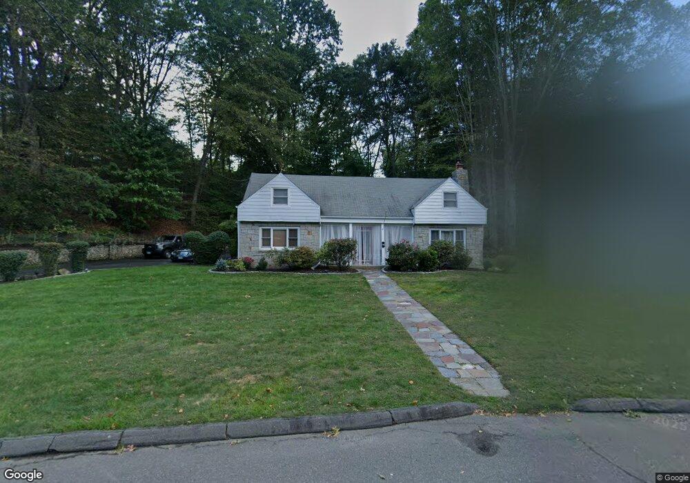
90 Laurel Rd New Haven, CT 06515
Westville NeighborhoodEstimated Value: $524,000 - $700,000
3
Beds
4
Baths
2,243
Sq Ft
$262/Sq Ft
Est. Value
About This Home
This home is located at 90 Laurel Rd, New Haven, CT 06515 and is currently estimated at $588,278, approximately $262 per square foot. 90 Laurel Rd is a home located in New Haven County with nearby schools including Elm City Montessori School and Hopkins School.
Ownership History
Date
Name
Owned For
Owner Type
Purchase Details
Closed on
Feb 28, 1996
Sold by
Naum Daniel and Naum Mioara
Bought by
Brown Dencil E and Grear-Brown Deborah
Current Estimated Value
Purchase Details
Closed on
Jan 27, 1994
Sold by
Partridge Chester W and Partridge Myrna F
Bought by
Naum Daniel and Naum Mioara
Create a Home Valuation Report for This Property
The Home Valuation Report is an in-depth analysis detailing your home's value as well as a comparison with similar homes in the area
Home Values in the Area
Average Home Value in this Area
Purchase History
| Date | Buyer | Sale Price | Title Company |
|---|---|---|---|
| Brown Dencil E | $160,000 | -- | |
| Naum Daniel | $100,000 | -- |
Source: Public Records
Mortgage History
| Date | Status | Borrower | Loan Amount |
|---|---|---|---|
| Open | Naum Daniel | $256,540 | |
| Closed | Naum Daniel | $24,000 | |
| Closed | Naum Daniel | $15,000 |
Source: Public Records
Tax History Compared to Growth
Tax History
| Year | Tax Paid | Tax Assessment Tax Assessment Total Assessment is a certain percentage of the fair market value that is determined by local assessors to be the total taxable value of land and additions on the property. | Land | Improvement |
|---|---|---|---|---|
| 2025 | $9,501 | $241,150 | $69,860 | $171,290 |
| 2024 | $9,284 | $241,150 | $69,860 | $171,290 |
| 2023 | $8,971 | $241,150 | $69,860 | $171,290 |
| 2022 | $9,586 | $241,150 | $69,860 | $171,290 |
| 2021 | $7,826 | $178,360 | $45,430 | $132,930 |
| 2020 | $7,826 | $178,360 | $45,430 | $132,930 |
| 2019 | $7,666 | $178,360 | $45,430 | $132,930 |
| 2018 | $7,666 | $178,360 | $45,430 | $132,930 |
| 2017 | $6,899 | $178,360 | $45,430 | $132,930 |
| 2016 | $7,297 | $175,630 | $47,180 | $128,450 |
| 2015 | $7,297 | $175,630 | $47,180 | $128,450 |
| 2014 | $7,297 | $175,630 | $47,180 | $128,450 |
Source: Public Records
Map
Nearby Homes
- 36 Birch Dr
- 360 Fountain St Unit 5
- 126 Willard St
- 119 Brooklawn Cir
- 195 Stevenson Rd
- 55 Marvel Rd
- 1016 Whalley Ave Unit 6
- 70 Fountain St Unit 4
- 233 Valley St
- 999 Whalley Ave Unit 1H
- 120 Emerson St
- 206 W Rock Ave
- 51 Fountain Terrace
- 119 Westwood Rd
- 1975 Chapel St
- 595 Central Ave
- 141 Valley St
- 136 Rock Creek Rd
- 57 Rock Creek Rd
- 699 Forest Rd
- 110 Laurel Rd
- 75 Mumford Rd
- 75 Laurel Rd
- 15 Knollwood Dr
- 276 Marvelwood Dr
- 69 Mumford Rd
- 266 Marvelwood Dr
- 65 Laurel Rd
- 240 Marvelwood Dr
- 140 Laurel Rd
- 127 Laurel Rd
- 85 Mumford Rd
- 230 Marvelwood Dr
- 115 Laurel Rd
- 55 Laurel Rd
- 25 Knollwood Dr
- 137 Laurel Rd
- 61 Mumford Rd
- 220 Marvelwood Dr
- 74 Mumford Rd