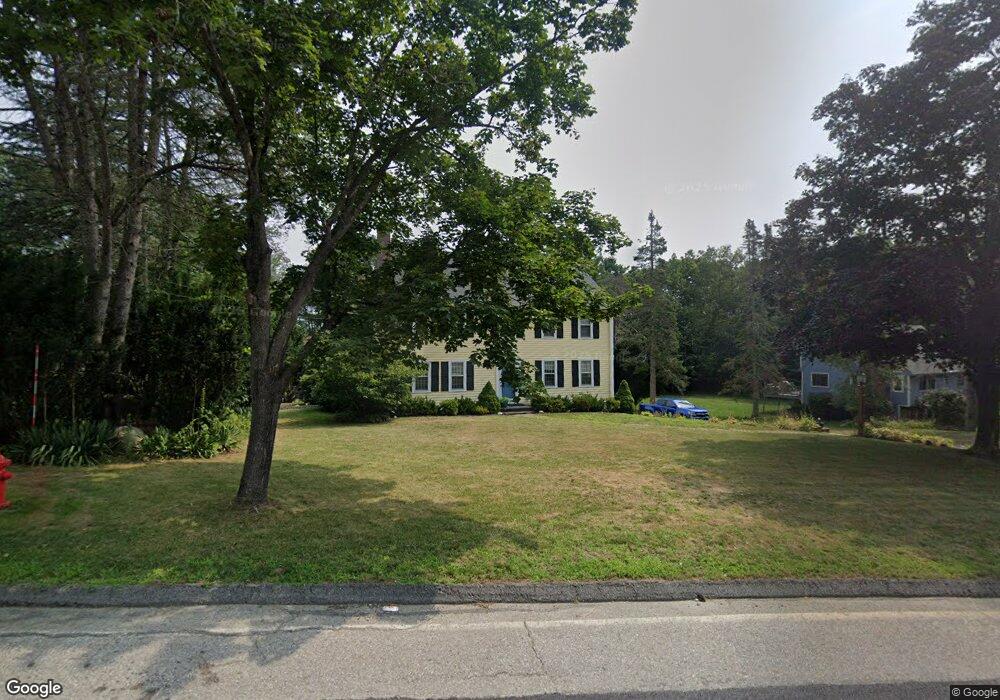
90 Lee St West Boylston, MA 01583
Estimated Value: $613,526 - $835,000
3
Beds
3
Baths
2,011
Sq Ft
$338/Sq Ft
Est. Value
About This Home
This home is located at 90 Lee St, West Boylston, MA 01583 and is currently estimated at $680,132, approximately $338 per square foot. 90 Lee St is a home located in Worcester County with nearby schools including Major Edwards Elementary School, West Boylston Junior/Senior High School, and Abby Kelley Foster Charter Public School.
Ownership History
Date
Name
Owned For
Owner Type
Purchase Details
Closed on
May 3, 2010
Sold by
Galante Antonio M and Galante Kathleen N
Bought by
Galante Kathleen N
Current Estimated Value
Home Financials for this Owner
Home Financials are based on the most recent Mortgage that was taken out on this home.
Original Mortgage
$160,000
Outstanding Balance
$106,926
Interest Rate
4.99%
Mortgage Type
Purchase Money Mortgage
Estimated Equity
$573,206
Purchase Details
Closed on
Jul 24, 1998
Sold by
Connor Edward J and Connor Cheryl D
Bought by
Galante Antonio M and Galante Katlheen N
Home Financials for this Owner
Home Financials are based on the most recent Mortgage that was taken out on this home.
Original Mortgage
$171,000
Interest Rate
6.99%
Mortgage Type
Purchase Money Mortgage
Create a Home Valuation Report for This Property
The Home Valuation Report is an in-depth analysis detailing your home's value as well as a comparison with similar homes in the area
Home Values in the Area
Average Home Value in this Area
Purchase History
| Date | Buyer | Sale Price | Title Company |
|---|---|---|---|
| Galante Kathleen N | -- | -- | |
| Galante Antonio M | $232,000 | -- |
Source: Public Records
Mortgage History
| Date | Status | Borrower | Loan Amount |
|---|---|---|---|
| Open | Galante Kathleen N | $160,000 | |
| Previous Owner | Galante Antonio M | $160,463 | |
| Previous Owner | Galante Antonio M | $171,000 | |
| Previous Owner | Galante Antonio M | $80,000 |
Source: Public Records
Tax History Compared to Growth
Tax History
| Year | Tax Paid | Tax Assessment Tax Assessment Total Assessment is a certain percentage of the fair market value that is determined by local assessors to be the total taxable value of land and additions on the property. | Land | Improvement |
|---|---|---|---|---|
| 2025 | $83 | $598,600 | $126,600 | $472,000 |
| 2024 | $8,068 | $545,900 | $130,100 | $415,800 |
| 2023 | $7,813 | $501,500 | $128,300 | $373,200 |
| 2022 | $7,555 | $427,300 | $131,800 | $295,500 |
| 2021 | $7,432 | $402,600 | $119,200 | $283,400 |
| 2020 | $7,034 | $378,600 | $122,400 | $256,200 |
| 2019 | $6,795 | $360,500 | $122,400 | $238,100 |
| 2018 | $6,483 | $346,300 | $122,400 | $223,900 |
| 2017 | $6,422 | $341,600 | $122,400 | $219,200 |
| 2016 | $6,277 | $340,200 | $113,800 | $226,400 |
| 2015 | $6,175 | $336,700 | $112,700 | $224,000 |
Source: Public Records
Map
Nearby Homes
- 156 Prospect St
- 39 Davidson Rd
- 47 Preservation Ln
- 21 Wyoming Dr
- 152 Worcester St Unit 8
- 62 Maple St
- 54 Maple St
- 1 Highland Ave
- 15 Lowell Ave
- 93 Winfield Rd
- 83 Stoneleigh Rd
- 39 Meola Ave
- 33 Meola Ave
- 26 Townsend Dr
- 12 Birchbrush Ln
- 1 Juneberry Ln Unit 82
- 33 Isleboro St
- 23 Orono St
- 29 Isleboro St
- 300 Malden St