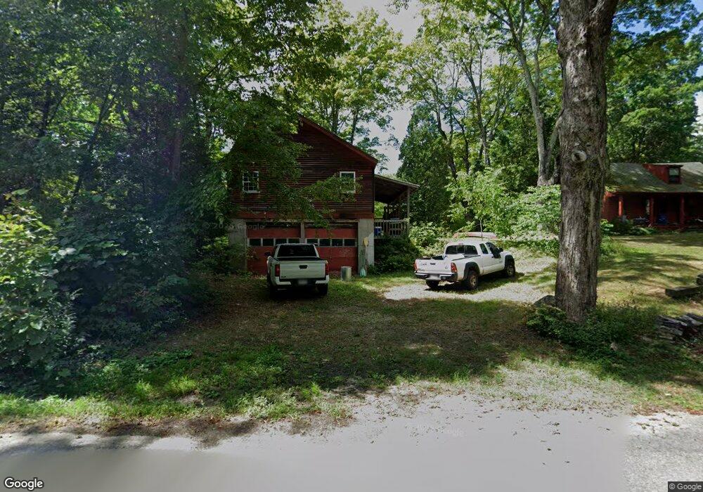
90 Whitaker Rd New Salem, MA 01355
New Salem NeighborhoodEstimated Value: $398,000 - $505,000
3
Beds
3
Baths
2,000
Sq Ft
$236/Sq Ft
Est. Value
About This Home
This home is located at 90 Whitaker Rd, New Salem, MA 01355 and is currently estimated at $471,082, approximately $235 per square foot. 90 Whitaker Rd is a home located in Franklin County with nearby schools including Swift River School and Ralph C Mahar Regional School.
Ownership History
Date
Name
Owned For
Owner Type
Purchase Details
Closed on
Mar 17, 2022
Sold by
Jones Thomas O and Mobbs Betty G
Bought by
Jones Michael T and Willey Lisabeth L
Current Estimated Value
Home Financials for this Owner
Home Financials are based on the most recent Mortgage that was taken out on this home.
Original Mortgage
$275,000
Outstanding Balance
$254,871
Interest Rate
3.55%
Mortgage Type
Purchase Money Mortgage
Estimated Equity
$216,211
Purchase Details
Closed on
Jul 19, 2006
Sold by
Swindells Ann G and Swindells Richard D
Bought by
Mobbs Betty G and Jones Thomas O
Purchase Details
Closed on
Jul 13, 2001
Sold by
Reutlinger Karen A
Bought by
Swindells Richard D and Swindells Ann G
Create a Home Valuation Report for This Property
The Home Valuation Report is an in-depth analysis detailing your home's value as well as a comparison with similar homes in the area
Home Values in the Area
Average Home Value in this Area
Purchase History
| Date | Buyer | Sale Price | Title Company |
|---|---|---|---|
| Jones Michael T | $365,000 | None Available | |
| Mobbs Betty G | $355,000 | -- | |
| Mobbs Betty G | $355,000 | -- | |
| Swindells Richard D | $225,000 | -- |
Source: Public Records
Mortgage History
| Date | Status | Borrower | Loan Amount |
|---|---|---|---|
| Open | Jones Michael T | $275,000 | |
| Previous Owner | Swindells Richard D | $180,000 |
Source: Public Records
Tax History Compared to Growth
Tax History
| Year | Tax Paid | Tax Assessment Tax Assessment Total Assessment is a certain percentage of the fair market value that is determined by local assessors to be the total taxable value of land and additions on the property. | Land | Improvement |
|---|---|---|---|---|
| 2025 | $4,947 | $364,300 | $66,100 | $298,200 |
| 2024 | $5,463 | $380,200 | $66,100 | $314,100 |
| 2023 | $5,580 | $363,500 | $64,900 | $298,600 |
| 2022 | $5,078 | $268,400 | $64,900 | $203,500 |
| 2021 | $4,872 | $248,200 | $60,400 | $187,800 |
| 2020 | $4,478 | $248,200 | $60,400 | $187,800 |
| 2019 | $4,361 | $248,200 | $60,400 | $187,800 |
| 2018 | $4,562 | $251,600 | $58,900 | $192,700 |
| 2017 | $4,343 | $242,200 | $56,200 | $186,000 |
| 2016 | $4,173 | $242,200 | $56,200 | $186,000 |
| 2015 | $4,351 | $264,000 | $63,900 | $200,100 |
Source: Public Records
Map
Nearby Homes
- 63 Cooleyville Rd
- 0 Cooleyville Rd
- 70 N Main St
- 72 N Main St
- 0 Wendell Rd
- Lot 55 Wendell Rd
- Lot 31 Wendell Rd
- 23 Pelham Hill Rd
- 85 Lake Dr
- 84 Lake Dr
- 359 Montague Rd
- 207 Leverett Rd
- 0 Shore Dr
- 4 West St
- 36 Merrill Dr
- 133 Lakeview Rd
- 2 Fay Rd
- Back Lot 0 Petersham Rd
- 28 Morse Village Rd
- 0 Dudleyville Rd
- 75 Whitaker Rd
- 0 Freeman Rd
- 102 Whitaker Rd
- 73 Whitaker Rd
- 39 Shutesbury Rd
- 626 Daniel Shays Hwy
- 65 Whitaker Rd
- 118 Whitaker Rd
- Lot A Shutesbury Rd
- 58 Whitaker Rd
- 35 Shutesbury Rd
- 1 Shutesbury Rd
- 59 Shutesbury Rd
- 52 Whitaker Rd
- 2 Shutesbury Rd
- 67 Shutesbury Rd
- Lot 0 Daniel Shays Hwy
- 618 Daniel Shays Hwy
- Lot A Cooleyville Rd
- 681 Daniel Shays Hwy