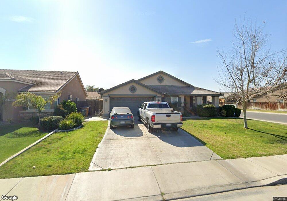
9001 Wheat Grass Ave Bakersfield, CA 93313
Panama NeighborhoodEstimated Value: $387,813 - $403,000
3
Beds
2
Baths
1,855
Sq Ft
$213/Sq Ft
Est. Value
About This Home
This home is located at 9001 Wheat Grass Ave, Bakersfield, CA 93313 and is currently estimated at $395,703, approximately $213 per square foot. 9001 Wheat Grass Ave is a home located in Kern County with nearby schools including Panama Elementary School, Stonecreek Junior High School, and Ridgeview High School.
Ownership History
Date
Name
Owned For
Owner Type
Purchase Details
Closed on
Oct 8, 2008
Sold by
Federal Home Loan Mortgage Corporation
Bought by
Castillo Raul Matozo
Current Estimated Value
Purchase Details
Closed on
Jul 28, 2008
Sold by
Loredo Bernardo
Bought by
Federal Home Loan Mortgage Corporation
Purchase Details
Closed on
May 30, 2007
Sold by
Ramirez Sylvia
Bought by
Loredo Bernardo
Home Financials for this Owner
Home Financials are based on the most recent Mortgage that was taken out on this home.
Original Mortgage
$226,944
Interest Rate
6.16%
Mortgage Type
Purchase Money Mortgage
Create a Home Valuation Report for This Property
The Home Valuation Report is an in-depth analysis detailing your home's value as well as a comparison with similar homes in the area
Home Values in the Area
Average Home Value in this Area
Purchase History
| Date | Buyer | Sale Price | Title Company |
|---|---|---|---|
| Castillo Raul Matozo | $182,000 | Ticor Title Redlands | |
| Federal Home Loan Mortgage Corporation | $135,066 | Accommodation | |
| Loredo Bernardo | -- | North American Title Company | |
| Loredo Bernardo | $284,000 | North American Title |
Source: Public Records
Mortgage History
| Date | Status | Borrower | Loan Amount |
|---|---|---|---|
| Previous Owner | Loredo Bernardo | $226,944 | |
| Previous Owner | Loredo Bernardo | $56,736 |
Source: Public Records
Tax History
| Year | Tax Paid | Tax Assessment Tax Assessment Total Assessment is a certain percentage of the fair market value that is determined by local assessors to be the total taxable value of land and additions on the property. | Land | Improvement |
|---|---|---|---|---|
| 2025 | $3,871 | $234,356 | $90,135 | $144,221 |
| 2024 | $3,795 | $229,762 | $88,368 | $141,394 |
| 2023 | $3,795 | $225,258 | $86,636 | $138,622 |
| 2022 | $3,651 | $220,842 | $84,938 | $135,904 |
| 2021 | $3,523 | $216,513 | $83,273 | $133,240 |
| 2020 | $3,454 | $214,294 | $82,420 | $131,874 |
| 2019 | $3,417 | $214,294 | $82,420 | $131,874 |
| 2018 | $3,292 | $205,974 | $79,220 | $126,754 |
| 2017 | $3,236 | $201,936 | $77,667 | $124,269 |
| 2016 | $3,071 | $197,978 | $76,145 | $121,833 |
| 2015 | $3,060 | $195,005 | $75,002 | $120,003 |
| 2014 | $3,005 | $191,186 | $73,533 | $117,653 |
Source: Public Records
Map
Nearby Homes
- 5005 Green Clover Ave Unit 1
- 5103 Green Clover Ave
- 5015 Silver Clover Ave
- 5407 Red Wheat Ave
- 9506 Orchard Grass Ct
- 4403 Oceanrock Ave
- 5400 Saddleback Ridge Ct
- 5612 Mckee Rd
- 9623 Kanosh Cobble Dr
- 9402 Cobble Mountain Rd
- 8208 Crestridge Ct
- 5518 Coburn Ridge Ct
- 5809 Turquoise Ridge Dr
- 5404 Viewcrest Dr
- 6009 Moonstone Peak Dr
- 9000 Farmington Way
- 4017 Rolling Rock Ave
- 5808 Esmerelda Ave
- 9202 Mcclintock Rd
- 5918 Esmerelda Ave
- 9005 Wheat Grass Ave
- 9100 Morning Harvest Ave
- 9009 Wheat Grass Ave Unit 2
- 8915 Wheat Grass Ave
- 9104 Morning Harvest Ave Unit 1
- 9010 Morning Harvest Ave
- 9108 Morning Harvest Ave
- 9000 Wheat Grass Ave
- 9004 Wheat Grass Ave Unit 2
- 9013 Wheat Grass Ave
- 8911 Wheat Grass Ave
- 8918 Wheat Grass Ave Unit 2
- 9008 Wheat Grass Ave Unit 2
- 9112 Morning Harvest Ave
- 9006 Morning Harvest Ave Unit 1
- 8914 Wheat Grass Ave
- 9012 Wheat Grass Ave
- 4909 Switch Grass Way
- 5101 Prairie Wheat Ave
- 9116 Morning Harvest Ave Unit 1
Your Personal Tour Guide
Ask me questions while you tour the home.