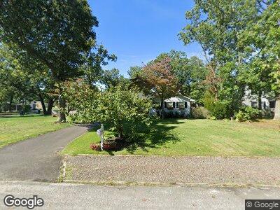
901 Bainbridge Ave Mays Landing, NJ 08330
Estimated Value: $323,114 - $355,000
3
Beds
2
Baths
1,224
Sq Ft
$280/Sq Ft
Est. Value
About This Home
This home is located at 901 Bainbridge Ave, Mays Landing, NJ 08330 and is currently estimated at $342,279, approximately $279 per square foot. 901 Bainbridge Ave is a home located in Atlantic County with nearby schools including Joseph Shaner School, George L. Hess Educational Complex, and William Davies Middle School.
Ownership History
Date
Name
Owned For
Owner Type
Purchase Details
Closed on
Sep 18, 2009
Sold by
Bonsall Joseph Colton and Grinnell Cheryl
Bought by
Graff Michael W and Maxwell Lauren M
Current Estimated Value
Home Financials for this Owner
Home Financials are based on the most recent Mortgage that was taken out on this home.
Original Mortgage
$202,268
Interest Rate
5.28%
Mortgage Type
FHA
Purchase Details
Closed on
Jan 29, 1993
Sold by
Taran Nikolai
Bought by
Bonsall Joseph and Bonsall Grinwell,Cheryl
Create a Home Valuation Report for This Property
The Home Valuation Report is an in-depth analysis detailing your home's value as well as a comparison with similar homes in the area
Home Values in the Area
Average Home Value in this Area
Purchase History
| Date | Buyer | Sale Price | Title Company |
|---|---|---|---|
| Graff Michael W | $206,000 | Foundation Title | |
| Bonsall Joseph | $108,000 | -- |
Source: Public Records
Mortgage History
| Date | Status | Borrower | Loan Amount |
|---|---|---|---|
| Open | Graff Michael W | $190,800 | |
| Closed | Graff Michael W | $190,800 | |
| Closed | Graff Michael W | $202,268 | |
| Previous Owner | Bonsall Joseph C | $90,000 |
Source: Public Records
Tax History Compared to Growth
Tax History
| Year | Tax Paid | Tax Assessment Tax Assessment Total Assessment is a certain percentage of the fair market value that is determined by local assessors to be the total taxable value of land and additions on the property. | Land | Improvement |
|---|---|---|---|---|
| 2024 | $6,090 | $177,500 | $45,400 | $132,100 |
| 2023 | $5,726 | $177,500 | $45,400 | $132,100 |
| 2022 | $5,726 | $177,500 | $45,400 | $132,100 |
| 2021 | $5,714 | $177,500 | $45,400 | $132,100 |
| 2020 | $5,714 | $177,500 | $45,400 | $132,100 |
| 2019 | $5,728 | $177,500 | $45,400 | $132,100 |
| 2018 | $5,527 | $177,500 | $45,400 | $132,100 |
| 2017 | $5,440 | $177,500 | $45,400 | $132,100 |
| 2016 | $5,288 | $177,500 | $45,400 | $132,100 |
| 2015 | $5,108 | $177,500 | $45,400 | $132,100 |
| 2014 | $5,123 | $195,000 | $54,100 | $140,900 |
Source: Public Records
Map
Nearby Homes
- 948 Adams Ave
- 18 Rembrandt Way
- 526 Bainbridge Ave
- 0 8th St Unit 593151
- 535 Park Rd
- 709 Farragut Ave
- 211 Hanthorn St
- 34 Hannum Ct
- 0 3rd St
- 6056 Main St
- 5926 Main St
- 20 Ernst Ct
- 507 14th Ave
- 0 Route 50 Hwy Unit 595564
- 23 Lewis Dr
- 706 Sugarbush Ct
- 706 Sugar Bush Ct Unit 906
- 22 Lewis Dr
- 6152 Old Harding Hwy
- 705 Camelback Ct
- 901 Bainbridge Ave
- 917 Bainbridge Ave
- 900 Adams Ave
- 916 Adams Ave
- 6209 9th St
- 933 Bainbridge Ave
- 759 Bainbridge Ave
- 916 Bainbridge Ave
- 758 Adams Ave
- 932 Bainbridge Ave
- 6208 9th St
- 901 Calhoun Ave
- 949 Bainbridge Ave
- 919 Calhoun Ave
- 917 Adams Ave
- 737 Bainbridge Ave
- 901 Adams Ave
- 948 Bainbridge Ave
- 736 Adams Ave
- 6204 9th St