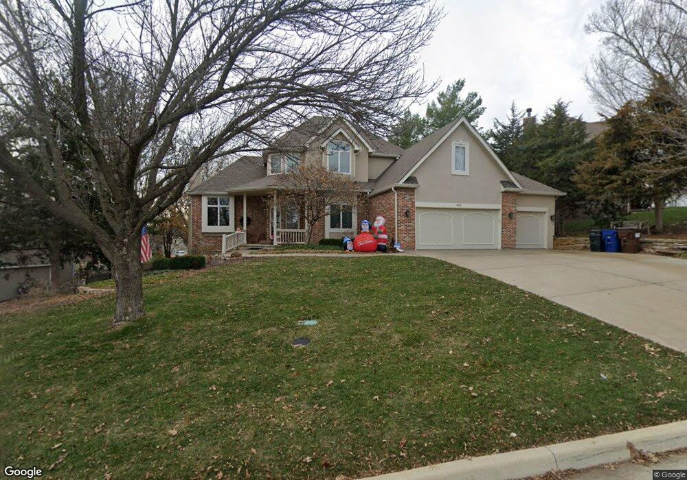
901 Deer Run Dr Lawrence, KS 66049
West Lawrence NeighborhoodEstimated Value: $576,218 - $749,000
5
Beds
5
Baths
3,247
Sq Ft
$201/Sq Ft
Est. Value
About This Home
This home is located at 901 Deer Run Dr, Lawrence, KS 66049 and is currently estimated at $651,555, approximately $200 per square foot. 901 Deer Run Dr is a home located in Douglas County with nearby schools including Langston Hughes Elementary School, Southwest Middle School, and Lawrence Free State High School.
Ownership History
Date
Name
Owned For
Owner Type
Purchase Details
Closed on
Jul 24, 2003
Sold by
Prudential Residential Services Lp
Bought by
Liang Jenn Tai and Liang Hwa Chi
Current Estimated Value
Home Financials for this Owner
Home Financials are based on the most recent Mortgage that was taken out on this home.
Original Mortgage
$304,000
Outstanding Balance
$128,174
Interest Rate
5.15%
Mortgage Type
Purchase Money Mortgage
Estimated Equity
$523,381
Create a Home Valuation Report for This Property
The Home Valuation Report is an in-depth analysis detailing your home's value as well as a comparison with similar homes in the area
Home Values in the Area
Average Home Value in this Area
Purchase History
| Date | Buyer | Sale Price | Title Company |
|---|---|---|---|
| Liang Jenn Tai | -- | Kansas Secured Title |
Source: Public Records
Mortgage History
| Date | Status | Borrower | Loan Amount |
|---|---|---|---|
| Open | Liang Jenn Tai | $304,000 |
Source: Public Records
Tax History Compared to Growth
Tax History
| Year | Tax Paid | Tax Assessment Tax Assessment Total Assessment is a certain percentage of the fair market value that is determined by local assessors to be the total taxable value of land and additions on the property. | Land | Improvement |
|---|---|---|---|---|
| 2025 | $7,869 | $64,527 | $9,200 | $55,327 |
| 2024 | $7,869 | $62,675 | $7,475 | $55,200 |
| 2023 | $7,675 | $59,271 | $7,475 | $51,796 |
| 2022 | $7,205 | $55,281 | $7,475 | $47,806 |
| 2021 | $6,224 | $46,425 | $6,334 | $40,091 |
| 2020 | $6,147 | $46,092 | $6,334 | $39,758 |
| 2019 | $6,087 | $45,689 | $6,334 | $39,355 |
| 2018 | $6,014 | $44,815 | $6,334 | $38,481 |
| 2017 | $5,884 | $43,366 | $6,334 | $37,032 |
| 2016 | $5,605 | $43,148 | $5,753 | $37,395 |
| 2015 | $2,985 | $45,919 | $5,753 | $40,166 |
| 2014 | $5,870 | $45,597 | $5,753 | $39,844 |
Source: Public Records
Map
Nearby Homes
- 5204 Foxchase Dr
- 5204 Fox Chase Dr
- 917 Summerfield Place
- 5208 Congressional Place
- 1017 Stoneridge Dr
- 4921 Colonial Way
- 5024 Cedar Grove Way
- 5017 Cedar Grove Way
- 5245 Overland Dr Unit A14
- 5245 Overland Dr Unit B26
- 5245 Overland Dr Unit D3
- 1007 New Boston Ct
- 1202 Little Knife
- 5714 Silverstone Dr
- Zachary Plan at Fairfield Farms
- Xavier Plan at Fairfield Farms
- Thaddeus Plan at Fairfield Farms
- Sutton Plan at Fairfield Farms
- Scorpio Plan at Fairfield Farms
- Porter Plan at Fairfield Farms
- 5201 Fox Chase Dr
- 905 Deer Run Dr
- 900 Deer Run Dr
- 5205 Fox Chase Dr
- 904 Deer Run Dr
- 5200 Fox Chase Dr
- 908 Deer Run Dr
- 816 Fox Chase Ct
- 5212 Deer Run Ct
- 5209 Fox Chase Dr
- 909 Deer Run Dr
- 5205 Deer Run Ct
- 5208 Fox Chase Dr
- 912 Deer Run Dr
- 905 Summerfield Place
- 901 Summerfield Place
- 809 Fox Chase Ct
- 5209 Deer Run Ct
- 5213 Deer Run Ct
- 812 Fox Chase Ct