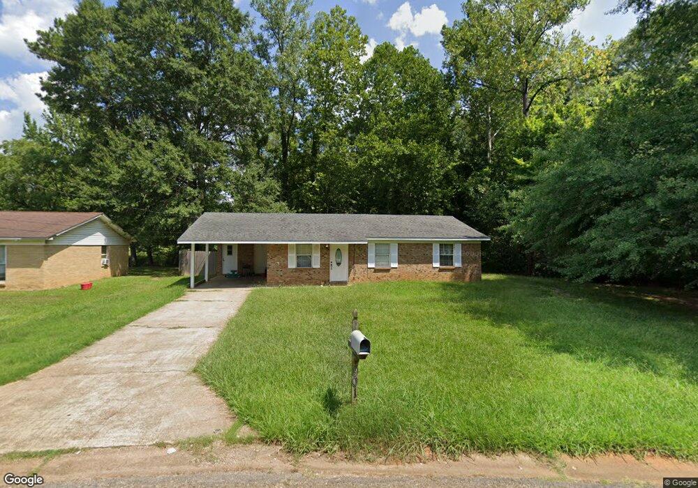
901 Honeysuckle Dr New Albany, MS 38652
Estimated Value: $107,000 - $217,000
--
Bed
1
Bath
1,185
Sq Ft
$128/Sq Ft
Est. Value
About This Home
This home is located at 901 Honeysuckle Dr, New Albany, MS 38652 and is currently estimated at $151,416, approximately $127 per square foot. 901 Honeysuckle Dr is a home located in Union County with nearby schools including New Albany Elementary School, New Albany/S.Tippah/Union County Alternative School, and New Albany Middle School.
Ownership History
Date
Name
Owned For
Owner Type
Purchase Details
Closed on
Jul 30, 2021
Sold by
Solorzano Gustavo and Solorzano Thelma
Bought by
Puebla Lorena
Current Estimated Value
Home Financials for this Owner
Home Financials are based on the most recent Mortgage that was taken out on this home.
Original Mortgage
$114,141
Outstanding Balance
$103,790
Interest Rate
2.9%
Mortgage Type
New Conventional
Estimated Equity
$47,626
Purchase Details
Closed on
Apr 12, 2012
Sold by
C And H Construction Llc
Bought by
Solorzano Gustavo and Solorzano Thelma
Purchase Details
Closed on
Aug 31, 2007
Sold by
Regional Enterprises Llc
Bought by
Mayo Jennifer
Create a Home Valuation Report for This Property
The Home Valuation Report is an in-depth analysis detailing your home's value as well as a comparison with similar homes in the area
Home Values in the Area
Average Home Value in this Area
Purchase History
| Date | Buyer | Sale Price | Title Company |
|---|---|---|---|
| Puebla Lorena | -- | None Available | |
| Solorzano Gustavo | -- | -- | |
| Mayo Jennifer | -- | -- |
Source: Public Records
Mortgage History
| Date | Status | Borrower | Loan Amount |
|---|---|---|---|
| Open | Puebla Lorena | $114,141 |
Source: Public Records
Tax History Compared to Growth
Tax History
| Year | Tax Paid | Tax Assessment Tax Assessment Total Assessment is a certain percentage of the fair market value that is determined by local assessors to be the total taxable value of land and additions on the property. | Land | Improvement |
|---|---|---|---|---|
| 2024 | $1,151 | $8,038 | $0 | $0 |
| 2023 | $769 | $5,358 | $0 | $0 |
| 2022 | $632 | $4,386 | $0 | $0 |
| 2021 | $434 | $4,386 | $0 | $0 |
| 2020 | $922 | $6,579 | $0 | $0 |
| 2019 | $922 | $6,579 | $0 | $0 |
| 2018 | $874 | $6,239 | $0 | $0 |
| 2017 | $850 | $6,239 | $0 | $0 |
| 2016 | $821 | $6,239 | $0 | $0 |
| 2015 | -- | $6,239 | $0 | $0 |
| 2014 | -- | $5,949 | $0 | $0 |
Source: Public Records
Map
Nearby Homes
- 0 Lot 2 Sam Tbarkley Dr Unit 23-1317
- 0 Lot 3 Sam T Barkley Dr
- 0 Lot 4 Sam T Barkley Dr
- 0 Lot 5 Sam T Barkley Dr
- 0 Lot 6 Sam T Barkley Dr
- 0 Lot 8 Sam T Barkley Dr
- 816 W Bankhead St
- 0 Coulter Dr Denton Rd Unit 24-3689
- 931 Reed St
- 0 Sam T Barkley Dr
- 0 Highway 30 W
- 0 Coulter Cove + - 52 Ac
- 1315 Moss Hill Dr
- Lot 48 Rolling Hills Dr
- Lot 49 Rolling Hills Dr
- Lot 102 Greenhaven Dr
- Lot 92 Greenhaven Dr
- Lot 100 Greenhaven Dr
- 901 Honeysuckle Dr
- 903 Honeysuckle Dr
- 905 Honeysuckle Dr
- 900 Honeysuckle Dr
- 902 Honeysuckle Dr
- 898 Honeysuckle Dr
- 898 Honeysuckle Dr
- 909 Honeysuckle Dr
- 706 Shady Grove Rd
- 904 Honeysuckle Dr
- 708 Shady Grove Rd
- 704 Shady Grove Rd
- 911 Honeysuckle Dr
- 702 Shady Grove Rd
- 913 Honeysuckle Dr
- 710 Shady Grove Rd
- 906 Honeysuckle Dr
- 705 Shady Grove Rd
- 700 Shady Grove Rd
- 712 Shady Grove Rd