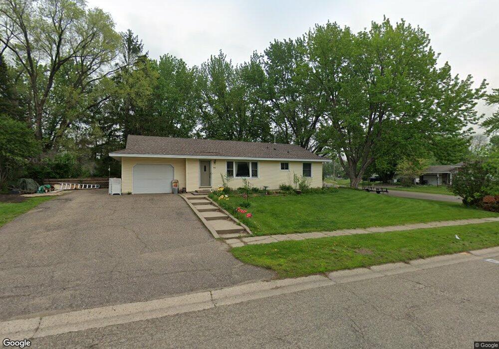
901 Mcintosh Dr Saint Paul, MN 55124
Old Town NeighborhoodEstimated Value: $321,474 - $361,000
3
Beds
1
Bath
984
Sq Ft
$343/Sq Ft
Est. Value
About This Home
This home is located at 901 Mcintosh Dr, Saint Paul, MN 55124 and is currently estimated at $337,119, approximately $342 per square foot. 901 Mcintosh Dr is a home located in Dakota County with nearby schools including Cedar Park Elementary STEM School, Valley Middle School, and Apple Valley Senior High School.
Ownership History
Date
Name
Owned For
Owner Type
Purchase Details
Closed on
Nov 15, 2002
Sold by
Weichelt Brent M and Weichelt Mary B
Bought by
Cross Julie A and Cross Michelle M
Current Estimated Value
Purchase Details
Closed on
Feb 26, 1999
Sold by
Daniels David J and Daniels Judy
Bought by
Weichelt Brent M and Weichelt Mary B
Purchase Details
Closed on
Jul 24, 1997
Sold by
Ruyter Darwin D and Ruyter Vicky F
Bought by
Daniels David J and Daniels Judy
Create a Home Valuation Report for This Property
The Home Valuation Report is an in-depth analysis detailing your home's value as well as a comparison with similar homes in the area
Home Values in the Area
Average Home Value in this Area
Purchase History
| Date | Buyer | Sale Price | Title Company |
|---|---|---|---|
| Cross Julie A | $155,500 | -- | |
| Weichelt Brent M | $112,000 | -- | |
| Daniels David J | $1,000 | -- |
Source: Public Records
Tax History Compared to Growth
Tax History
| Year | Tax Paid | Tax Assessment Tax Assessment Total Assessment is a certain percentage of the fair market value that is determined by local assessors to be the total taxable value of land and additions on the property. | Land | Improvement |
|---|---|---|---|---|
| 2024 | $2,912 | $272,300 | $86,300 | $186,000 |
| 2023 | $2,912 | $266,700 | $86,400 | $180,300 |
| 2022 | $2,528 | $267,800 | $86,200 | $181,600 |
| 2021 | $2,416 | $229,700 | $75,000 | $154,700 |
| 2020 | $2,412 | $216,100 | $71,400 | $144,700 |
| 2019 | $2,088 | $210,000 | $68,000 | $142,000 |
| 2018 | $2,052 | $193,200 | $64,700 | $128,500 |
| 2017 | $2,046 | $183,100 | $61,600 | $121,500 |
| 2016 | $2,540 | $174,500 | $58,700 | $115,800 |
| 2015 | $2,348 | $150,240 | $50,313 | $99,927 |
| 2014 | -- | $143,809 | $48,052 | $95,757 |
| 2013 | -- | $130,620 | $43,512 | $87,108 |
Source: Public Records
Map
Nearby Homes
- 14786 Hallmark Dr
- 14825 Haven Dr
- 921 Cortland Dr S
- 834 Fireside Dr
- 841 Cortland Dr
- 889 Whitney Dr
- 892 Redwell Ln
- 249 Elm Dr
- 15722 Griffon Ct
- 7765 157th St W
- 7616 157th St W Unit D
- 148 Spruce Dr
- 14350 Hickory Way
- 441 Walnut Ln
- 8090 159th St W
- 7600 157th St W Unit 105
- 14208 Heritage Ln
- 14620 Garrett Ave Unit 310
- 15813 Garden View Dr
- 14242 Glencove Trail
- 905 Mcintosh Dr
- 875 Haralson Dr
- 900 Mcintosh Dr
- 874 Haralson Dr
- 904 Mcintosh Dr
- 871 Haralson Dr
- 92 150th St W
- 96 150th St W
- 870 Haralson Dr
- 88 150th St W
- 908 Mcintosh Dr
- 892 Mcintosh Dr
- 100 150th St W
- 867 Haralson Dr
- 866 Haralson Dr
- 912 Mcintosh Dr
- 84 150th St W
- 881 Mcintosh Dr
- 863 Haralson Dr
- 108 150th St W