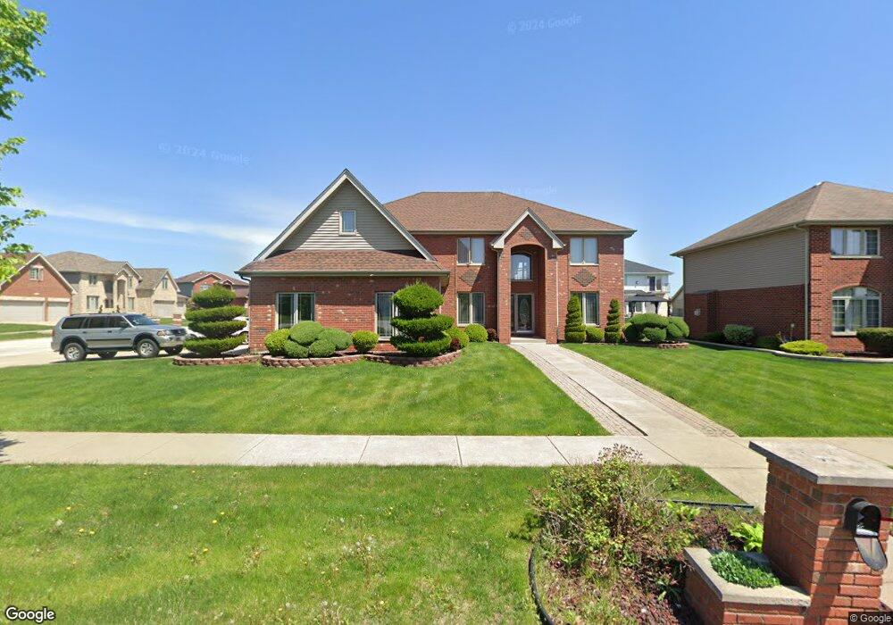
901 Willow Rd Matteson, IL 60443
West Matteson NeighborhoodEstimated Value: $398,000 - $475,000
4
Beds
3
Baths
3,201
Sq Ft
$139/Sq Ft
Est. Value
About This Home
This home is located at 901 Willow Rd, Matteson, IL 60443 and is currently estimated at $444,557, approximately $138 per square foot. 901 Willow Rd is a home located in Cook County with nearby schools including Colin Powell Middle School and Southland College Prep.
Ownership History
Date
Name
Owned For
Owner Type
Purchase Details
Closed on
Oct 11, 2010
Sold by
Idowu Olukayode and Idowu Rolonda
Bought by
Idowu Olukayode
Current Estimated Value
Purchase Details
Closed on
Jun 15, 2006
Sold by
Idowu Olukayode A
Bought by
Idowu Olukayode A and Idowu Rolonda
Home Financials for this Owner
Home Financials are based on the most recent Mortgage that was taken out on this home.
Original Mortgage
$320,000
Outstanding Balance
$186,671
Interest Rate
6.72%
Mortgage Type
New Conventional
Estimated Equity
$257,886
Purchase Details
Closed on
May 18, 2004
Sold by
State Bank Of Countryside
Bought by
Idowu Olukayode A
Home Financials for this Owner
Home Financials are based on the most recent Mortgage that was taken out on this home.
Original Mortgage
$285,112
Interest Rate
8%
Mortgage Type
Purchase Money Mortgage
Create a Home Valuation Report for This Property
The Home Valuation Report is an in-depth analysis detailing your home's value as well as a comparison with similar homes in the area
Home Values in the Area
Average Home Value in this Area
Purchase History
| Date | Buyer | Sale Price | Title Company |
|---|---|---|---|
| Idowu Olukayode | -- | None Available | |
| Idowu Olukayode A | -- | Git | |
| Idowu Olukayode A | $317,000 | -- |
Source: Public Records
Mortgage History
| Date | Status | Borrower | Loan Amount |
|---|---|---|---|
| Open | Idowu Olukayode A | $320,000 | |
| Closed | Idowu Olukayode A | $285,112 |
Source: Public Records
Tax History
| Year | Tax Paid | Tax Assessment Tax Assessment Total Assessment is a certain percentage of the fair market value that is determined by local assessors to be the total taxable value of land and additions on the property. | Land | Improvement |
|---|---|---|---|---|
| 2025 | $16,450 | $39,809 | $6,037 | $33,772 |
| 2024 | $16,450 | $39,809 | $6,037 | $33,772 |
| 2023 | $12,756 | $43,000 | $6,037 | $36,963 |
| 2022 | $12,756 | $27,247 | $5,214 | $22,033 |
| 2021 | $12,924 | $27,245 | $5,213 | $22,032 |
| 2020 | $12,608 | $27,245 | $5,213 | $22,032 |
| 2019 | $13,775 | $28,641 | $4,664 | $23,977 |
| 2018 | $13,571 | $28,641 | $4,664 | $23,977 |
| 2017 | $13,228 | $28,641 | $4,664 | $23,977 |
| 2016 | $11,605 | $24,923 | $4,116 | $20,807 |
| 2015 | $11,331 | $24,923 | $4,116 | $20,807 |
| 2014 | $12,739 | $28,339 | $4,116 | $24,223 |
| 2013 | $12,818 | $30,492 | $4,116 | $26,376 |
Source: Public Records
Map
Nearby Homes
- 6216 Pond View Dr
- 6125 Sunflower Dr
- 6158 White Birch Ln
- 21131 Vivienne Dr
- 1010 Regent Dr
- 997 Regent Dr
- 6037 Spring Ln
- 6021 Spring Ln
- 912 Princeton Ave
- 829 Princeton Ave
- 21156 Christina Dr
- 5631 Colgate Ln
- 21206 Sophia Dr
- 6306 Beaver Dam Rd
- 21143 Gray Hawk Dr Unit 2554
- 21218 Shannon Ave
- 443 Danielle Rd
- 5503 Georgetown Dr
- 6503 Blue Sky Ln Unit 2502
- 5804 Kathryn Ln
Your Personal Tour Guide
Ask me questions while you tour the home.