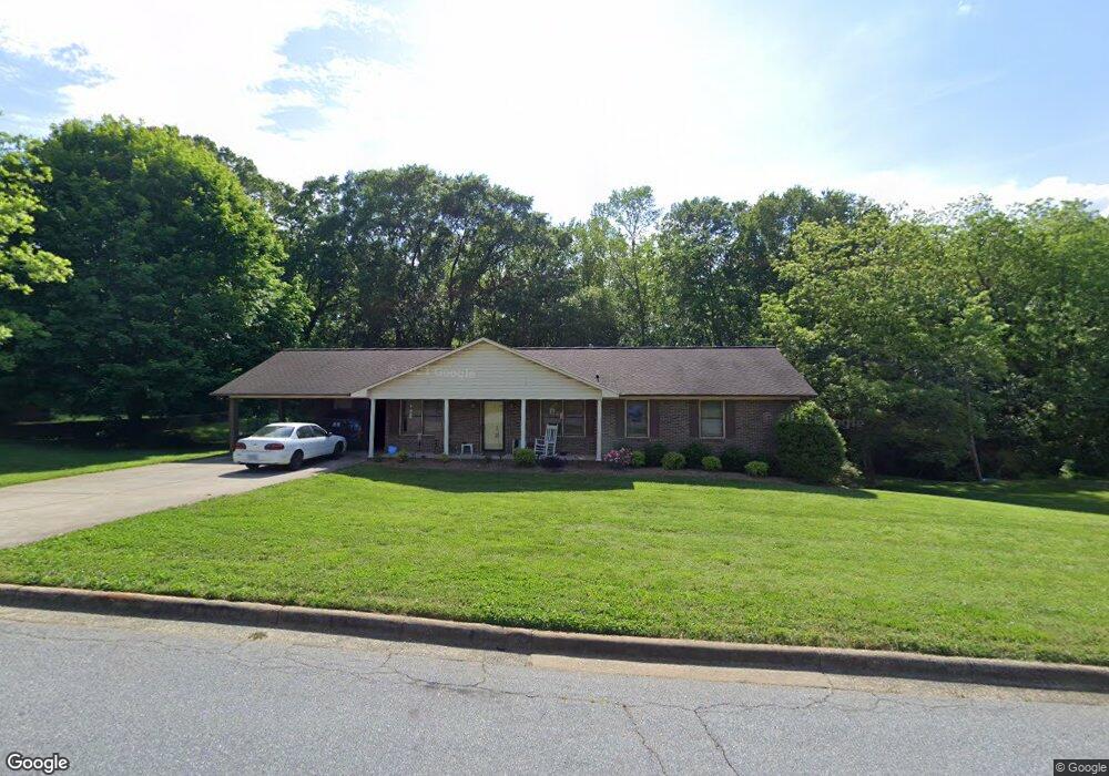
902 Tait St Lincolnton, NC 28092
Estimated Value: $306,000 - $496,000
3
Beds
2
Baths
3,056
Sq Ft
$131/Sq Ft
Est. Value
About This Home
This home is located at 902 Tait St, Lincolnton, NC 28092 and is currently estimated at $398,937, approximately $130 per square foot. 902 Tait St is a home located in Lincoln County with nearby schools including S. Ray Lowder Elementary School, Lincolnton Middle School, and Lincolnton High School.
Ownership History
Date
Name
Owned For
Owner Type
Purchase Details
Closed on
Jul 16, 2025
Sold by
Burns Pamela Love and Burchfield Gary Paul
Bought by
Burchfield Gary Paul
Current Estimated Value
Purchase Details
Closed on
Feb 9, 2017
Sold by
Burchfield Charlote J
Bought by
Burns Pamela Love and Burchfield Gary Paul
Purchase Details
Closed on
Sep 11, 2014
Sold by
Warlick Nadean H
Bought by
Warlick Weaver Glenda
Purchase Details
Closed on
Oct 28, 1985
Bought by
Warlick Nadean H
Create a Home Valuation Report for This Property
The Home Valuation Report is an in-depth analysis detailing your home's value as well as a comparison with similar homes in the area
Home Values in the Area
Average Home Value in this Area
Purchase History
| Date | Buyer | Sale Price | Title Company |
|---|---|---|---|
| Burchfield Gary Paul | -- | None Listed On Document | |
| Burchfield Gary Paul | -- | None Listed On Document | |
| Burns Pamela Love | -- | None Available | |
| Warlick Weaver Glenda | -- | None Available | |
| Warlick Nadean H | $6,000 | -- |
Source: Public Records
Tax History Compared to Growth
Tax History
| Year | Tax Paid | Tax Assessment Tax Assessment Total Assessment is a certain percentage of the fair market value that is determined by local assessors to be the total taxable value of land and additions on the property. | Land | Improvement |
|---|---|---|---|---|
| 2025 | $3,996 | $385,942 | $33,900 | $352,042 |
| 2024 | $3,976 | $385,942 | $33,900 | $352,042 |
| 2023 | $3,971 | $385,942 | $33,900 | $352,042 |
| 2022 | $2,609 | $211,526 | $26,400 | $185,126 |
| 2021 | $2,609 | $211,526 | $26,400 | $185,126 |
| 2020 | $2,452 | $211,526 | $26,400 | $185,126 |
| 2019 | $2,452 | $211,526 | $26,400 | $185,126 |
| 2018 | $2,229 | $181,748 | $28,800 | $152,948 |
| 2017 | $2,128 | $181,748 | $28,800 | $152,948 |
| 2016 | $2,128 | $181,748 | $28,800 | $152,948 |
| 2015 | $2,172 | $181,748 | $28,800 | $152,948 |
| 2014 | $2,232 | $185,620 | $31,800 | $153,820 |
Source: Public Records
Map
Nearby Homes
- 217 Rock Creek Dr
- 709 Catawba St
- 916 E Park Dr
- 810 & 812 Lincoln St E Unit 810
- 329 E Congress St
- 515 S Academy St
- 68 Mockingbird Ln
- 1024 Catawba St
- 140 Robin Rd
- 622 E Pine St
- 109 Saddletree Rd
- 818 Grier St
- 317 S High St
- 675 Heather Dr
- 110 W Pine St
- 101 Saddletree Rd
- 423 N Cedar St
- 106 Saddletree Rd
- 316 N Government St
- 665 S Grove St