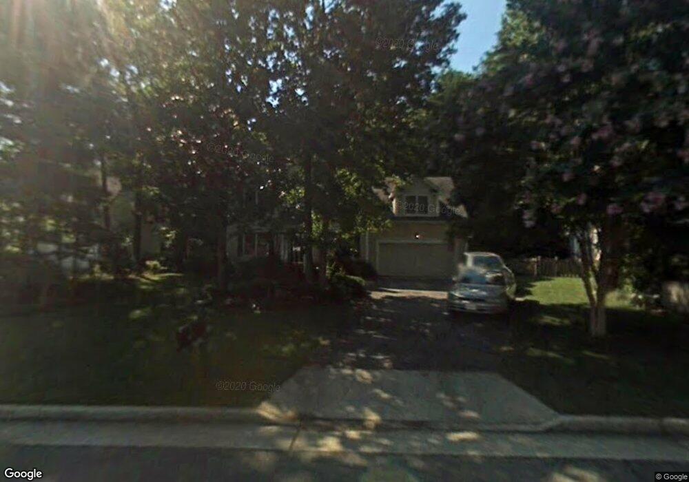
9021 Laurel Branch Cir Mechanicsville, VA 23116
Atlee NeighborhoodEstimated Value: $506,821 - $531,000
4
Beds
3
Baths
2,336
Sq Ft
$220/Sq Ft
Est. Value
About This Home
This home is located at 9021 Laurel Branch Cir, Mechanicsville, VA 23116 and is currently estimated at $514,955, approximately $220 per square foot. 9021 Laurel Branch Cir is a home located in Hanover County with nearby schools including Pearson's Corner Elementary School, Chickahominy Middle School, and Atlee High School.
Ownership History
Date
Name
Owned For
Owner Type
Purchase Details
Closed on
Nov 23, 1999
Sold by
Bohn Michael K
Bought by
Morris Daniel B
Current Estimated Value
Home Financials for this Owner
Home Financials are based on the most recent Mortgage that was taken out on this home.
Original Mortgage
$135,500
Outstanding Balance
$41,715
Interest Rate
7.86%
Estimated Equity
$473,240
Create a Home Valuation Report for This Property
The Home Valuation Report is an in-depth analysis detailing your home's value as well as a comparison with similar homes in the area
Home Values in the Area
Average Home Value in this Area
Purchase History
| Date | Buyer | Sale Price | Title Company |
|---|---|---|---|
| Morris Daniel B | $182,500 | -- |
Source: Public Records
Mortgage History
| Date | Status | Borrower | Loan Amount |
|---|---|---|---|
| Open | Morris Daniel B | $135,500 |
Source: Public Records
Tax History Compared to Growth
Tax History
| Year | Tax Paid | Tax Assessment Tax Assessment Total Assessment is a certain percentage of the fair market value that is determined by local assessors to be the total taxable value of land and additions on the property. | Land | Improvement |
|---|---|---|---|---|
| 2025 | $3,307 | $402,600 | $100,000 | $302,600 |
| 2024 | $3,307 | $402,600 | $100,000 | $302,600 |
| 2023 | $3,040 | $388,900 | $90,000 | $298,900 |
| 2022 | $2,674 | $325,100 | $85,000 | $240,100 |
| 2021 | $2,444 | $297,300 | $70,000 | $227,300 |
| 2020 | $2,440 | $297,300 | $70,000 | $227,300 |
| 2019 | $2,408 | $297,300 | $70,000 | $227,300 |
| 2018 | $2,408 | $297,300 | $70,000 | $227,300 |
| 2017 | $2,247 | $277,400 | $60,000 | $217,400 |
| 2016 | $2,247 | $277,400 | $60,000 | $217,400 |
| 2015 | $2,247 | $277,400 | $60,000 | $217,400 |
| 2014 | $2,083 | $257,200 | $60,000 | $197,200 |
Source: Public Records
Map
Nearby Homes
- 9013 Laurel Branch Cir
- 10342 Kilby Ct
- 10434 Oak Cottage Dr
- 10347 Hepburn Ct
- 8487 Cheraw Rd
- 11063 Linderwood Dr
- 8572 Anderson Ct
- 8564 Anderson Ct
- 10996 Seward Way
- 10292 Wanchese Way
- 10288 Wanchese Way
- The Ellwood Plan at Patrick Henry Heights
- 8355 Patrick Henry Blvd
- 11251 Linderwood Dr
- 11021 Milestone Dr
- 9273 Susquehanna Trail
- 11012 Milestone Dr
- 10259 Matthews Grove Ln
- 10294 Henderson Hall Rd
- 9409 Charter Lake Dr
- 9017 Laurel Branch Cir
- 9025 Laurel Branch Cir
- 10374 Tarleton Dr
- 10367 Tarleton Dr
- 9029 Laurel Branch Cir
- 10370 Tarleton Dr
- 9024 Laurel Branch Cir
- 9028 Gold Ridge Ln
- 9018 Laurel Branch Cir
- 9011 Laurel Branch Cir
- 9016 Laurel Branch Cir
- 9032 Gold Ridge Ln
- 9033 Laurel Branch Cir
- 9010 Laurel Branch Cir
- 10363 Tarleton Dr
- 9030 Laurel Branch Cir
- 9012 Laurel Branch Cir
- 9014 Laurel Branch Cir
- 9037 Laurel Branch Cir
- 9036 Gold Ridge Ln