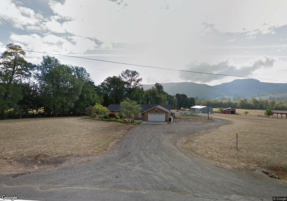
90269 Hill Rd Springfield, OR 97478
Estimated Value: $666,322 - $812,000
3
Beds
2
Baths
1,614
Sq Ft
$476/Sq Ft
Est. Value
About This Home
This home is located at 90269 Hill Rd, Springfield, OR 97478 and is currently estimated at $768,581, approximately $476 per square foot. 90269 Hill Rd is a home located in Lane County with nearby schools including Yolanda Elementary School, Briggs Middle School, and Thurston High School.
Ownership History
Date
Name
Owned For
Owner Type
Purchase Details
Closed on
Jun 16, 2011
Sold by
Hall Dale R
Bought by
Costa Mark A and Costa Carleen D
Current Estimated Value
Home Financials for this Owner
Home Financials are based on the most recent Mortgage that was taken out on this home.
Original Mortgage
$226,000
Outstanding Balance
$154,724
Interest Rate
4.56%
Mortgage Type
New Conventional
Estimated Equity
$613,857
Purchase Details
Closed on
Jun 17, 2010
Sold by
Hall Dale
Bought by
Hall Dale R and The Dale R Hall Jr Living Trust
Purchase Details
Closed on
Jun 21, 2005
Sold by
Garner Ellison Eugene and Garner Luann
Bought by
Hall Dale and Hall Anita
Home Financials for this Owner
Home Financials are based on the most recent Mortgage that was taken out on this home.
Original Mortgage
$287,600
Interest Rate
5.72%
Mortgage Type
Fannie Mae Freddie Mac
Create a Home Valuation Report for This Property
The Home Valuation Report is an in-depth analysis detailing your home's value as well as a comparison with similar homes in the area
Purchase History
| Date | Buyer | Sale Price | Title Company |
|---|---|---|---|
| Costa Mark A | $350,000 | Evergreen Land Title Company | |
| Hall Dale R | -- | None Available | |
| Hall Dale | $359,500 | American Title Group |
Source: Public Records
Mortgage History
| Date | Status | Borrower | Loan Amount |
|---|---|---|---|
| Open | Costa Mark A | $226,000 | |
| Previous Owner | Hall Dale | $287,600 |
Source: Public Records
Tax History
| Year | Tax Paid | Tax Assessment Tax Assessment Total Assessment is a certain percentage of the fair market value that is determined by local assessors to be the total taxable value of land and additions on the property. | Land | Improvement |
|---|---|---|---|---|
| 2025 | $3,610 | $321,855 | -- | -- |
| 2024 | $3,511 | $312,590 | -- | -- |
| 2023 | $3,511 | $303,607 | -- | -- |
| 2022 | $3,280 | $294,851 | $0 | $0 |
| 2021 | $3,203 | $286,267 | $0 | $0 |
| 2020 | $3,106 | $277,930 | $0 | $0 |
| 2019 | $2,991 | $269,835 | $0 | $0 |
| 2018 | $2,891 | $254,345 | $0 | $0 |
| 2017 | $2,681 | $254,345 | $0 | $0 |
| 2016 | $2,610 | $246,936 | $0 | $0 |
| 2015 | $2,542 | $239,744 | $0 | $0 |
| 2014 | $3,287 | $313,581 | $0 | $0 |
Source: Public Records
Map
Nearby Homes
- 0 Hill Rd
- 89112 Sky High Dr
- 37186 Tree Farm Rd
- 91375 Marcola Rd
- 0 Marcola Rd
- 37082 Goats Rd
- 3333 Hayden Bridge Rd
- 2783 31st St
- 2309 35th St
- 3710 River Heights Dr
- 3442 River Heights Dr
- 3488 River Heights Dr
- 3767 Vitus Ln
- 2790 23rd St
- 2135 37th Place
- 2483 30th Place
- 2985 W St
- 37075 Camp Creek Rd
- 3125 V St
- 2343 31st St
Your Personal Tour Guide
Ask me questions while you tour the home.