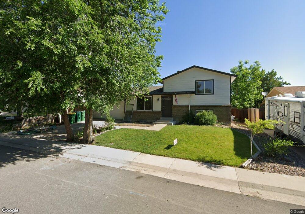
9035 W Euclid Ave Littleton, CO 80123
Kipling Hills NeighborhoodEstimated Value: $480,574 - $547,000
3
Beds
3
Baths
832
Sq Ft
$603/Sq Ft
Est. Value
About This Home
This home is located at 9035 W Euclid Ave, Littleton, CO 80123 and is currently estimated at $501,894, approximately $603 per square foot. 9035 W Euclid Ave is a home located in Jefferson County with nearby schools including Powderhorn Elementary School, Summit Ridge Middle School, and Dakota Ridge Senior High School.
Ownership History
Date
Name
Owned For
Owner Type
Purchase Details
Closed on
Sep 2, 2022
Sold by
Larry Hannebaum
Bought by
Ira Robert Maxwell
Current Estimated Value
Purchase Details
Closed on
Aug 24, 2006
Sold by
Hammond Jonathan D
Bought by
Hannebaum Larry
Home Financials for this Owner
Home Financials are based on the most recent Mortgage that was taken out on this home.
Original Mortgage
$185,200
Interest Rate
7.5%
Mortgage Type
Purchase Money Mortgage
Purchase Details
Closed on
Apr 5, 2006
Sold by
Homecomings Financial Network Inc
Bought by
Hammond Jonathan D
Home Financials for this Owner
Home Financials are based on the most recent Mortgage that was taken out on this home.
Original Mortgage
$141,600
Interest Rate
8.37%
Mortgage Type
Fannie Mae Freddie Mac
Purchase Details
Closed on
Jan 3, 2006
Sold by
Stakhiv Yuriy
Bought by
First Franklin Financial Corp
Purchase Details
Closed on
Apr 7, 2004
Sold by
Sindiy Yelena
Bought by
Stakhiv Yuriy
Purchase Details
Closed on
Jan 29, 2003
Sold by
Thomassen Lesley A
Bought by
Sindiy Yelena
Home Financials for this Owner
Home Financials are based on the most recent Mortgage that was taken out on this home.
Original Mortgage
$189,050
Interest Rate
5.9%
Purchase Details
Closed on
Jul 30, 1999
Sold by
Taylor Rhonda E
Bought by
Thomassen Lesley A
Home Financials for this Owner
Home Financials are based on the most recent Mortgage that was taken out on this home.
Original Mortgage
$155,459
Interest Rate
7.63%
Mortgage Type
FHA
Purchase Details
Closed on
Jul 28, 1995
Sold by
Sugar Katherine H and Inskeep Lori A
Bought by
Taylor Rhonda E
Home Financials for this Owner
Home Financials are based on the most recent Mortgage that was taken out on this home.
Original Mortgage
$97,100
Interest Rate
7.05%
Create a Home Valuation Report for This Property
The Home Valuation Report is an in-depth analysis detailing your home's value as well as a comparison with similar homes in the area
Home Values in the Area
Average Home Value in this Area
Purchase History
| Date | Buyer | Sale Price | Title Company |
|---|---|---|---|
| Ira Robert Maxwell | $320,000 | Land Title Guarantee Company | |
| Hannebaum Larry | $231,500 | Title America | |
| Hammond Jonathan D | $177,000 | None Available | |
| Homecomings Financial Network Inc | -- | None Available | |
| First Franklin Financial Corp | -- | -- | |
| Stakhiv Yuriy | -- | -- | |
| Sindiy Yelena | $199,000 | Land Title | |
| Thomassen Lesley A | $156,500 | Stewart Title | |
| Taylor Rhonda E | $121,400 | North American Title |
Source: Public Records
Mortgage History
| Date | Status | Borrower | Loan Amount |
|---|---|---|---|
| Previous Owner | Hannebaum Larry | $185,200 | |
| Previous Owner | Hammond Jonathan D | $141,600 | |
| Previous Owner | Sindiy Yelena | $189,050 | |
| Previous Owner | Thomassen Lesley A | $155,459 | |
| Previous Owner | Taylor Rhonda E | $97,100 |
Source: Public Records
Tax History Compared to Growth
Tax History
| Year | Tax Paid | Tax Assessment Tax Assessment Total Assessment is a certain percentage of the fair market value that is determined by local assessors to be the total taxable value of land and additions on the property. | Land | Improvement |
|---|---|---|---|---|
| 2024 | $3,033 | $27,307 | $10,163 | $17,144 |
| 2023 | $3,033 | $27,307 | $10,163 | $17,144 |
| 2022 | $2,510 | $25,161 | $8,357 | $16,804 |
| 2021 | $2,867 | $25,885 | $8,598 | $17,287 |
| 2020 | $2,583 | $23,136 | $7,002 | $16,134 |
| 2019 | $2,545 | $23,136 | $7,002 | $16,134 |
| 2018 | $2,291 | $19,888 | $6,263 | $13,625 |
| 2017 | $2,117 | $19,888 | $6,263 | $13,625 |
| 2016 | $1,988 | $17,898 | $5,695 | $12,203 |
| 2015 | $1,409 | $17,898 | $5,695 | $12,203 |
| 2014 | $1,715 | $13,947 | $4,594 | $9,353 |
Source: Public Records
Map
Nearby Homes
- 6705 S Field St Unit 802
- 6705 S Field St Unit 801
- 8729 W Euclid Place
- 6755 S Field St Unit 618
- 6755 S Field St Unit 623
- 9364 W Coal Mine Ave
- 6766 S Holland Way
- 9505 W Coal Mine Ave Unit F
- 9519 W Coal Mine Ave Unit F
- 9423 W Ontario Dr
- 9603 W Euclid Dr
- 6784 S Independence St
- 9526 W Walker Place
- 6451 S Hoyt St
- 6765 S Independence St
- 6763 S Independence St
- 6753 S Independence St
- 6751 S Independence St
- 6365 S Dudley Way
- 8878 W Plymouth Ave
- 9045 W Euclid Ave
- 9025 W Euclid Ave
- 6543 S Field Way
- 6541 S Field Way
- 9075 W Euclid Ave
- 6612 S Field Ct
- 9015 W Euclid Ave
- 6576 S Flower St
- 6545 S Field Way
- 6537 S Field Way
- 6566 S Flower St
- 6613 S Field Ct
- 6622 S Field Ct
- 8985 W Euclid Ave
- 6625 S Field St
- 6547 S Field Way
- 6535 S Field Way
- 6556 S Flower St
- 6623 S Field Ct
- 6542 S Field Way