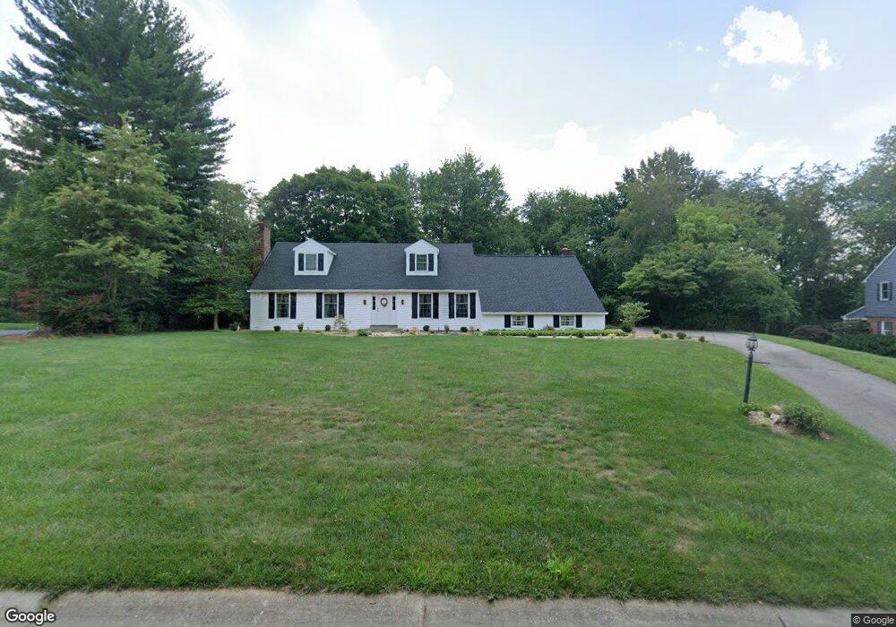
904 Barnstable Ct Hockessin, DE 19707
Estimated Value: $666,000 - $767,000
4
Beds
3
Baths
2,632
Sq Ft
$273/Sq Ft
Est. Value
About This Home
This home is located at 904 Barnstable Ct, Hockessin, DE 19707 and is currently estimated at $719,029, approximately $273 per square foot. 904 Barnstable Ct is a home located in New Castle County with nearby schools including Dupont (H.B.) Middle School, Alexis I. du Pont High School, and Hockessin Montessori School.
Ownership History
Date
Name
Owned For
Owner Type
Purchase Details
Closed on
Jun 18, 2003
Sold by
Boden Nancy H and Nancy H Boden Revocable Trust
Bought by
Boden Herbert S and Boden Nancy H
Current Estimated Value
Home Financials for this Owner
Home Financials are based on the most recent Mortgage that was taken out on this home.
Original Mortgage
$106,972
Interest Rate
5.71%
Mortgage Type
Purchase Money Mortgage
Purchase Details
Closed on
Nov 30, 2001
Sold by
Boden Herbert S and Boden Nancy H
Bought by
Boden Nancy H and The Nancy H Boden Revocable Tr
Create a Home Valuation Report for This Property
The Home Valuation Report is an in-depth analysis detailing your home's value as well as a comparison with similar homes in the area
Home Values in the Area
Average Home Value in this Area
Purchase History
| Date | Buyer | Sale Price | Title Company |
|---|---|---|---|
| Boden Herbert S | -- | -- | |
| Boden Nancy H | -- | -- |
Source: Public Records
Mortgage History
| Date | Status | Borrower | Loan Amount |
|---|---|---|---|
| Closed | Boden Herbert S | $106,972 |
Source: Public Records
Tax History
| Year | Tax Paid | Tax Assessment Tax Assessment Total Assessment is a certain percentage of the fair market value that is determined by local assessors to be the total taxable value of land and additions on the property. | Land | Improvement |
|---|---|---|---|---|
| 2024 | $5,634 | $166,000 | $32,600 | $133,400 |
| 2023 | $4,911 | $166,000 | $32,600 | $133,400 |
| 2022 | $4,975 | $166,000 | $32,600 | $133,400 |
| 2021 | $5,075 | $166,000 | $32,600 | $133,400 |
| 2020 | $5,093 | $166,000 | $32,600 | $133,400 |
| 2019 | $5,238 | $166,000 | $32,600 | $133,400 |
| 2018 | $4,975 | $166,000 | $32,600 | $133,400 |
| 2017 | $4,909 | $166,000 | $32,600 | $133,400 |
| 2016 | $4,571 | $166,000 | $32,600 | $133,400 |
| 2015 | $4,251 | $166,000 | $32,600 | $133,400 |
| 2014 | $3,897 | $166,000 | $32,600 | $133,400 |
Source: Public Records
Map
Nearby Homes
- 112 Cameron Dr
- 105 Bellfield Ct
- 408 Willowbend Ct
- 1075 Yorklyn Rd
- 634 Grant Ave
- 11 Yorkridge Trail
- 809 Christopher Ct
- 12 Larchmont Ct
- 567 Southwood Rd
- 513 Pershing Rd
- 500 Defoe Rd
- 7 Piersons Ridge Unit RG
- 257 Grove View Dr
- 255 Grove View Dr
- 1848 Brackenville Rd
- 531 Chandler Mill Rd
- 2160 Brackenville Rd
- 87 Chandler Ct
- 1777 Brackenville Rd
- 411 Harrison Dr
- 906 Barnstable Ct
- 902 Barnstable Ct
- 903 Barnstable Ct
- 901 Barnstable Ct
- 908 Barnstable Ct
- 900 Barnstable Ct
- 905 Barnstable Ct
- 805 Walnut Hill Ct
- 803 Walnut Hill Ct
- 907 Barnstable Ct
- 807 Walnut Hill Ct
- 801 Walnut Hill Ct
- 804 Westridge Dr
- 806 Westridge Dr
- 910 Barnstable Ct
- 802 Westridge Dr
- 808 Westridge Dr
- 809 Walnut Hill Ct
- 810 Westridge Dr
- 804 Walnut Hill Ct
Your Personal Tour Guide
Ask me questions while you tour the home.