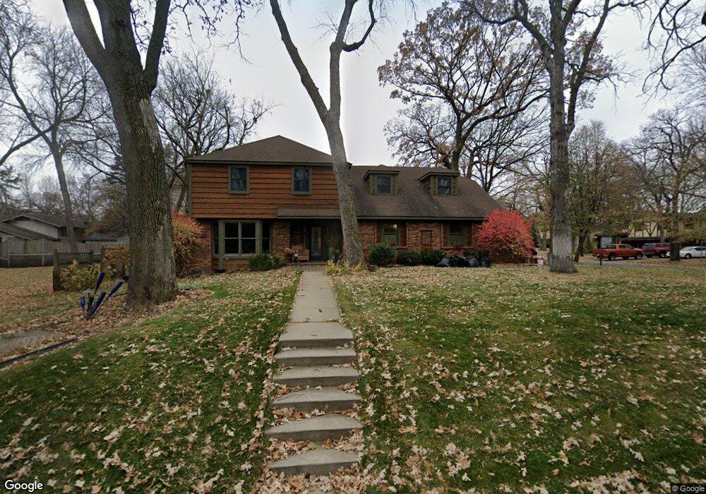
905 Gloria Dr Saint Cloud, MN 56303
Estimated Value: $359,000 - $529,000
4
Beds
3
Baths
3,224
Sq Ft
$138/Sq Ft
Est. Value
About This Home
This home is located at 905 Gloria Dr, Saint Cloud, MN 56303 and is currently estimated at $443,359, approximately $137 per square foot. 905 Gloria Dr is a home located in Stearns County with nearby schools including Westwood Elementary School, North Junior High School, and Apollo Senior High School.
Ownership History
Date
Name
Owned For
Owner Type
Purchase Details
Closed on
Sep 4, 2015
Sold by
Milligan Kathleen Kathleen
Bought by
Esplan Michael Michael
Current Estimated Value
Home Financials for this Owner
Home Financials are based on the most recent Mortgage that was taken out on this home.
Original Mortgage
$232,000
Outstanding Balance
$182,096
Interest Rate
3.89%
Estimated Equity
$261,263
Create a Home Valuation Report for This Property
The Home Valuation Report is an in-depth analysis detailing your home's value as well as a comparison with similar homes in the area
Purchase History
| Date | Buyer | Sale Price | Title Company |
|---|---|---|---|
| Esplan Michael Michael | $290,000 | -- |
Source: Public Records
Mortgage History
| Date | Status | Borrower | Loan Amount |
|---|---|---|---|
| Open | Esplan Michael Michael | $232,000 |
Source: Public Records
Tax History
| Year | Tax Paid | Tax Assessment Tax Assessment Total Assessment is a certain percentage of the fair market value that is determined by local assessors to be the total taxable value of land and additions on the property. | Land | Improvement |
|---|---|---|---|---|
| 2025 | $4,802 | $415,900 | $60,000 | $355,900 |
| 2024 | $4,840 | $369,500 | $60,000 | $309,500 |
| 2023 | $4,840 | $369,500 | $45,000 | $324,500 |
| 2022 | $4,132 | $295,400 | $45,000 | $250,400 |
| 2021 | $3,910 | $295,400 | $45,000 | $250,400 |
| 2020 | $3,726 | $281,200 | $45,000 | $236,200 |
| 2019 | $3,672 | $261,700 | $45,000 | $216,700 |
| 2018 | $3,524 | $243,500 | $45,000 | $198,500 |
| 2017 | $3,448 | $230,300 | $45,000 | $185,300 |
| 2016 | $3,234 | $0 | $0 | $0 |
| 2015 | $3,942 | $0 | $0 | $0 |
| 2014 | -- | $0 | $0 | $0 |
Source: Public Records
Map
Nearby Homes
- 5815 Rivers Edge Dr
- 611 Brookwood Ln
- 6201 Cape East Ct
- 1133 County Road 134
- 1072 County Road 134
- 34 Glenview Loop
- 6346 Cape West Ct
- 939 Cypress Rd Unit 4
- 939 Cypress Rd Unit 42
- 939 Cypress Rd Unit 25
- 1773 Wildwood Rd
- 144 Glenview Loop
- 6545 Westwood Pkwy
- 1804 Amblewood Dr
- 1766 Cottonwood Cir
- 253 10th Ave N
- 236 11th Ave N
- 6010 Prairie Rose Dr
- 6536 Kenwood Rd
- 1924 Pleasant Ave
- 5818 Michael Ct
- 901 Gloria Dr
- 5817 Michael Ct
- 5855 Ridgewood Rd
- 910 Gloria Dr
- 5820 Michael Ct
- 5815 Michael Ct
- 902 Gloria Dr
- 5821 Michael Ct
- 5814 Michael Ct
- 5811 Michael Ct
- 5822 Michael Ct
- 909 Julie Dr
- 5841 Ridgewood Rd
- 5863 Ridgewood Rd
- 5812 Michael Ct
- 23 Fairfield Ct
- 5813 Michael Ct
- 922 Julie Dr
- 19 Fairfield Ct