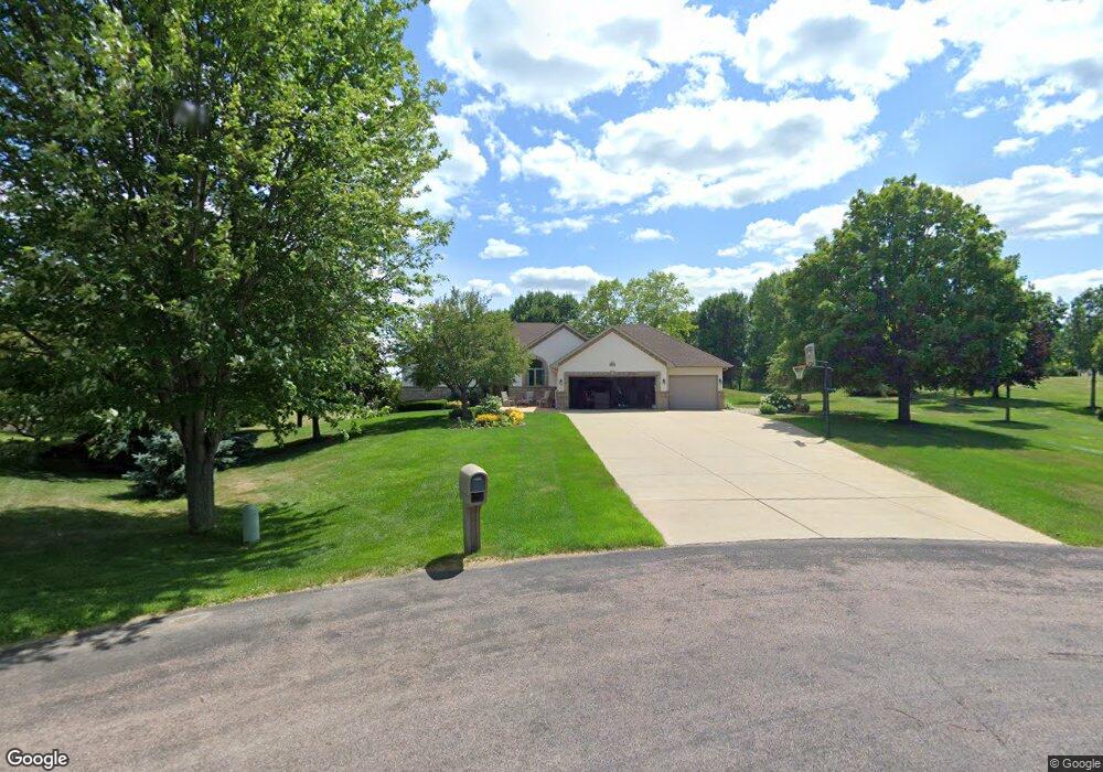
905 Wild Rose Ct Shakopee, MN 55379
Estimated Value: $627,000 - $802,230
4
Beds
3
Baths
1,704
Sq Ft
$423/Sq Ft
Est. Value
About This Home
This home is located at 905 Wild Rose Ct, Shakopee, MN 55379 and is currently estimated at $720,308, approximately $422 per square foot. 905 Wild Rose Ct is a home located in Scott County with nearby schools including Sweeney Elementary School, East Middle School, and Shakopee Senior High School.
Ownership History
Date
Name
Owned For
Owner Type
Purchase Details
Closed on
Jun 18, 2024
Sold by
County Of Scott
Bought by
City Of Shakopee
Current Estimated Value
Purchase Details
Closed on
Mar 17, 2022
Sold by
Brekke Barbara J Weckman
Bought by
Brekke Barbara J Weckman and Barbara J Weckman Brekke Trust
Purchase Details
Closed on
Nov 21, 2003
Sold by
Mensing Charles A and Mensing Lola M
Bought by
Brekke Jon P and Weckman Brekke Barbara J
Purchase Details
Closed on
Jan 6, 1999
Sold by
The Pink Rose Corp
Bought by
Mensing Charles A and Mensing Lola M
Create a Home Valuation Report for This Property
The Home Valuation Report is an in-depth analysis detailing your home's value as well as a comparison with similar homes in the area
Home Values in the Area
Average Home Value in this Area
Purchase History
| Date | Buyer | Sale Price | Title Company |
|---|---|---|---|
| City Of Shakopee | $500 | None Listed On Document | |
| Brekke Barbara J Weckman | -- | None Listed On Document | |
| Brekke Jon P | $490,000 | -- | |
| Mensing Charles A | $45,000 | -- |
Source: Public Records
Tax History Compared to Growth
Tax History
| Year | Tax Paid | Tax Assessment Tax Assessment Total Assessment is a certain percentage of the fair market value that is determined by local assessors to be the total taxable value of land and additions on the property. | Land | Improvement |
|---|---|---|---|---|
| 2025 | $6,474 | $722,100 | $331,100 | $391,000 |
| 2024 | $5,970 | $721,500 | $334,200 | $387,300 |
| 2023 | $6,074 | $664,400 | $307,000 | $357,400 |
| 2022 | $5,298 | $667,400 | $281,400 | $386,000 |
| 2021 | $4,654 | $511,200 | $188,900 | $322,300 |
| 2020 | $5,820 | $506,900 | $186,300 | $320,600 |
| 2019 | $5,152 | $532,100 | $208,400 | $323,700 |
| 2018 | $5,466 | $0 | $0 | $0 |
| 2016 | $5,278 | $0 | $0 | $0 |
Source: Public Records
Map
Nearby Homes
- 13720 Marystown Rd
- 13950 Marystown Rd
- 1742 Marsh View Terrace
- 1719 Marsh View Terrace
- 1764 Marsh View Terrace
- 1741 Marsh View Terrace
- 2495 Marsh View Ct
- 1650 Denali Dr
- 2483 Marsh View Ct
- 1634 Denali Dr
- 1695 Denali Dr
- 1667 Denali Dr
- 2494 Marsh View Ct
- 13864 Stonebrooke Curve
- 1842 Rainier Dr
- 1860 Rainer Dr
- 13599 Stonebrooke Curve
- 1XX Stonebrooke Curve
- 3XX Stonebrooke Curve
- 1824 Rainier Dr
- 895 Wild Rose Ct
- 917 Wild Rose Ct
- 885 Wild Rose Ct
- 925 Rosewood Cir
- 871 Wild Rose Ct
- 920 Rosewood Cir
- 13844 Pribyl Pond Ln
- 957 Rosewood Cir
- 981 Rosewood Cir
- 1XX Pribyl Pond Ln
- 13X Pribyl Pond Ln
- 940 Rosewood Cir
- 13739 Pribyl Pond Ln
- 851 Rosewood Cir
- 13781 Pribyl Pond Ln
- 13781 Pribyl Pond Ln
- 856 Rosewood Cir
- 13701 Pribyl Pond Ln
- 13775 Marystown Rd
- 831 Rosewood Cir