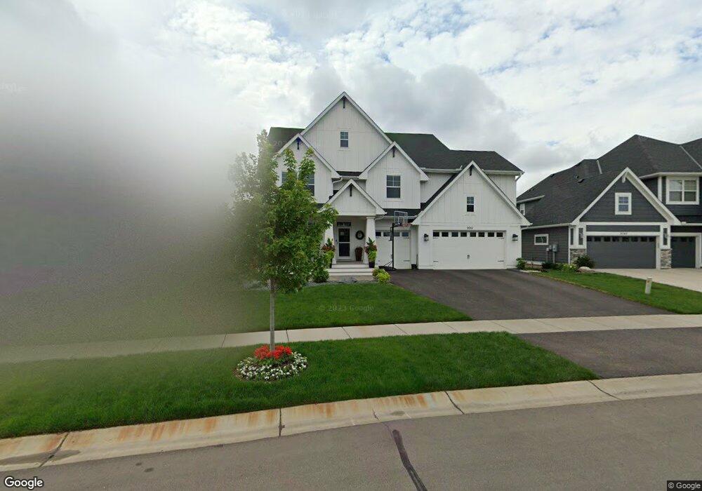
9051 Bur Oak Rd Saint Paul, MN 55129
Estimated Value: $930,227 - $1,088,000
5
Beds
5
Baths
3,855
Sq Ft
$259/Sq Ft
Est. Value
About This Home
This home is located at 9051 Bur Oak Rd, Saint Paul, MN 55129 and is currently estimated at $1,000,307, approximately $259 per square foot. 9051 Bur Oak Rd is a home with nearby schools including Red Rock Elementary School, Lake Middle School, and East Ridge High School.
Ownership History
Date
Name
Owned For
Owner Type
Purchase Details
Closed on
Dec 9, 2016
Sold by
Robert Thomas Homes Inc
Bought by
Flifford Steven and Flifford Betsy
Current Estimated Value
Home Financials for this Owner
Home Financials are based on the most recent Mortgage that was taken out on this home.
Original Mortgage
$564,550
Outstanding Balance
$456,566
Interest Rate
3.57%
Mortgage Type
New Conventional
Estimated Equity
$543,741
Create a Home Valuation Report for This Property
The Home Valuation Report is an in-depth analysis detailing your home's value as well as a comparison with similar homes in the area
Home Values in the Area
Average Home Value in this Area
Purchase History
| Date | Buyer | Sale Price | Title Company |
|---|---|---|---|
| Flifford Steven | $706,130 | Esquire Title Service Llc |
Source: Public Records
Mortgage History
| Date | Status | Borrower | Loan Amount |
|---|---|---|---|
| Open | Flifford Steven | $564,550 |
Source: Public Records
Tax History Compared to Growth
Tax History
| Year | Tax Paid | Tax Assessment Tax Assessment Total Assessment is a certain percentage of the fair market value that is determined by local assessors to be the total taxable value of land and additions on the property. | Land | Improvement |
|---|---|---|---|---|
| 2024 | $12,392 | $934,500 | $150,000 | $784,500 |
| 2023 | $12,392 | $946,400 | $160,000 | $786,400 |
| 2022 | $10,688 | $906,900 | $162,000 | $744,900 |
| 2021 | $10,172 | $755,700 | $135,000 | $620,700 |
| 2020 | $10,840 | $729,400 | $125,000 | $604,400 |
| 2019 | $10,486 | $758,500 | $135,000 | $623,500 |
| 2018 | $9,262 | $711,900 | $130,000 | $581,900 |
| 2017 | $470 | $629,400 | $130,000 | $499,400 |
| 2016 | -- | $23,300 | $23,300 | $0 |
Source: Public Records
Map
Nearby Homes
- 5174 Sundial Ln
- 4764 Ashton Curve
- 5194 Sundial Ln
- 4983 Sunflower Dr
- 5014 Dale Ridge Rd
- 4418 Ashton Curve
- 5237 Windlass Dr
- 5054 Dale Ridge Rd
- The Somerset 3 Plan at The Villas at Summerhill Woodbury
- The Somerset 4 Plan at The Villas at Summerhill Woodbury
- The Somerset 2 Plan at The Villas at Summerhill Woodbury
- The Somerset 2B Plan at The Villas at Summerhill Woodbury
- The Somerset 1 Plan at The Villas at Summerhill Woodbury
- 9125 Compass Pointe Rd
- 5165 Windlass Dr
- 5189 Windlass Dr
- Vanderbilt Plan at Westwind - Landmark Collection
- Springfield Plan at Westwind - Discovery Collection
- Itasca Plan at Westwind - Landmark Collection
- McKinley Plan at Westwind - Landmark Collection
- 9045 Bur Oak Rd
- 9057 Radio Dr
- 9039 Bur Oak Rd
- 9163 Red Oak Trail
- 9177 Red Oak Trail
- 9149 Red Oak Trail
- 9135 Red Oak Trail
- 9067 16268 Equestrian Trail
- 9050 Bur Oak Rd
- 9033 Bur Oak Rd
- 9191 Red Oak Trail
- 9042 Bur Oak Rd
- 9058 Bur Oak Rd
- 9205 Red Oak Trail
- 9121 Red Oak Trail
- 9027 Bur Oak Rd
- 9034 Bur Oak Rd
- 9107 Red Oak Trail
- 9245 Red Oak Trail
- 9148 Red Oak Trail