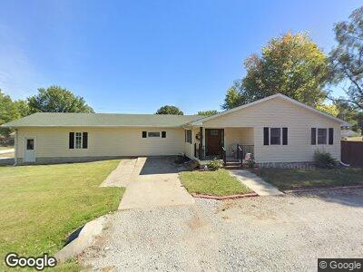
906 Mobile Ave Farragut, IA 51639
Estimated Value: $168,000 - $193,000
3
Beds
2
Baths
1,914
Sq Ft
$94/Sq Ft
Est. Value
About This Home
This home is located at 906 Mobile Ave, Farragut, IA 51639 and is currently estimated at $180,346, approximately $94 per square foot. 906 Mobile Ave is a home located in Fremont County with nearby schools including Shenandoah Elementary School, Shenandoah Middle School, and Shenandoah High School.
Ownership History
Date
Name
Owned For
Owner Type
Purchase Details
Closed on
Mar 11, 2010
Sold by
K And D Enterprises Inc
Bought by
Laumann Mark Paul
Current Estimated Value
Purchase Details
Closed on
Sep 16, 2008
Sold by
Laumann Mark P and Laumann Linda K
Bought by
Laumann Mark P and Laumann Linda K
Home Financials for this Owner
Home Financials are based on the most recent Mortgage that was taken out on this home.
Original Mortgage
$51,500
Interest Rate
6.41%
Mortgage Type
Credit Line Revolving
Create a Home Valuation Report for This Property
The Home Valuation Report is an in-depth analysis detailing your home's value as well as a comparison with similar homes in the area
Home Values in the Area
Average Home Value in this Area
Purchase History
| Date | Buyer | Sale Price | Title Company |
|---|---|---|---|
| Laumann Mark Paul | $557,000 | -- | |
| Laumann Mark P | -- | -- |
Source: Public Records
Mortgage History
| Date | Status | Borrower | Loan Amount |
|---|---|---|---|
| Open | Laumann Mark P | $22,000 | |
| Open | Laumann Mark P | $89,600 | |
| Previous Owner | Laumann Mark P | $51,500 |
Source: Public Records
Tax History Compared to Growth
Tax History
| Year | Tax Paid | Tax Assessment Tax Assessment Total Assessment is a certain percentage of the fair market value that is determined by local assessors to be the total taxable value of land and additions on the property. | Land | Improvement |
|---|---|---|---|---|
| 2024 | $2,584 | $160,730 | $5,460 | $155,270 |
| 2023 | $2,584 | $160,730 | $5,460 | $155,270 |
| 2022 | $2,196 | $131,740 | $9,460 | $122,280 |
| 2021 | $2,196 | $122,890 | $8,830 | $114,060 |
| 2020 | $2,152 | $109,470 | $8,830 | $100,640 |
| 2019 | $2,318 | $108,820 | $0 | $0 |
| 2018 | $2,276 | $108,820 | $0 | $0 |
| 2017 | $2,082 | $98,030 | $0 | $0 |
| 2016 | $2,034 | $98,030 | $0 | $0 |
| 2015 | $2,034 | $98,030 | $0 | $0 |
| 2014 | $2,054 | $98,030 | $0 | $0 |
Source: Public Records
Map
Nearby Homes
- 1110 New Orleans Ave
- 1009 Jackson Ave
- 00 200 St
- 2410 400th Ave
- 2474 400th Ave
- 602 Alice Ave
- 509 Kearney Ave
- 0 280 St
- 2528 U S 59
- 27 W Ridge Dr
- 1102 Cherry Hills Dr
- 14 Country Club Ln
- 2 Country Club Ln
- 1601 S Elm St
- 1410 S Elm St
- 1305 Maple St
- 814 South Ave
- 1405 S Elm St
- 811 W Summit Ave
- 9 Country Club Ln