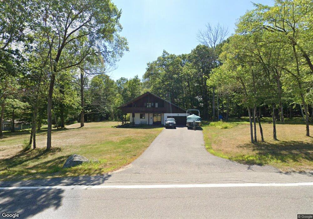
906 Moultonboro Neck Rd Moultonborough, NH 03254
Estimated Value: $564,000 - $996,000
3
Beds
3
Baths
2,672
Sq Ft
$269/Sq Ft
Est. Value
About This Home
This home is located at 906 Moultonboro Neck Rd, Moultonborough, NH 03254 and is currently estimated at $719,441, approximately $269 per square foot. 906 Moultonboro Neck Rd is a home located in Carroll County with nearby schools including Moultonborough Central School and Moultonborough Academy High School.
Ownership History
Date
Name
Owned For
Owner Type
Purchase Details
Closed on
Sep 18, 2017
Sold by
Turcketta Joseph B and Turcketta Julie V
Bought by
Turcketta Joseph B
Current Estimated Value
Home Financials for this Owner
Home Financials are based on the most recent Mortgage that was taken out on this home.
Original Mortgage
$122,040
Outstanding Balance
$64,191
Interest Rate
3.18%
Mortgage Type
New Conventional
Estimated Equity
$655,250
Purchase Details
Closed on
Dec 22, 2004
Sold by
Gosselin Peter W
Bought by
Turcketta Joseph B and Turcketta Julie V
Home Financials for this Owner
Home Financials are based on the most recent Mortgage that was taken out on this home.
Original Mortgage
$234,400
Interest Rate
5.74%
Mortgage Type
Purchase Money Mortgage
Create a Home Valuation Report for This Property
The Home Valuation Report is an in-depth analysis detailing your home's value as well as a comparison with similar homes in the area
Home Values in the Area
Average Home Value in this Area
Purchase History
| Date | Buyer | Sale Price | Title Company |
|---|---|---|---|
| Turcketta Joseph B | -- | -- | |
| Turcketta Joseph B | $293,000 | -- |
Source: Public Records
Mortgage History
| Date | Status | Borrower | Loan Amount |
|---|---|---|---|
| Open | Turcketta Joseph B | $122,040 | |
| Previous Owner | Turcketta Joseph B | $234,400 |
Source: Public Records
Tax History Compared to Growth
Tax History
| Year | Tax Paid | Tax Assessment Tax Assessment Total Assessment is a certain percentage of the fair market value that is determined by local assessors to be the total taxable value of land and additions on the property. | Land | Improvement |
|---|---|---|---|---|
| 2024 | $3,066 | $542,700 | $155,600 | $387,100 |
| 2023 | $2,487 | $436,400 | $117,700 | $318,700 |
| 2022 | $1,902 | $397,900 | $108,500 | $289,400 |
| 2021 | $2,361 | $338,200 | $89,500 | $248,700 |
| 2020 | $2,310 | $324,000 | $89,500 | $234,500 |
| 2019 | $2,107 | $294,700 | $89,500 | $205,200 |
| 2018 | $2,145 | $277,800 | $83,600 | $194,200 |
| 2017 | $2,075 | $252,400 | $80,500 | $171,900 |
| 2016 | $2,072 | $237,100 | $80,500 | $156,600 |
| 2015 | $2,077 | $230,500 | $80,500 | $150,000 |
| 2014 | $2,077 | $234,400 | $80,500 | $153,900 |
| 2013 | $2,050 | $235,900 | $80,500 | $155,400 |
Source: Public Records
Map
Nearby Homes
- 31 Rays Way
- 5 Ferry Rd
- 16 Long Island Rd
- 29 Kona Farm Rd
- 21 Orton Ln
- 27 First Point Rd
- 00 Beede Rd
- 11 Geery Ln
- 10 Woodridge Rd
- 167 Long Island Rd
- 244 Wentworth Shores Rd
- 14 Island View Dr
- 41 Saint Gallen St
- 30 Leopards Leap
- 7 Lady Slipper Ln
- 9 Lady Slipper Ln
- 7 Flint Dr
- 203 Krainewood Dr
- 00 Grande St Unit 44
- 72 Sundorf St
- 910 Moultonboro Neck Rd
- 7 Kimball Dr
- 25 Kimball Dr
- 914 Moultonboro Neck Rd
- 935 Moultonboro Neck Rd
- 33 Kimball Dr
- 850 Moultonboro Neck Rd
- 836 Moultonboro Neck Rd
- 30 Rays Way
- 861 Moultonboro Neck Rd
- 16 Connector Rd
- 35 Rays Way
- 834 Moultonboro Neck Rd
- 21 Rays Way
- 847 Moultonboro Neck Rd
- 832 Moultonboro Neck Rd
- 8 Connector Rd
- 22 Rays Way
- 36 Rays Way
- 20 Rays Way