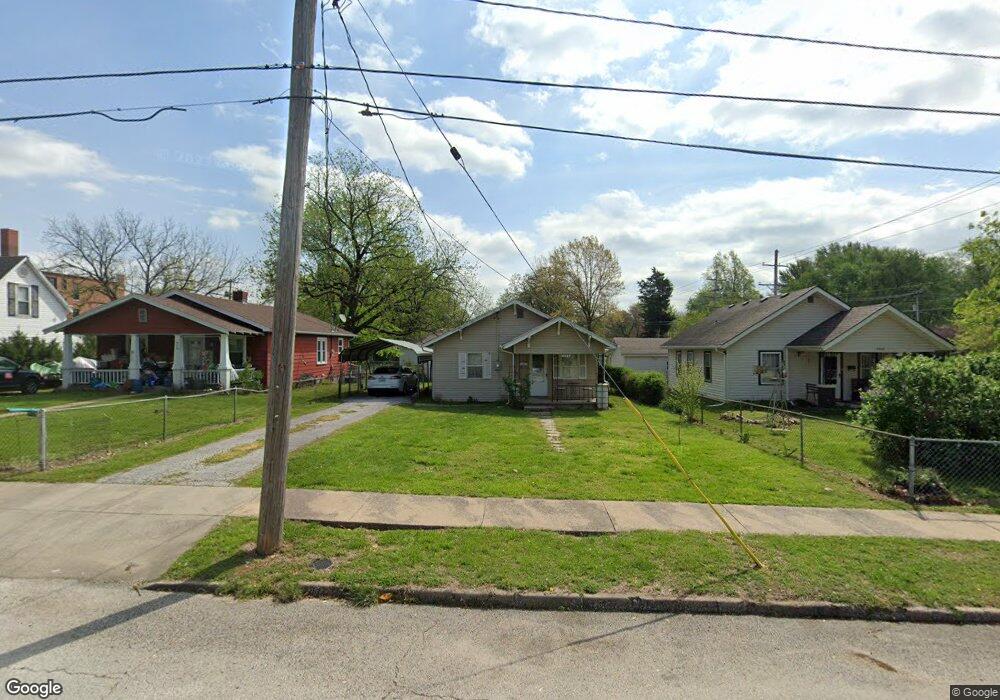
906 N Fremont Ave Springfield, MO 65802
Cooper Park NeighborhoodEstimated Value: $116,000 - $145,000
2
Beds
1
Bath
1,020
Sq Ft
$125/Sq Ft
Est. Value
About This Home
This home is located at 906 N Fremont Ave, Springfield, MO 65802 and is currently estimated at $127,331, approximately $124 per square foot. 906 N Fremont Ave is a home located in Greene County with nearby schools including Weller Elementary School, Pipkin Middle School, and Central High School.
Ownership History
Date
Name
Owned For
Owner Type
Purchase Details
Closed on
Jul 19, 2019
Sold by
Ross Nickolyn L and Ross John
Bought by
Mcsparren Michael L and Mcsparren Jennifer
Current Estimated Value
Home Financials for this Owner
Home Financials are based on the most recent Mortgage that was taken out on this home.
Original Mortgage
$61,858
Outstanding Balance
$54,790
Interest Rate
4.37%
Mortgage Type
FHA
Estimated Equity
$72,541
Purchase Details
Closed on
Dec 5, 2004
Sold by
Ross Nickolyn L and Ross John
Bought by
Ross Nickolyn L and Rapp Kathleen J
Create a Home Valuation Report for This Property
The Home Valuation Report is an in-depth analysis detailing your home's value as well as a comparison with similar homes in the area
Home Values in the Area
Average Home Value in this Area
Purchase History
| Date | Buyer | Sale Price | Title Company |
|---|---|---|---|
| Mcsparren Michael L | -- | None Available | |
| Ross Nickolyn L | -- | Lincoln Land Title Inc |
Source: Public Records
Mortgage History
| Date | Status | Borrower | Loan Amount |
|---|---|---|---|
| Open | Mcsparren Michael L | $61,858 |
Source: Public Records
Tax History Compared to Growth
Tax History
| Year | Tax Paid | Tax Assessment Tax Assessment Total Assessment is a certain percentage of the fair market value that is determined by local assessors to be the total taxable value of land and additions on the property. | Land | Improvement |
|---|---|---|---|---|
| 2025 | $488 | $10,970 | $3,670 | $7,300 |
| 2024 | $488 | $9,090 | $2,380 | $6,710 |
| 2023 | $485 | $9,090 | $2,380 | $6,710 |
| 2022 | $492 | $9,010 | $2,380 | $6,630 |
| 2021 | $492 | $9,010 | $2,380 | $6,630 |
| 2020 | $473 | $8,290 | $2,380 | $5,910 |
| 2019 | $460 | $8,290 | $2,380 | $5,910 |
| 2018 | $403 | $7,260 | $2,380 | $4,880 |
| 2017 | $399 | $7,260 | $2,380 | $4,880 |
| 2016 | $398 | $7,260 | $2,380 | $4,880 |
| 2015 | $394 | $7,260 | $2,380 | $4,880 |
| 2014 | $381 | $6,960 | $2,380 | $4,580 |
Source: Public Records
Map
Nearby Homes
- 1126 N Rogers Ave
- 1201 N Fremont Ave
- 1226 E Scott St
- 1627 E Central St
- 1218 N Rogers Ave
- 1221 E Scott St
- 1133 N Prospect Ave
- 1301 N Rogers Ave
- 1311 N Fremont Ave
- 1701 E Chestnut St
- 1213 E Saint Louis St
- 1360 E Locust St
- 1462 E Mcdaniel St
- 1407 E Locust St
- 1414 N Sherman Ave
- 338 S Weller Ave
- 1435 E Walnut St
- 1342 N Clay Ave
- 1433 E Pacific St
- 1505 E Walnut St
- 900 N Fremont Ave
- 910 N Fremont Ave
- 916 N Fremont Ave
- 1425 E Central St
- 830 N Fremont Ave
- 907 N Fremont Ave
- 911 N Fremont Ave
- 826 N Fremont Ave
- 915 N Pickwick Ave
- 1435 E Central St
- 917 N Fremont Ave
- 831 N Pickwick Ave
- 1384 E Central St
- 921 N Fremont Ave
- 1369 E Central St
- 827 N Pickwick Ave
- 927 N Fremont Ave
- 818 N Fremont Ave
- 1368 E Central St
- 821 N Fremont Ave