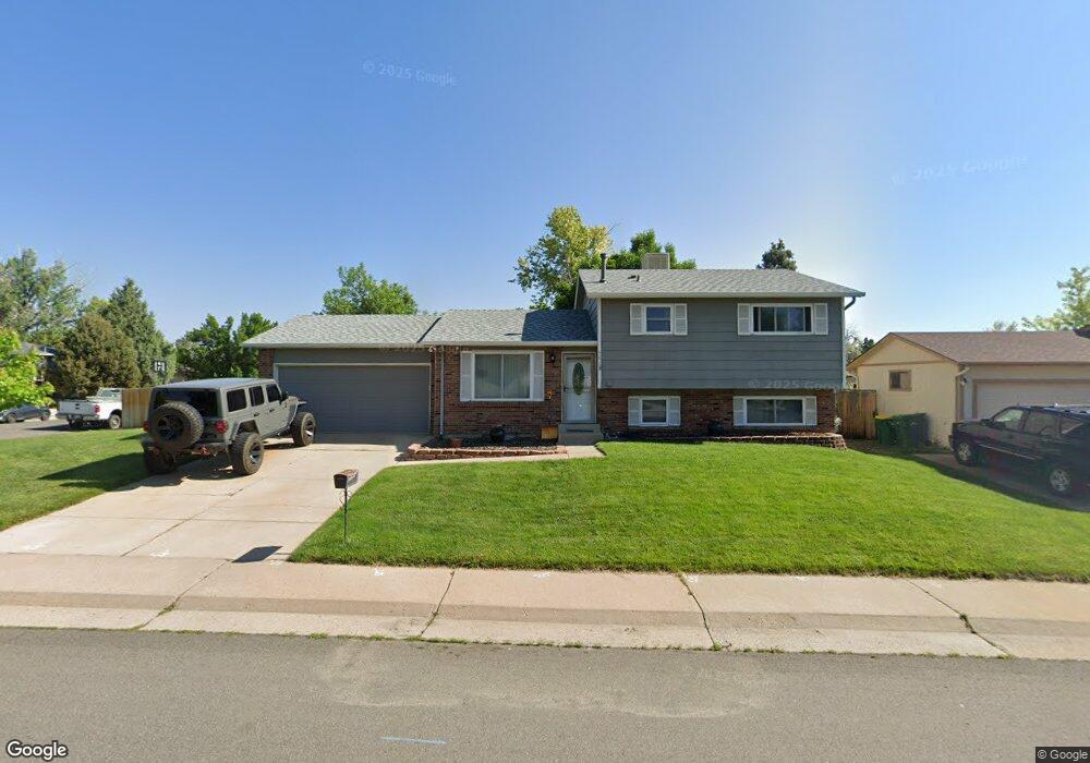
9075 W Euclid Ave Littleton, CO 80123
Kipling Hills NeighborhoodEstimated Value: $530,000 - $564,000
4
Beds
3
Baths
1,052
Sq Ft
$520/Sq Ft
Est. Value
About This Home
This home is located at 9075 W Euclid Ave, Littleton, CO 80123 and is currently estimated at $546,884, approximately $519 per square foot. 9075 W Euclid Ave is a home located in Jefferson County with nearby schools including Powderhorn Elementary School, Summit Ridge Middle School, and Dakota Ridge Senior High School.
Create a Home Valuation Report for This Property
The Home Valuation Report is an in-depth analysis detailing your home's value as well as a comparison with similar homes in the area
Home Values in the Area
Average Home Value in this Area
Tax History Compared to Growth
Tax History
| Year | Tax Paid | Tax Assessment Tax Assessment Total Assessment is a certain percentage of the fair market value that is determined by local assessors to be the total taxable value of land and additions on the property. | Land | Improvement |
|---|---|---|---|---|
| 2024 | $3,013 | $30,765 | $11,379 | $19,386 |
| 2023 | $3,013 | $30,765 | $11,379 | $19,386 |
| 2022 | $2,758 | $27,648 | $9,248 | $18,400 |
| 2021 | $2,793 | $28,444 | $9,514 | $18,930 |
| 2020 | $2,439 | $24,889 | $7,432 | $17,457 |
| 2019 | $2,408 | $24,889 | $7,432 | $17,457 |
| 2018 | $2,230 | $22,252 | $7,261 | $14,991 |
| 2017 | $2,035 | $22,252 | $7,261 | $14,991 |
| 2016 | $1,885 | $19,892 | $6,328 | $13,564 |
| 2015 | $1,658 | $19,892 | $6,328 | $13,564 |
| 2014 | $1,658 | $16,402 | $5,672 | $10,730 |
Source: Public Records
Map
Nearby Homes
- 6705 S Field St Unit 802
- 6705 S Field St Unit 801
- 8729 W Euclid Place
- 6755 S Field St Unit 618
- 6755 S Field St Unit 623
- 9364 W Coal Mine Ave
- 6766 S Holland Way
- 9505 W Coal Mine Ave Unit F
- 9519 W Coal Mine Ave Unit F
- 9423 W Ontario Dr
- 9603 W Euclid Dr
- 6784 S Independence St
- 9526 W Walker Place
- 6451 S Hoyt St
- 6765 S Independence St
- 6763 S Independence St
- 6753 S Independence St
- 6751 S Independence St
- 6365 S Dudley Way
- 8878 W Plymouth Ave
- 9045 W Euclid Ave
- 6576 S Flower St
- 9035 W Euclid Ave
- 6613 S Field Ct
- 6566 S Flower St
- 9115 W Euclid Ave
- 6577 S Flower St
- 9106 W Euclid Ave
- 6612 S Field Ct
- 6541 S Field Way
- 6537 S Field Way
- 9025 W Euclid Ave
- 6623 S Field Ct
- 6556 S Flower St
- 6567 S Flower St
- 6543 S Field Way
- 9136 W Euclid Ave
- 9155 W Euclid Ave
- 6622 S Field Ct
- 6535 S Field Way