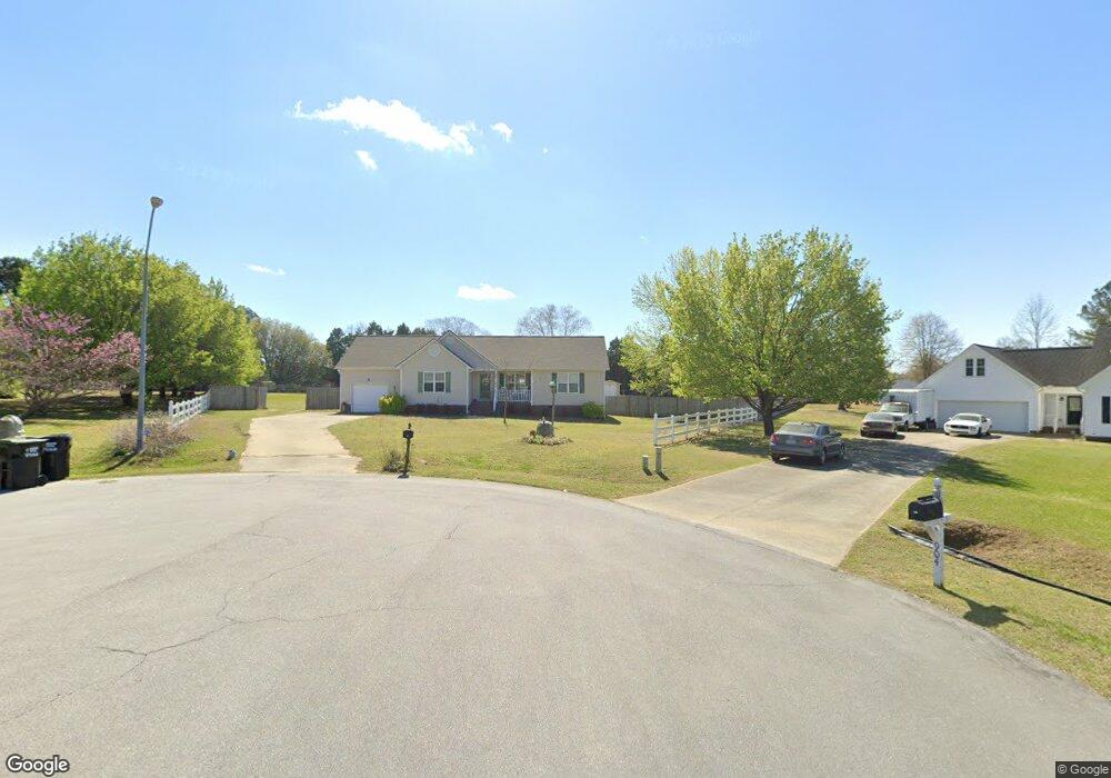
908 Colt Cir Clayton, NC 27520
Cleveland NeighborhoodEstimated Value: $321,000 - $369,000
3
Beds
2
Baths
1,630
Sq Ft
$212/Sq Ft
Est. Value
About This Home
This home is located at 908 Colt Cir, Clayton, NC 27520 and is currently estimated at $345,097, approximately $211 per square foot. 908 Colt Cir is a home located in Johnston County with nearby schools including Cleveland Elementary School, Cleveland Middle School, and Cleveland High School.
Ownership History
Date
Name
Owned For
Owner Type
Purchase Details
Closed on
Mar 23, 2012
Sold by
Brooks William Newell and Brooks Pamela T
Bought by
Brooks Pamela T
Current Estimated Value
Purchase Details
Closed on
Jun 29, 2006
Sold by
Bank Of New York
Bought by
Brooks William Newell and Brooks Pamela T
Home Financials for this Owner
Home Financials are based on the most recent Mortgage that was taken out on this home.
Original Mortgage
$119,250
Outstanding Balance
$70,600
Interest Rate
6.6%
Mortgage Type
New Conventional
Estimated Equity
$274,497
Purchase Details
Closed on
Aug 3, 2004
Sold by
Thomas Jason C
Bought by
Atkinson Keith
Create a Home Valuation Report for This Property
The Home Valuation Report is an in-depth analysis detailing your home's value as well as a comparison with similar homes in the area
Home Values in the Area
Average Home Value in this Area
Purchase History
| Date | Buyer | Sale Price | Title Company |
|---|---|---|---|
| Brooks Pamela T | -- | None Available | |
| Brooks William Newell | $132,500 | None Available | |
| Atkinson Keith | $147,000 | -- |
Source: Public Records
Mortgage History
| Date | Status | Borrower | Loan Amount |
|---|---|---|---|
| Open | Brooks William Newell | $119,250 |
Source: Public Records
Tax History Compared to Growth
Tax History
| Year | Tax Paid | Tax Assessment Tax Assessment Total Assessment is a certain percentage of the fair market value that is determined by local assessors to be the total taxable value of land and additions on the property. | Land | Improvement |
|---|---|---|---|---|
| 2025 | $1,854 | $291,890 | $66,410 | $225,480 |
| 2024 | $1,610 | $198,720 | $66,410 | $132,310 |
| 2023 | $1,555 | $198,720 | $66,410 | $132,310 |
| 2022 | $1,634 | $198,720 | $66,410 | $132,310 |
| 2021 | $1,634 | $198,720 | $66,410 | $132,310 |
| 2020 | $1,654 | $198,720 | $66,410 | $132,310 |
| 2019 | $1,654 | $198,720 | $66,410 | $132,310 |
| 2018 | $1,302 | $152,710 | $40,270 | $112,440 |
| 2017 | $1,302 | $152,710 | $40,270 | $112,440 |
| 2016 | $1,302 | $152,710 | $40,270 | $112,440 |
| 2015 | $1,302 | $152,710 | $40,270 | $112,440 |
| 2014 | $1,302 | $152,710 | $40,270 | $112,440 |
Source: Public Records
Map
Nearby Homes
- 208 Hunting Lodge Rd
- 99 Barton Bay Ln
- 219 Beaver Ridge Way
- 926 Lazy Branch Dr
- 121 Wilmack Dr
- 171 Creekstone Dr
- 147 E Wellesley Dr
- 216 Deep Pool Ct
- 619 Rudy Dr
- The Buford II Plan at Wellesley
- The Harrington Plan at Wellesley
- The Caldwell Plan at Wellesley
- The Braselton II Plan at Wellesley
- The Greenbrier II Plan at Wellesley
- The Bradley Plan at Wellesley
- The McGinnis Plan at Wellesley
- 280 Ambassador Dr
- 290 Ambassador Dr
- 305 Ambassador Dr
- 302 Ambassador Dr
- 905 Colt Cir
- 904 Colt Cir
- 901 Colt Cir
- 900 Colt Cir
- 104 Winchester Place
- 413 Hunting Lodge Rd
- 108 Winchester Place
- 119 Hunting Lodge Rd
- 419 Hunting Lodge Rd
- 407 Hunting Lodge Rd
- 301 Hunting Lodge Rd
- 112 Winchester Place
- 204 Hunting Lodge Rd
- 200 Hunting Lodge Rd
- 113 Hunting Lodge Rd
- 124 Hunting Lodge Rd
- 120 Hunting Lodge Rd
- 305 Hunting Lodge Rd
- 113 Winchester Place
- 105 Winchester Place