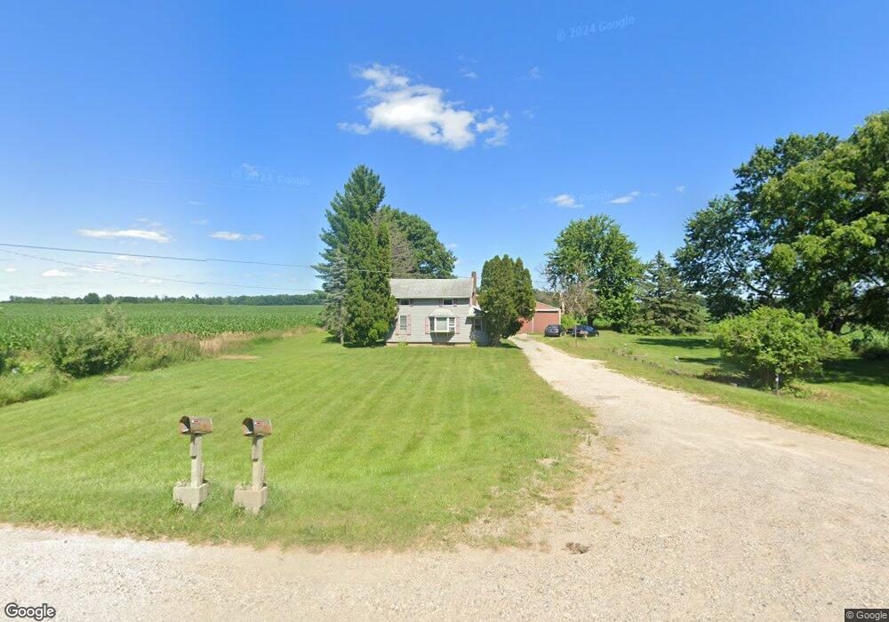
9085 S Us Highway 27 Dewitt, MI 48820
Estimated Value: $184,739 - $230,000
2
Beds
1
Bath
1,160
Sq Ft
$181/Sq Ft
Est. Value
About This Home
This home is located at 9085 S Us Highway 27, Dewitt, MI 48820 and is currently estimated at $209,435, approximately $180 per square foot. 9085 S Us Highway 27 is a home located in Clinton County with nearby schools including St. Johns High School.
Ownership History
Date
Name
Owned For
Owner Type
Purchase Details
Closed on
Oct 20, 2011
Sold by
Ridge Heather E
Bought by
Ridge Todd M
Current Estimated Value
Purchase Details
Closed on
Apr 13, 2011
Sold by
Ridge Todd M and Ridge Heather E
Bought by
Tcf National Bank
Purchase Details
Closed on
Nov 30, 2004
Sold by
Powell Donna L
Bought by
Ridge Todd M and Ridge Heather E
Home Financials for this Owner
Home Financials are based on the most recent Mortgage that was taken out on this home.
Original Mortgage
$94,500
Interest Rate
5.71%
Mortgage Type
Purchase Money Mortgage
Create a Home Valuation Report for This Property
The Home Valuation Report is an in-depth analysis detailing your home's value as well as a comparison with similar homes in the area
Purchase History
| Date | Buyer | Sale Price | Title Company |
|---|---|---|---|
| Ridge Todd M | -- | None Available | |
| Tcf National Bank | $67,425 | None Available | |
| Ridge Todd M | $95,000 | Transnation Title |
Source: Public Records
Mortgage History
| Date | Status | Borrower | Loan Amount |
|---|---|---|---|
| Previous Owner | Ridge Todd M | $94,500 |
Source: Public Records
Tax History
| Year | Tax Paid | Tax Assessment Tax Assessment Total Assessment is a certain percentage of the fair market value that is determined by local assessors to be the total taxable value of land and additions on the property. | Land | Improvement |
|---|---|---|---|---|
| 2025 | $1,505 | $73,000 | $18,200 | $54,800 |
| 2024 | $7 | $70,800 | $17,900 | $52,900 |
| 2023 | $636 | $62,900 | $0 | $0 |
| 2022 | $1,349 | $61,700 | $15,000 | $46,700 |
| 2021 | $1,290 | $57,000 | $12,500 | $44,500 |
| 2020 | $1,257 | $54,100 | $12,500 | $41,600 |
| 2019 | $1,189 | $52,700 | $12,500 | $40,200 |
| 2018 | $1,161 | $53,200 | $12,500 | $40,700 |
| 2017 | $1,140 | $52,400 | $12,500 | $39,900 |
| 2016 | $1,124 | $53,300 | $12,500 | $40,800 |
| 2015 | -- | $50,100 | $0 | $0 |
| 2011 | -- | $46,900 | $0 | $0 |
Source: Public Records
Map
Nearby Homes
- 2615 Alward Rd
- V/L E Chadwick Rd
- 11549 S Us Highway 27
- V/L E Round Lake Rd
- 2540 E Round Lake Rd
- 0 Old U S 27 Unit 291913
- 513 N Scott St
- 0 E Chadwick Rd
- 0 E Howe Rd Unit 26004308
- E Howe Rd
- 303 W Washington St
- 1114 N Chimney Hill Dr
- 14013 Ambrosia Ave
- 12615 Kruger Ln
- 3535 Stanwood Dr
- 11625 Murano Dr Unit 63
- 603 Cherry St
- 11740 Kalamata Dr
- 1448 Primrose Ln
- 1465 Primrose Ln
- 9060 Old U S 27
- 9060 S Us Highway 27
- 9020 S Us Highway 27
- 9100 S Us Highway 27
- 8934 S Us Highway 27
- 8850 S Us Highway 27
- 8833 S Us Highway 27
- 8833 S Us Highway 27
- 9280 S Us Highway 27
- 9320 S Us Highway 27
- 9320 Old U S 27
- 8720 S Us Highway 27
- 8720 S Us Highway 27
- 1100 W Locher Rd
- 9363 S Us Highway 27
- 8665 S Us Highway 27
- 8665 Old U S 27
- 8668 S Us Highway 27
- 9409 S Us Highway 27
- 9409 S Us Highway 27
Your Personal Tour Guide
Ask me questions while you tour the home.